About Kuchinoerabujima
Kuchinoerabujima is a stratovolcano(es) rising to 657 meters (2,156 feet) in Japan's Western Pacific Volcanic Regions. The volcano is currently active, with its most recent eruption in 2020 CE. The volcano has produced 31 recorded eruptions, with a maximum Volcanic Explosivity Index (VEI) of 4.
Geography & Climate
Kuchinoerabujima is located in Japan, within the Ryukyu Volcanic Arc of the broader Western Pacific Volcanic Regions. Situated at 30.44° N, 130.22° E in the Northern Hemisphere, the volcano lies within a subtropical climate zone. With a summit elevation of 657 meters above sea level, Kuchinoerabujima is a moderately sized peak that remains accessible to hikers and researchers for much of the year. The volcanic landform is characterized as a composite, which describes the physical shape and structure of the volcanic edifice as observed from the surface.
Geological Context
Kuchinoerabujima sits in a subduction zone, where one tectonic plate dives beneath another, creating intense heat and pressure that generates magma. Subduction zones are responsible for many of the world's most explosive volcanoes and deadliest eruptions. For communities in Japan near Kuchinoerabujima, this tectonic setting means the volcano is capable of producing powerful explosive eruptions, pyroclastic flows, and lahars that can threaten populated areas within tens of kilometers of the summit. The dominant rock type is andesite / basaltic andesite, a dark, fine-grained volcanic rock that forms from rapidly cooling, low-viscosity lava. Basaltic eruptions tend to be less explosive and produce fluid lava flows that can travel long distances. While less immediately dangerous than explosive eruptions, basaltic lava flows can destroy structures and infrastructure in their path, and volcanic gases released during these eruptions can affect air quality over a wide area.
Eruption History Summary
Kuchinoerabujima has 31 recorded eruptions in the geological database, spanning from 9520 BCE to 2020 CE. The most powerful recorded event was a cataclysmic eruption with ash columns reaching the stratosphere in 1933 CE, reaching VEI 4 on the Volcanic Explosivity Index. Notable eruptions include 2020 CE (VEI 3), 2018 CE (VEI 3), 2015 CE (VEI 3). With an average interval of roughly 372 years between eruptions over a span of 11,540 years, this is one of the more frequently active volcanoes in the database. This persistent activity suggests a robust and well-supplied magma system beneath the volcano. With eruptive activity as recently as 2020 CE, Kuchinoerabujima remains an actively monitored volcano.
Significance
With a maximum recorded VEI of 4, Kuchinoerabujima has demonstrated the capacity for significant explosive eruptions that can impact regional aviation, agriculture, and communities tens of kilometers from the summit. VEI 4 eruptions produce ash columns reaching 15-25 kilometers into the atmosphere. Its 31 recorded eruptions make it one of the most prolific volcanoes in our database, reflecting a persistent and well-documented eruptive history that has provided volcanologists with extensive data for understanding eruption patterns and forecasting future activity. Given its recent activity, Kuchinoerabujima is closely monitored by geological survey organizations to provide early warning of future unrest.
GVP Reference Summary
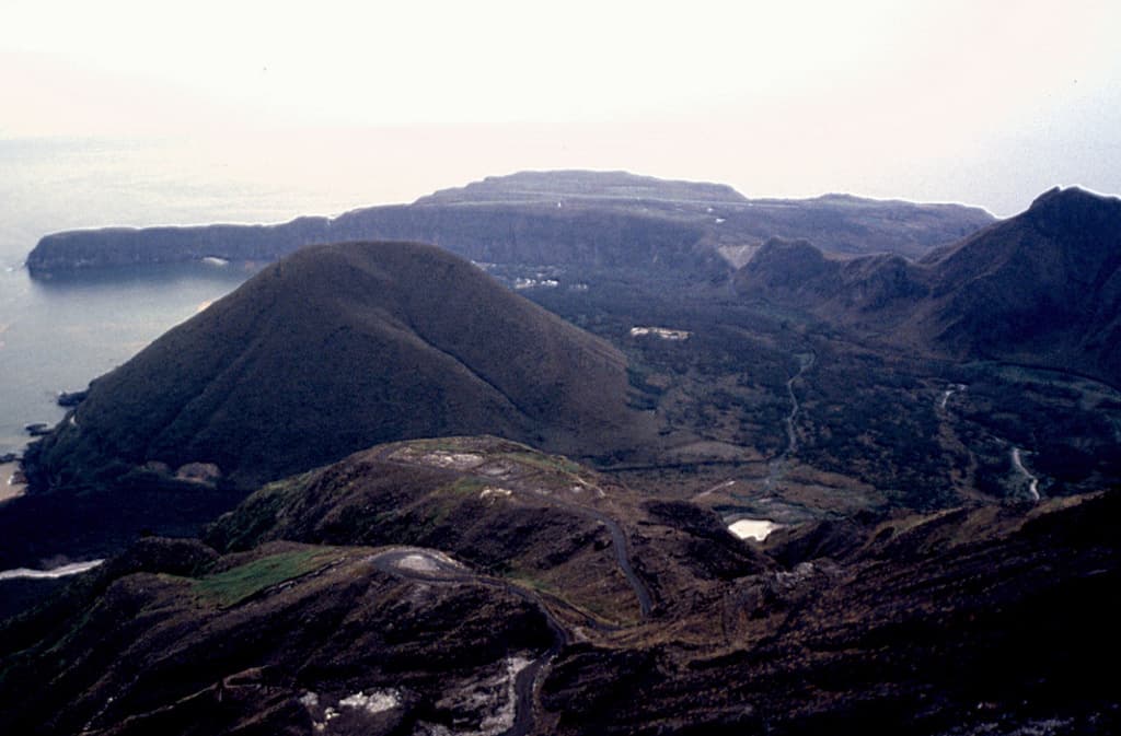
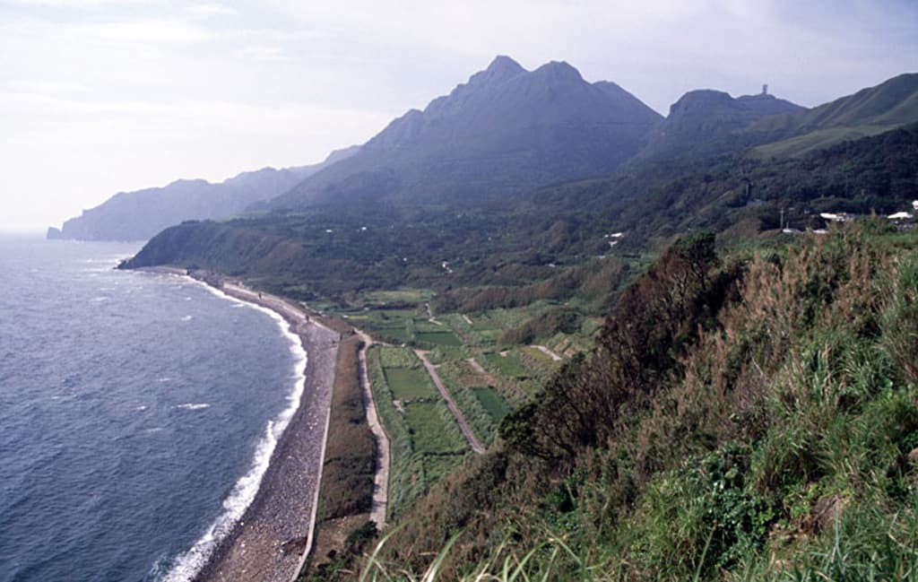
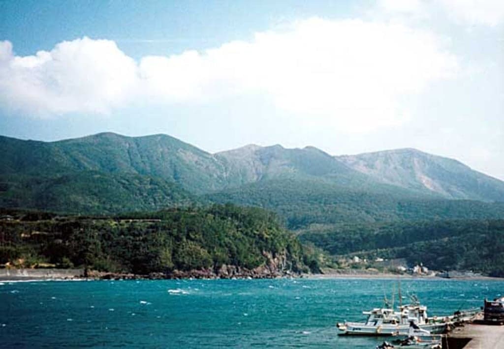
A group of young stratovolcanoes forms the eastern end of the irregularly shaped island of Kuchinoerabujima in the northern Ryukyu Islands, 15 km W of Yakushima. The Furudake, Shindake, and Noikeyama cones were erupted from south to north, respectively, forming a composite cone with multiple craters. All historical eruptions have occurred from Shindake, although a lava flow from the S flank of Furudake that reached the coast has a very fresh morphology. Frequent explosive eruptions have taken place from Shindake since 1840; the largest of these was in December 1933. Several villages on the 4 x 12 km island are located within a few kilometers of the active crater and have suffered damage from eruptions.
— Smithsonian Institution, Global Volcanism Program
31 Recorded Eruptions
How Kuchinoerabujima's 19 size-rated eruptions break down by Volcanic Explosivity Index. Select a bar to see what that size means.
Explosive — ash plumes reaching 1–5 km, localized impact.
Of Kuchinoerabujima's 19 size-rated eruptions on record, the most common was VEI 2 (9 of 19, 47%). Its record is centred on moderate explosive eruptions (VEI 2–3), with larger events far rarer. The largest on record reached VEI 4.
Based on the Smithsonian GVP eruption record. This describes Kuchinoerabujima's past eruptions only — it does not predict future activity. What is the VEI? · Most explosive volcanoes
| Year | VEI | Type | Area |
|---|---|---|---|
| 2020 | 3 | Confirmed Eruption | — |
| 2020 | 1 | Confirmed Eruption | — |
| 2018 – 2019 | 3 | Confirmed Eruption | Shindake Crater |
| 2015 | 3 | Confirmed Eruption | Shindake crater |
| 2014 | 1 | Confirmed Eruption | Shindake |
| 1980 | 2 | Confirmed Eruption | NNE-SSW fissure on E side of Shindake |
| 1976 | 2 | Confirmed Eruption | Shindake |
| 1974 | 1 | Confirmed Eruption | Shindake |
| 1973 | 2 | Confirmed Eruption | Shindake |
| 1972 | 2 | Confirmed Eruption | Shindake |
| 1968 – 1969 | 3 | Confirmed Eruption | Shindake |
| 1966 | 2 | Confirmed Eruption | Shindake |
| 1945 | 2 | Confirmed Eruption | NNE-SSW fissure on E side of Shindake |
| 1933 – 1934 | 4 | Confirmed Eruption | Shindake |
| 1932 | 1 | Uncertain Eruption | Shindake |
| 1931 | 3 | Confirmed Eruption | SW flank of Shindake |
| 1914 | 2 | Confirmed Eruption | Shindake |
| 1906 – 1907 | — | Uncertain Eruption | Shindake |
| 1841 | 2 | Confirmed Eruption | Shindake |
| 1840 | 2 | Confirmed Eruption | Shindake |
| 1560 | — | Confirmed Eruption | Furudake |
| 1470 | — | Confirmed Eruption | Furudake |
| 1440 | — | Confirmed Eruption | Shindake |
| 1110 | — | Confirmed Eruption | Furudake |
| 1100 | — | Confirmed Eruption | Shindake |
| 970 | — | Confirmed Eruption | Furudake |
| 600 | — | Confirmed Eruption | Shindake |
| 1140 BCE | — | Confirmed Eruption | Furudake |
| 1450 BCE | — | Confirmed Eruption | Shindake |
| 3480 BCE | — | Confirmed Eruption | Furudake |
| 9520 BCE | — | Confirmed Eruption | Furudake |
Real-Time Data
Frequently Asked Questions About Kuchinoerabujima
Is Kuchinoerabujima an active volcano?+
Yes, Kuchinoerabujima is considered an active volcano. Its most recent eruption was in 2020 CE. The volcano is monitored by geological agencies, and its activity status is based on observed eruptions within recorded history.
When did Kuchinoerabujima last erupt?+
The most recent recorded eruption of Kuchinoerabujima occurred in 2020 CE with a Volcanic Explosivity Index (VEI) of 3. The eruption was classified as a "Confirmed Eruption." Kuchinoerabujima has 31 recorded eruptions in total.
How high is Kuchinoerabujima?+
Kuchinoerabujima has a summit elevation of 657 meters (2,156 feet) above sea level. At 657 meters, it is a relatively low-elevation volcano.
What type of volcano is Kuchinoerabujima?+
Kuchinoerabujima is classified as a Stratovolcano(es). Stratovolcano(es) volcanoes have distinct geological characteristics that set them apart from other volcanic types.
Where is Kuchinoerabujima located?+
Kuchinoerabujima is located in Japan, in the Western Pacific Volcanic Regions. More specifically, it lies within the Ryukyu Volcanic Arc. Its exact coordinates are 30.443° latitude, 130.217° longitude.
Is it safe to visit Kuchinoerabujima?+
Visiting Kuchinoerabujima requires checking current volcanic activity and alert levels. As an active volcano with eruptions as recent as 2020 CE, conditions can change rapidly. Always consult local geological authorities and follow official warnings before visiting. Many active volcanoes have designated safe viewing areas and guided tour options.