About Tombel Graben
Tombel Graben is a volcanic field rising to 500 meters (1,641 feet) in Cameroon's Northern Africa Volcanic Regions. No historical eruptions have been recorded, though the volcano is classified based on geological evidence of past activity.
Geography & Climate
Tombel Graben is located in Cameroon, within the Western Africa Volcanic Province of the broader Northern Africa Volcanic Regions. Situated at 4.76° N, 9.72° E in the Northern Hemisphere, the volcano lies within a tropical climate zone. At just 500 meters above sea level, Tombel Graben is a relatively low-elevation volcanic feature. Despite its modest height, it remains an active geological formation with the same underlying magmatic processes as its taller counterparts. The volcanic landform is characterized as a cluster, which describes the physical shape and structure of the volcanic edifice as observed from the surface.
Geological Context
Tombel Graben is an intraplate volcano, meaning it formed away from any plate boundary. These volcanoes are often powered by hotspots — plumes of abnormally hot mantle material rising from deep within the Earth. Hotspot volcanoes like Tombel Graben tend to produce effusive eruptions with lava flows that can be relatively predictable, giving nearby communities in Cameroon more time to prepare. However, they can also produce explosive phases, particularly when magma interacts with groundwater. The dominant rock type is trachybasalt / tephrite basanite, a dark, fine-grained volcanic rock that forms from rapidly cooling, low-viscosity lava. Basaltic eruptions tend to be less explosive and produce fluid lava flows that can travel long distances. While less immediately dangerous than explosive eruptions, basaltic lava flows can destroy structures and infrastructure in their path, and volcanic gases released during these eruptions can affect air quality over a wide area.
GVP Reference Summary
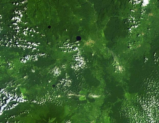
Young cinder cones and maars are abundant in the low-lying Tombel Graben (also referred to as the Tombel Plain) between Mount Cameroon and Mount Manengouba (within 4°58'N, 9°51'E and 4°33'N, 9°35'E). Mount Koupe, composed of Tertiary syenite, dominates the area. Activity began with the emission of large lava flows over Precambrian metamorphic rocks and Cretaceous sandstones, and concluded with explosive activity forming numerous cinder cones. The 800 km2 volcanic field, which erupted basanitic, basaltic, and trachybasaltic rocks, contains three large lake-filled maars, including Barombi Mbo, a compound maar near the town of Kumba. Legends record an eruption of Le Djungo (also known as Mont Pelé) that destroyed a village; though a small craterless cone is marked along a fault line on a map in Nkono (2009, after Nkouathio et al., 2002) it's unclear what cone is being described by the story, because no noticeably younger or unvegetated cones are apparent in satellite imagery. Two samples taken from the Njombe area in the farthest SW part of the field were K-Ar dated as possible Holocene (Nkouathio et al., 2008), though the error was too large to be definitive.
— Smithsonian Institution, Global Volcanism Program
0 Recorded Eruptions
No eruption records available for Tombel Graben.
Real-Time Data
Frequently Asked Questions About Tombel Graben
Is Tombel Graben an active volcano?+
Tombel Graben is classified as active based on credible evidence of past eruptions. Although its last known eruption was in prehistoric times, volcanologists consider it capable of erupting again.
How high is Tombel Graben?+
Tombel Graben has a summit elevation of 500 meters (1,641 feet) above sea level. At 500 meters, it is a relatively low-elevation volcano.
What type of volcano is Tombel Graben?+
Tombel Graben is classified as a Volcanic field. Volcanic fields consist of clusters of small volcanic vents and cinder cones spread across a region. Rather than a single central vent, eruptions can occur at many points across the field.
Where is Tombel Graben located?+
Tombel Graben is located in Cameroon, in the Northern Africa Volcanic Regions. More specifically, it lies within the Western Africa Volcanic Province. Its exact coordinates are 4.758° latitude, 9.717° longitude.
Is it safe to visit Tombel Graben?+
Tombel Graben can generally be visited, but as with any volcano, visitors should check local conditions and any advisory notices before traveling. Cameroon may have specific regulations for accessing volcanic areas. Guided tours are often the safest and most informative way to experience a volcano.