About Apastepeque Field
Apastepeque Field is a volcanic field rising to 700 meters (2,297 feet) in El Salvador's Middle America-Caribbean Volcanic Regions. No historical eruptions have been recorded, though the volcano is classified based on geological evidence of past activity.
Geography & Climate
Apastepeque Field is located in El Salvador, within the Central America Volcanic Arc of the broader Middle America-Caribbean Volcanic Regions. Situated at 13.70° N, 88.77° W in the Northern Hemisphere, the volcano lies within a tropical climate zone. With a summit elevation of 700 meters above sea level, Apastepeque Field is a moderately sized peak that remains accessible to hikers and researchers for much of the year. The volcanic landform is characterized as a cluster, which describes the physical shape and structure of the volcanic edifice as observed from the surface.
GVP Reference Summary
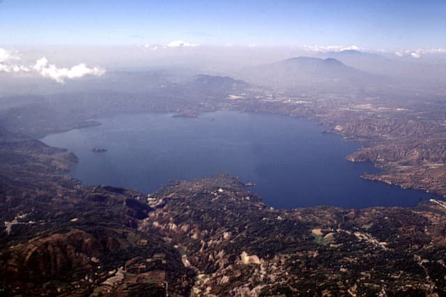
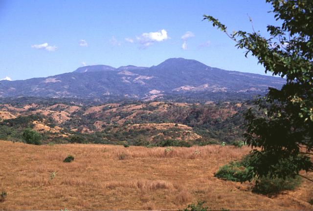
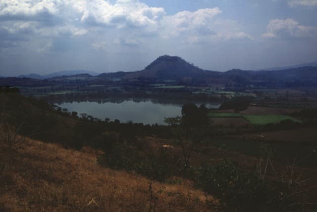
The Apastepeque volcanic field, N of the city of San Vicente, consists of a dense cluster of about two dozen volcanic features, including lava domes, cinder cones, and maars. Andesitic-to-dacitic lava domes were emplaced in some locations following dacitic pumice eruptions; after the more siliceous eruptions ended, a series of basaltic cinder cones formed. Some of the basaltic eruptions concluded with the formation of maars up to 100 m deep, including those now occupied by lakes such as Laguna de Apastepeque and Laguna Chalchuapán. No eruption dates are known.
— Smithsonian Institution, Global Volcanism Program
0 Recorded Eruptions
No eruption records available for Apastepeque Field.
Real-Time Data
Frequently Asked Questions About Apastepeque Field
Is Apastepeque Field an active volcano?+
Apastepeque Field is not currently classified as active. Its activity evidence is listed as "unknown." No recorded eruptions have been documented. However, no volcano is ever considered permanently extinct.
How high is Apastepeque Field?+
Apastepeque Field has a summit elevation of 700 meters (2,297 feet) above sea level. At 700 meters, it is a relatively low-elevation volcano.
What type of volcano is Apastepeque Field?+
Apastepeque Field is classified as a Volcanic field. Volcanic fields consist of clusters of small volcanic vents and cinder cones spread across a region. Rather than a single central vent, eruptions can occur at many points across the field.
Where is Apastepeque Field located?+
Apastepeque Field is located in El Salvador, in the Middle America-Caribbean Volcanic Regions. More specifically, it lies within the Central America Volcanic Arc. Its exact coordinates are 13.696° latitude, -88.772° longitude.
Is it safe to visit Apastepeque Field?+
Apastepeque Field can generally be visited, but as with any volcano, visitors should check local conditions and any advisory notices before traveling. El Salvador may have specific regulations for accessing volcanic areas. Guided tours are often the safest and most informative way to experience a volcano.