About Balut
Balut is a stratovolcano rising to 840 meters (2,756 feet) in Philippines's Western Pacific Volcanic Regions. No historical eruptions have been recorded, though the volcano is classified based on geological evidence of past activity.
Geography & Climate
Balut is located in Philippines, within the Mindanao Volcanic Province of the broader Western Pacific Volcanic Regions. Situated at 5.40° N, 125.38° E in the Northern Hemisphere, the volcano lies within a tropical climate zone. With a summit elevation of 840 meters above sea level, Balut is a moderately sized peak that remains accessible to hikers and researchers for much of the year. The volcanic landform is characterized as a composite, which describes the physical shape and structure of the volcanic edifice as observed from the surface.
GVP Reference Summary
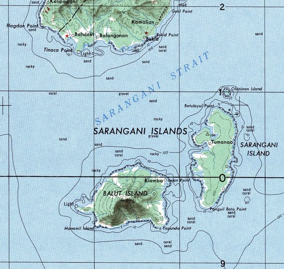
Balut volcano, also known as Sanguil, forms a small island in the Sarangani Island group south of the Batulaki Peninsula of southern Mindanao. Hot springs and thermally altered ground are located on the W and SW flanks. Reports in Mindanao of a major eruption in 1641 CE from an unknown volcano to the south, which caused darkness over much of Mindanao, were originally attributed to Balut; later work indicated that the source was Melebingoy, ~80 km NW of Balut on southern Mindanao.
— Smithsonian Institution, Global Volcanism Program
0 Recorded Eruptions
No eruption records available for Balut.
Real-Time Data
Frequently Asked Questions About Balut
Is Balut an active volcano?+
Balut is not currently classified as active. Its activity evidence is listed as "unknown." No recorded eruptions have been documented. However, no volcano is ever considered permanently extinct.
How high is Balut?+
Balut has a summit elevation of 840 meters (2,756 feet) above sea level. At 840 meters, it is a relatively low-elevation volcano.
What type of volcano is Balut?+
Balut is classified as a Stratovolcano. Stratovolcanoes (also called composite volcanoes) are steep, conical volcanoes built up by many layers of hardened lava, tephra, and volcanic ash. They are among the most common and dangerous types, known for explosive eruptions.
Where is Balut located?+
Balut is located in Philippines, in the Western Pacific Volcanic Regions. More specifically, it lies within the Mindanao Volcanic Province. Its exact coordinates are 5.398° latitude, 125.376° longitude.
Is it safe to visit Balut?+
Balut can generally be visited, but as with any volcano, visitors should check local conditions and any advisory notices before traveling. Philippines may have specific regulations for accessing volcanic areas. Guided tours are often the safest and most informative way to experience a volcano.


