About Melebingoy
Melebingoy is a stratovolcano rising to 1,824 meters (5,985 feet) in Philippines's Western Pacific Volcanic Regions. Its last known eruption was in 1641 CE. The volcano has produced 3 recorded eruptions, with a maximum Volcanic Explosivity Index (VEI) of 5.
Geography & Climate
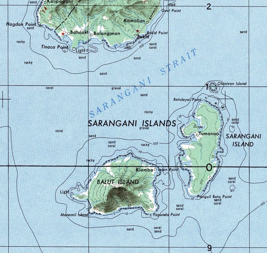
Melebingoy is located in Philippines, within the Mindanao Volcanic Province of the broader Western Pacific Volcanic Regions. Situated at 6.11° N, 124.89° E in the Northern Hemisphere, the volcano lies within a tropical climate zone. With a summit elevation of 1,824 meters above sea level, Melebingoy is a moderately sized peak that remains accessible to hikers and researchers for much of the year. The volcanic landform is characterized as a composite, which describes the physical shape and structure of the volcanic edifice as observed from the surface.
Geological Context
Melebingoy sits in a subduction zone, where one tectonic plate dives beneath another, creating intense heat and pressure that generates magma. Subduction zones are responsible for many of the world's most explosive volcanoes and deadliest eruptions. For communities in Philippines near Melebingoy, this tectonic setting means the volcano is capable of producing powerful explosive eruptions, pyroclastic flows, and lahars that can threaten populated areas within tens of kilometers of the summit. The dominant rock type is andesite / basaltic andesite, a dark, fine-grained volcanic rock that forms from rapidly cooling, low-viscosity lava. Basaltic eruptions tend to be less explosive and produce fluid lava flows that can travel long distances. While less immediately dangerous than explosive eruptions, basaltic lava flows can destroy structures and infrastructure in their path, and volcanic gases released during these eruptions can affect air quality over a wide area.
Eruption History Summary
Melebingoy has 3 recorded eruptions in the geological database, spanning from 1920 BCE to 1640 CE. The most powerful recorded event was a paroxysmal eruption with devastating regional consequences in 1640 CE, reaching VEI 5 on the Volcanic Explosivity Index. Notable eruptions include 1640 CE (VEI 5), 1380 CE (VEI 4), 1920 BCE (VEI 4). These eruptions span roughly 3,560 years of volcanic history.
Significance
With a maximum recorded VEI of 5, Melebingoy has demonstrated the capacity for paroxysmal eruptions comparable to the 1980 eruption of Mount St. Helens. Eruptions of this scale can devastate areas within 20-30 kilometers and produce ash fall that disrupts aviation and agriculture across hundreds of kilometers.
GVP Reference Summary
Mélébingóy (previously known as Parker) is a low, vegetated stratovolcano overlooking Sarangani Bay near the southern tip of Mindanao Island. The steep andesitic-dacitic stratovolcano is surrounded by extensive, youthful pyroclastic-flow deposits. The summit is truncated by a 2.9-km-wide caldera with steep-sided walls that rise 200-500 m above heart-shaped Maughan Lake. This volcano was the source of a major explosive eruption in 1641 CE that was previously attributed to Awu volcano on Sangihe Island. The eruption caused darkness over the island of Mindanao, deposited voluminous pyroclastic flows and lahars, and resulted in the formation of the summit caldera. This was the last of three major explosive eruptions during the previous 3,800 years.
— Smithsonian Institution, Global Volcanism Program
3 Recorded Eruptions
| Year | VEI | Type | Area |
|---|---|---|---|
| 1640 | 5 | Confirmed Eruption | — |
| 1380 | 4 | Confirmed Eruption | — |
| 1920 BCE | 4 | Confirmed Eruption | — |
Real-Time Data
Frequently Asked Questions About Melebingoy
Is Melebingoy an active volcano?+
Melebingoy is classified as active based on credible evidence of past eruptions. Although its last known eruption was in 1641 CE, volcanologists consider it capable of erupting again.
When did Melebingoy last erupt?+
The most recent recorded eruption of Melebingoy occurred in 1640 CE with a Volcanic Explosivity Index (VEI) of 5. The eruption was classified as a "Confirmed Eruption." Melebingoy has 3 recorded eruptions in total.
How high is Melebingoy?+
Melebingoy has a summit elevation of 1,824 meters (5,985 feet) above sea level. At 1,824 meters, it is a moderately sized volcanic peak, roughly comparable to Mount Vesuvius (1,281m).
What type of volcano is Melebingoy?+
Melebingoy is classified as a Stratovolcano. Stratovolcanoes (also called composite volcanoes) are steep, conical volcanoes built up by many layers of hardened lava, tephra, and volcanic ash. They are among the most common and dangerous types, known for explosive eruptions.
Where is Melebingoy located?+
Melebingoy is located in Philippines, in the Western Pacific Volcanic Regions. More specifically, it lies within the Mindanao Volcanic Province. Its exact coordinates are 6.113° latitude, 124.892° longitude.
Is it safe to visit Melebingoy?+
Melebingoy can generally be visited, but as with any volcano, visitors should check local conditions and any advisory notices before traveling. Philippines may have specific regulations for accessing volcanic areas. Guided tours are often the safest and most informative way to experience a volcano.