About Talagabodas
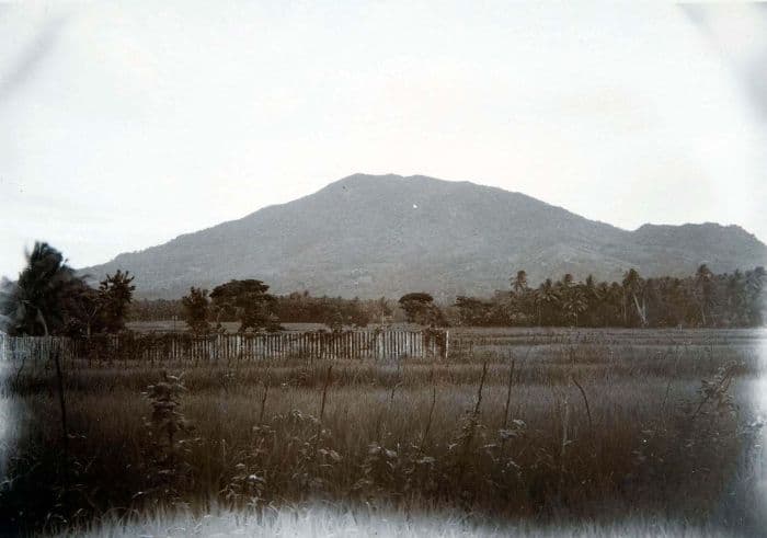
Talagabodas is a stratovolcano rising to 2,201 meters (7,221 feet) in Indonesia's Sunda-Banda Volcanic Regions. No historical eruptions have been recorded, though the volcano is classified based on geological evidence of past activity.
Geography & Climate
Talagabodas is located in Indonesia, within the Sunda Volcanic Arc of the broader Sunda-Banda Volcanic Regions. Situated at 7.21° S, 108.07° E in the Southern Hemisphere, the volcano lies within a tropical climate zone. At 2,201 meters above sea level, Talagabodas rises above the surrounding terrain into montane or subalpine conditions. The elevation creates distinct ecological zones along its flanks, from forested lower slopes to exposed rocky terrain near the summit. The volcanic landform is characterized as a composite, which describes the physical shape and structure of the volcanic edifice as observed from the surface.
Geological Context
Talagabodas sits in a subduction zone, where one tectonic plate dives beneath another, creating intense heat and pressure that generates magma. Subduction zones are responsible for many of the world's most explosive volcanoes and deadliest eruptions. For communities in Indonesia near Talagabodas, this tectonic setting means the volcano is capable of producing powerful explosive eruptions, pyroclastic flows, and lahars that can threaten populated areas within tens of kilometers of the summit. The dominant rock type is basalt / picro-basalt, a dark, fine-grained volcanic rock that forms from rapidly cooling, low-viscosity lava. Basaltic eruptions tend to be less explosive and produce fluid lava flows that can travel long distances. While less immediately dangerous than explosive eruptions, basaltic lava flows can destroy structures and infrastructure in their path, and volcanic gases released during these eruptions can affect air quality over a wide area.
GVP Reference Summary
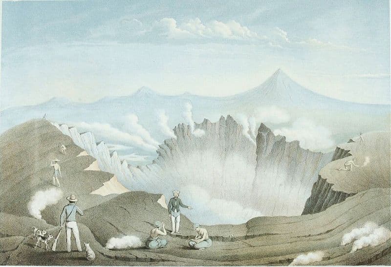
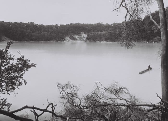
The Gunung Talagabodas stratovolcano lies immediately north of the more well-known Galunggung volcano. Talagabodas, also spelled Telaga Bodas, is one of the older Quaternary volcanoes in an arcuate N-S trending volcano group east of the city of Garut and is built up of andesitic lavas and pyroclastics. Younger pyroclastics from Gunung Putri-Eweranda overlap the Talagabodas products in the north. The crater of Talagabodas has shifted 1.3 km north from the summit crater of Canar and contains a large sulfur-saturated lake. Fumaroles, mud pots, and a warm spring are found around the lake, which has an elevated temperature. The age of the most recent eruption is not known. Changes in lake color occurred in 1913 and 1921, and expanded solfataric activity was reported in 1927. Suffocating gases have frequently killed animals that have wandered into the Pajagalan valley on the NE flank and the Kawah Saat geothermal area south of the crater lake. The Kawah Karaha fumaroles 9 km N are also part of the geothermal system (Tripp et al., 2002).
— Smithsonian Institution, Global Volcanism Program
0 Recorded Eruptions
No eruption records available for Talagabodas.
Real-Time Data
Frequently Asked Questions About Talagabodas
Is Talagabodas an active volcano?+
Talagabodas is not currently classified as active. Its activity evidence is listed as "Unrest / Holocene." No recorded eruptions have been documented. However, no volcano is ever considered permanently extinct.
How high is Talagabodas?+
Talagabodas has a summit elevation of 2,201 meters (7,221 feet) above sea level. At 2,201 meters, it is comparable in height to many significant mountain peaks and stands well above the tree line.
What type of volcano is Talagabodas?+
Talagabodas is classified as a Stratovolcano. Stratovolcanoes (also called composite volcanoes) are steep, conical volcanoes built up by many layers of hardened lava, tephra, and volcanic ash. They are among the most common and dangerous types, known for explosive eruptions.
Where is Talagabodas located?+
Talagabodas is located in Indonesia, in the Sunda-Banda Volcanic Regions. More specifically, it lies within the Sunda Volcanic Arc. Its exact coordinates are -7.208° latitude, 108.070° longitude.
Is it safe to visit Talagabodas?+
Talagabodas can generally be visited, but as with any volcano, visitors should check local conditions and any advisory notices before traveling. Indonesia may have specific regulations for accessing volcanic areas. Guided tours are often the safest and most informative way to experience a volcano.