About Galunggung
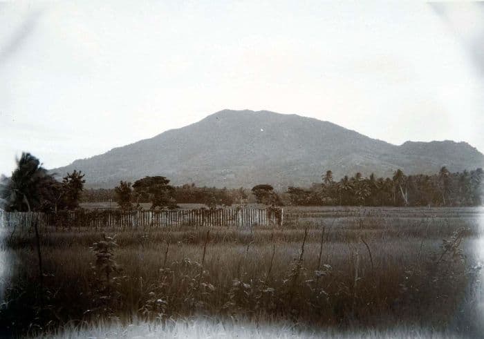
Galunggung is a stratovolcano rising to 2,168 meters (7,113 feet) in Indonesia's Sunda-Banda Volcanic Regions. It last erupted in 1984 CE, and volcanologists consider it an active volcanic system. The volcano has produced 7 recorded eruptions, with a maximum Volcanic Explosivity Index (VEI) of 5.
Geography & Climate
Galunggung is located in Indonesia, within the Sunda Volcanic Arc of the broader Sunda-Banda Volcanic Regions. Situated at 7.25° S, 108.06° E in the Southern Hemisphere, the volcano lies within a tropical climate zone. At 2,168 meters above sea level, Galunggung rises above the surrounding terrain into montane or subalpine conditions. The elevation creates distinct ecological zones along its flanks, from forested lower slopes to exposed rocky terrain near the summit. The volcanic landform is characterized as a composite, which describes the physical shape and structure of the volcanic edifice as observed from the surface.
Geological Context
Galunggung sits in a subduction zone, where one tectonic plate dives beneath another, creating intense heat and pressure that generates magma. Subduction zones are responsible for many of the world's most explosive volcanoes and deadliest eruptions. For communities in Indonesia near Galunggung, this tectonic setting means the volcano is capable of producing powerful explosive eruptions, pyroclastic flows, and lahars that can threaten populated areas within tens of kilometers of the summit. The dominant rock type is basalt / picro-basalt, a dark, fine-grained volcanic rock that forms from rapidly cooling, low-viscosity lava. Basaltic eruptions tend to be less explosive and produce fluid lava flows that can travel long distances. While less immediately dangerous than explosive eruptions, basaltic lava flows can destroy structures and infrastructure in their path, and volcanic gases released during these eruptions can affect air quality over a wide area.
Eruption History Summary
Galunggung has 7 recorded eruptions in the geological database, spanning from 2250 BCE to 1984 CE. The most powerful recorded event was a paroxysmal eruption with devastating regional consequences in 1822 CE, reaching VEI 5 on the Volcanic Explosivity Index. Notable eruptions include 1982 CE (VEI 4), 1894 CE (VEI 3), 1822 CE (VEI 5). This eruption frequency indicates a moderately active volcanic system with periodic reawakenings. The most recent eruption in 1984 CE places this volcano within the modern era of volcanological observation.
Significance
With a maximum recorded VEI of 5, Galunggung has demonstrated the capacity for paroxysmal eruptions comparable to the 1980 eruption of Mount St. Helens. Eruptions of this scale can devastate areas within 20-30 kilometers and produce ash fall that disrupts aviation and agriculture across hundreds of kilometers. With 7 recorded eruptions on file, Galunggung has enough documented activity to help scientists identify patterns in its eruptive behavior. Given its recent activity, Galunggung is closely monitored by geological survey organizations to provide early warning of future unrest.
GVP Reference Summary
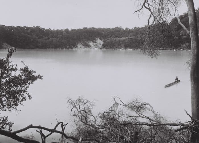
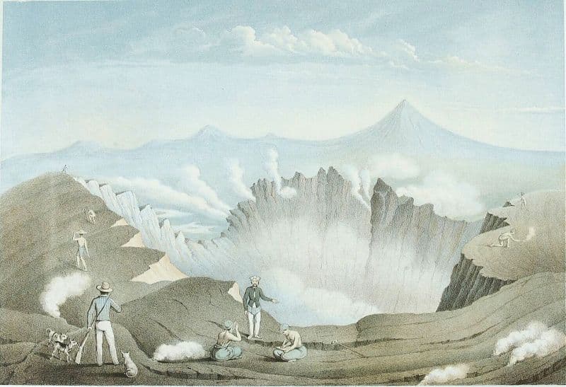
The forested slopes of Galunggung in western Java SE of Bandung are cut by a 2-km-wide collapse scarp open towards the ESE. The "Ten Thousand Hills of Tasikmalaya" dotting the plain below the volcano are debris-avalanche hummocks from the collapse about 4,200 years ago. An eruption in 1822 produced pyroclastic flows and lahars that killed over 4,000 people. A series of major explosive eruptions starting in April 1982 destroyed a number of villages, killed as many as 30 people, and forced over 60,000 to evacuate. Pyroclastic flows and heavy widespread ash caused significant damage. A large passenger jet that encountered the ash plume on 24 June lost power to all four engines but managed to land safely in Jakarta. The 1982 activity destroyed a 1918 dome and formed the Warirang crater, almost as wide as the valley, about 2 km down from the summit.
— Smithsonian Institution, Global Volcanism Program
7 Recorded Eruptions
| Year | VEI | Type | Area |
|---|---|---|---|
| 1984 | 1 | Confirmed Eruption | — |
| 1982 | 4 | Confirmed Eruption | New crater at Gunung Jadi location |
| 1918 | 1 | Confirmed Eruption | Gunung Jadi |
| 1894 | 3 | Confirmed Eruption | — |
| 1822 | 5 | Confirmed Eruption | — |
| 850 | — | Uncertain Eruption | — |
| 2250 BCE | 5 | Confirmed Eruption | — |
Real-Time Data
Frequently Asked Questions About Galunggung
Is Galunggung an active volcano?+
Yes, Galunggung is considered an active volcano. Its most recent eruption was in 1984 CE. The volcano is monitored by geological agencies, and its activity status is based on observed eruptions within recorded history.
When did Galunggung last erupt?+
The most recent recorded eruption of Galunggung occurred in 1984 CE with a Volcanic Explosivity Index (VEI) of 1. The eruption was classified as a "Confirmed Eruption." Galunggung has 7 recorded eruptions in total.
How high is Galunggung?+
Galunggung has a summit elevation of 2,168 meters (7,113 feet) above sea level. At 2,168 meters, it is comparable in height to many significant mountain peaks and stands well above the tree line.
What type of volcano is Galunggung?+
Galunggung is classified as a Stratovolcano. Stratovolcanoes (also called composite volcanoes) are steep, conical volcanoes built up by many layers of hardened lava, tephra, and volcanic ash. They are among the most common and dangerous types, known for explosive eruptions.
Where is Galunggung located?+
Galunggung is located in Indonesia, in the Sunda-Banda Volcanic Regions. More specifically, it lies within the Sunda Volcanic Arc. Its exact coordinates are -7.250° latitude, 108.058° longitude.
Is it safe to visit Galunggung?+
Visiting Galunggung requires checking current volcanic activity and alert levels. As an active volcano with eruptions as recent as 1984 CE, conditions can change rapidly. Always consult local geological authorities and follow official warnings before visiting. Many active volcanoes have designated safe viewing areas and guided tour options.