About Guntur
Guntur is a complex rising to 2,251 meters (7,386 feet) in Indonesia's Sunda-Banda Volcanic Regions. Its last known eruption was in 1847 CE. The volcano has produced 20 recorded eruptions, with a maximum Volcanic Explosivity Index (VEI) of 3.
Geography & Climate
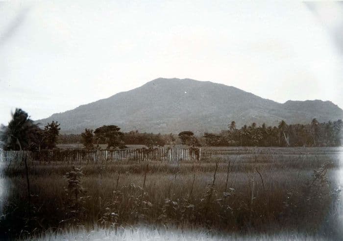
Guntur is located in Indonesia, within the Sunda Volcanic Arc of the broader Sunda-Banda Volcanic Regions. Situated at 7.14° S, 107.84° E in the Southern Hemisphere, the volcano lies within a tropical climate zone. At 2,251 meters above sea level, Guntur rises above the surrounding terrain into montane or subalpine conditions. The elevation creates distinct ecological zones along its flanks, from forested lower slopes to exposed rocky terrain near the summit. The volcanic landform is characterized as a composite, which describes the physical shape and structure of the volcanic edifice as observed from the surface.
Geological Context
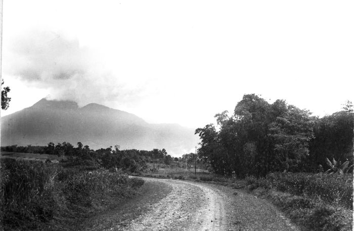
Guntur sits in a subduction zone, where one tectonic plate dives beneath another, creating intense heat and pressure that generates magma. Subduction zones are responsible for many of the world's most explosive volcanoes and deadliest eruptions. For communities in Indonesia near Guntur, this tectonic setting means the volcano is capable of producing powerful explosive eruptions, pyroclastic flows, and lahars that can threaten populated areas within tens of kilometers of the summit. The dominant rock type is andesite / basaltic andesite, a dark, fine-grained volcanic rock that forms from rapidly cooling, low-viscosity lava. Basaltic eruptions tend to be less explosive and produce fluid lava flows that can travel long distances. While less immediately dangerous than explosive eruptions, basaltic lava flows can destroy structures and infrastructure in their path, and volcanic gases released during these eruptions can affect air quality over a wide area.
Eruption History Summary
Guntur has 20 recorded eruptions in the geological database, spanning from 1809 CE to 1887 CE. The most powerful recorded event was a severe eruption capable of regional ash fall and pyroclastic flows in 1843 CE, reaching VEI 3 on the Volcanic Explosivity Index. With an average interval of roughly 4 years between eruptions over a span of 78 years, this is one of the more frequently active volcanoes in the database. This persistent activity suggests a robust and well-supplied magma system beneath the volcano.
Significance
With a maximum recorded VEI of 3, Guntur has produced eruptions capable of generating pyroclastic flows and significant ash fall in the surrounding area. While not among the largest eruptions globally, VEI 3 events pose serious hazards to local populations and can disrupt regional air travel. Its 20 recorded eruptions make it one of the most prolific volcanoes in our database, reflecting a persistent and well-documented eruptive history that has provided volcanologists with extensive data for understanding eruption patterns and forecasting future activity.
GVP Reference Summary
Guntur is a complex of several overlapping stratovolcanoes about 10 km NW of the city of Garut in western Java. Young lava flows, the most recent of which was erupted in 1840, are visible on the flanks of the erosionally unmodified Gunung Guntur, which rises about 1550 m above the plain of Garut. It is one of a group of younger cones constructed to the SW of an older eroded group of volcanoes at the NE end of the complex. Guntur, whose name means "thunder," is the only center with recorded activity, with eruptions since the late-17th century. Although it produced frequent explosive eruptions in the 19th century, it has not erupted since.
— Smithsonian Institution, Global Volcanism Program
20 Recorded Eruptions
| Year | VEI | Type | Area |
|---|---|---|---|
| 1887 | — | Uncertain Eruption | — |
| 1885 | — | Uncertain Eruption | — |
| 1847 | 2 | Confirmed Eruption | — |
| 1843 | 3 | Confirmed Eruption | — |
| 1843 | 2 | Confirmed Eruption | — |
| 1841 | 2 | Confirmed Eruption | — |
| 1840 | 2 | Confirmed Eruption | — |
| 1836 | 2 | Confirmed Eruption | — |
| 1834 | 2 | Confirmed Eruption | — |
| 1833 | 2 | Confirmed Eruption | — |
| 1832 | 2 | Confirmed Eruption | — |
| 1832 | 2 | Confirmed Eruption | — |
| 1829 | 2 | Confirmed Eruption | — |
| 1828 | 2 | Confirmed Eruption | — |
| 1827 | 2 | Confirmed Eruption | — |
| 1825 | 2 | Confirmed Eruption | — |
| 1818 | 2 | Confirmed Eruption | — |
| 1816 | 2 | Confirmed Eruption | — |
| 1815 | 2 | Confirmed Eruption | — |
| 1809 | 2 | Confirmed Eruption | — |
Real-Time Data
Frequently Asked Questions About Guntur
Is Guntur an active volcano?+
Guntur is classified as active based on credible evidence of past eruptions. Although its last known eruption was in 1847 CE, volcanologists consider it capable of erupting again.
When did Guntur last erupt?+
The most recent recorded eruption of Guntur occurred in 1887 CE. The eruption was classified as a "Uncertain Eruption." Guntur has 20 recorded eruptions in total.
How high is Guntur?+
Guntur has a summit elevation of 2,251 meters (7,386 feet) above sea level. At 2,251 meters, it is comparable in height to many significant mountain peaks and stands well above the tree line.
What type of volcano is Guntur?+
Guntur is classified as a Complex. Complex volcanoes have distinct geological characteristics that set them apart from other volcanic types.
Where is Guntur located?+
Guntur is located in Indonesia, in the Sunda-Banda Volcanic Regions. More specifically, it lies within the Sunda Volcanic Arc. Its exact coordinates are -7.143° latitude, 107.841° longitude.
Is it safe to visit Guntur?+
Guntur can generally be visited, but as with any volcano, visitors should check local conditions and any advisory notices before traveling. Indonesia may have specific regulations for accessing volcanic areas. Guided tours are often the safest and most informative way to experience a volcano.