About Papandayan
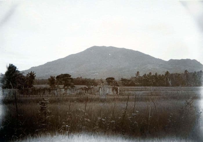
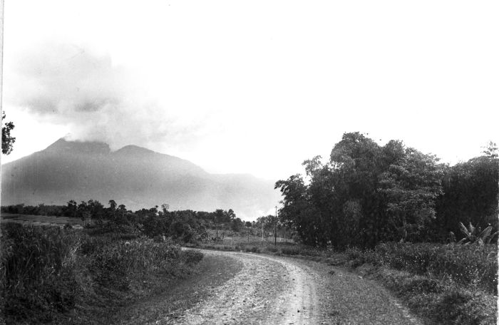
Papandayan is a stratovolcano(es) rising to 2,643 meters (8,672 feet) in Indonesia's Sunda-Banda Volcanic Regions. It has been active in recent decades, with its last eruption in 2002 CE. The volcano has produced 4 recorded eruptions, with a maximum Volcanic Explosivity Index (VEI) of 3.
Geography & Climate
Papandayan is located in Indonesia, within the Sunda Volcanic Arc of the broader Sunda-Banda Volcanic Regions. Situated at 7.32° S, 107.73° E in the Southern Hemisphere, the volcano lies within a tropical climate zone. At 2,643 meters above sea level, Papandayan rises above the surrounding terrain into montane or subalpine conditions. The elevation creates distinct ecological zones along its flanks, from forested lower slopes to exposed rocky terrain near the summit. The volcanic landform is characterized as a composite, which describes the physical shape and structure of the volcanic edifice as observed from the surface.
Geological Context
Papandayan sits in a subduction zone, where one tectonic plate dives beneath another, creating intense heat and pressure that generates magma. Subduction zones are responsible for many of the world's most explosive volcanoes and deadliest eruptions. For communities in Indonesia near Papandayan, this tectonic setting means the volcano is capable of producing powerful explosive eruptions, pyroclastic flows, and lahars that can threaten populated areas within tens of kilometers of the summit. The dominant rock type is andesite / basaltic andesite, a dark, fine-grained volcanic rock that forms from rapidly cooling, low-viscosity lava. Basaltic eruptions tend to be less explosive and produce fluid lava flows that can travel long distances. While less immediately dangerous than explosive eruptions, basaltic lava flows can destroy structures and infrastructure in their path, and volcanic gases released during these eruptions can affect air quality over a wide area.
Eruption History Summary
Papandayan has 4 recorded eruptions in the geological database, spanning from 1772 CE to 2002 CE. The most powerful recorded event was a severe eruption capable of regional ash fall and pyroclastic flows in 1772 CE, reaching VEI 3 on the Volcanic Explosivity Index. These eruptions span roughly 230 years of volcanic history. With eruptive activity as recently as 2002 CE, Papandayan remains an actively monitored volcano.
Significance
With a maximum recorded VEI of 3, Papandayan has produced eruptions capable of generating pyroclastic flows and significant ash fall in the surrounding area. While not among the largest eruptions globally, VEI 3 events pose serious hazards to local populations and can disrupt regional air travel. Given its recent activity, Papandayan is closely monitored by geological survey organizations to provide early warning of future unrest.
GVP Reference Summary
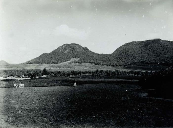
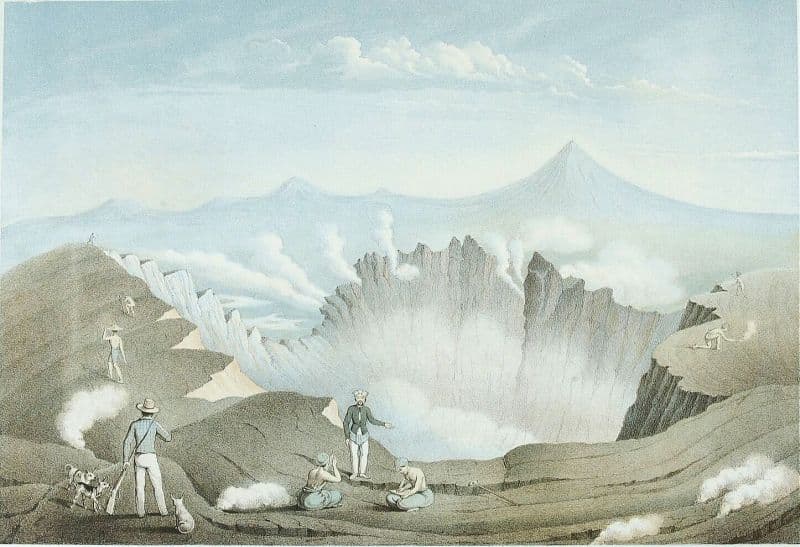
Papandayan is a complex stratovolcano at the S end of a curved volcanic massif with Kendang volcano ~9 km away at the N end, Gunung Puntang ~3.5 km NNE, and Gunung Jaya ~6 km NNE. Several episodes of collapse have created an irregular profile and produced debris avalanches that have affected lowland areas. The summit area includes four large craters, including the 1.1-km-wide, flat-floored Alun-Alun crater. A sulfur-encrusted fumarole field occupies the active Kawah Mas ("Golden Crater"). The first reported eruption, in 1772 CE, included a collapse of the NE flank and a debris avalanche that destroyed 40 villages and killed almost 3,000 people. Smaller phreatic eruptions occurred during 1923-25, 1942, and 2002.
— Smithsonian Institution, Global Volcanism Program
4 Recorded Eruptions
| Year | VEI | Type | Area |
|---|---|---|---|
| 2002 | 2 | Confirmed Eruption | Kawah Baru, Kawah Nangklak |
| 1942 | 1 | Confirmed Eruption | — |
| 1923 | 1 | Confirmed Eruption | Kawah Baru, Kawah Nangklak |
| 1772 | 3 | Confirmed Eruption | — |
Real-Time Data
Frequently Asked Questions About Papandayan
Is Papandayan an active volcano?+
Yes, Papandayan is considered an active volcano. Its most recent eruption was in 2002 CE. The volcano is monitored by geological agencies, and its activity status is based on observed eruptions within recorded history.
When did Papandayan last erupt?+
The most recent recorded eruption of Papandayan occurred in 2002 CE with a Volcanic Explosivity Index (VEI) of 2. The eruption was classified as a "Confirmed Eruption." Papandayan has 4 recorded eruptions in total.
How high is Papandayan?+
Papandayan has a summit elevation of 2,643 meters (8,672 feet) above sea level. At 2,643 meters, it is comparable in height to many significant mountain peaks and stands well above the tree line.
What type of volcano is Papandayan?+
Papandayan is classified as a Stratovolcano(es). Stratovolcano(es) volcanoes have distinct geological characteristics that set them apart from other volcanic types.
Where is Papandayan located?+
Papandayan is located in Indonesia, in the Sunda-Banda Volcanic Regions. More specifically, it lies within the Sunda Volcanic Arc. Its exact coordinates are -7.317° latitude, 107.731° longitude.
Is it safe to visit Papandayan?+
Visiting Papandayan requires checking current volcanic activity and alert levels. As an active volcano with eruptions as recent as 2002 CE, conditions can change rapidly. Always consult local geological authorities and follow official warnings before visiting. Many active volcanoes have designated safe viewing areas and guided tour options.