About Bufumbira Volcanic Field
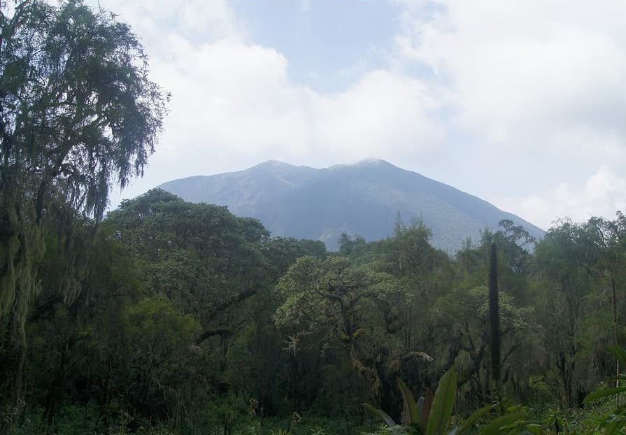
Bufumbira Volcanic Field is a volcanic field rising to 2,100 meters (6,890 feet) in Uganda's Eastern Africa Volcanic Regions. No historical eruptions have been recorded, though the volcano is classified based on geological evidence of past activity.
Geography & Climate
Bufumbira Volcanic Field is located in Uganda, within the Albertine Rift Volcanic Province of the broader Eastern Africa Volcanic Regions. Situated at 1.30° S, 29.68° E in the Southern Hemisphere, the volcano lies within a tropical climate zone. At 2,100 meters above sea level, Bufumbira Volcanic Field rises above the surrounding terrain into montane or subalpine conditions. The elevation creates distinct ecological zones along its flanks, from forested lower slopes to exposed rocky terrain near the summit. The volcanic landform is characterized as a cluster, which describes the physical shape and structure of the volcanic edifice as observed from the surface.
GVP Reference Summary
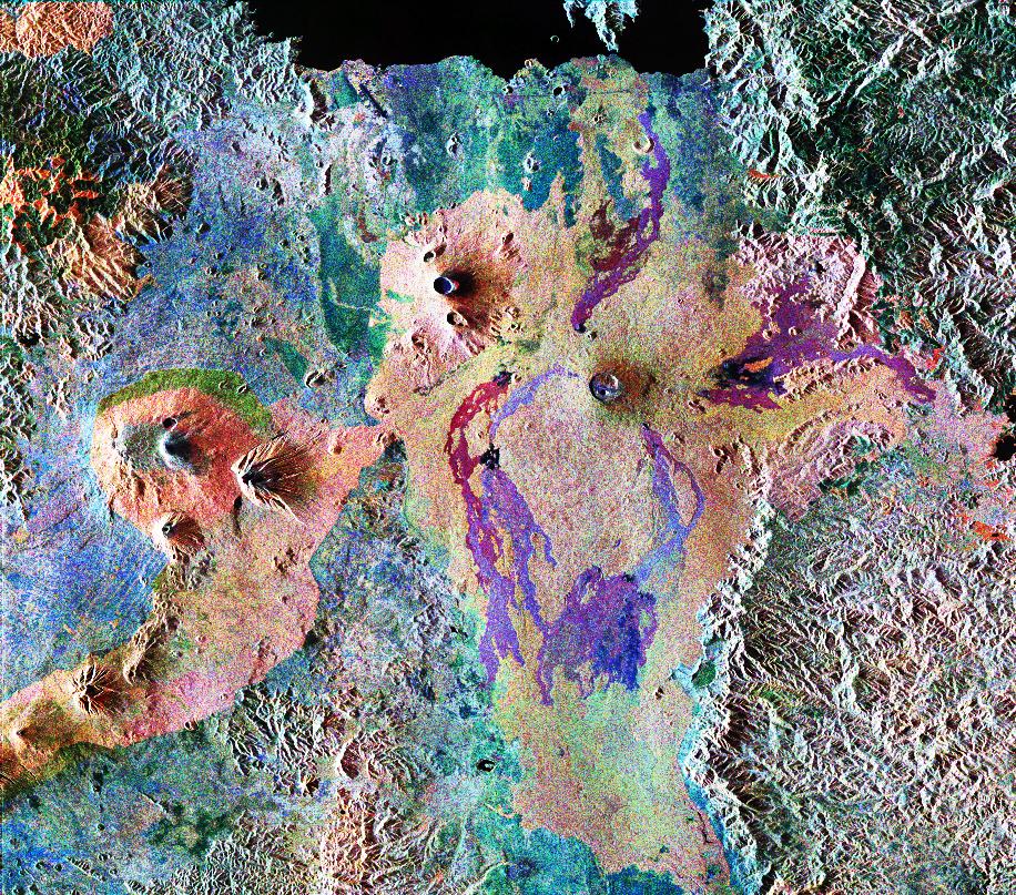
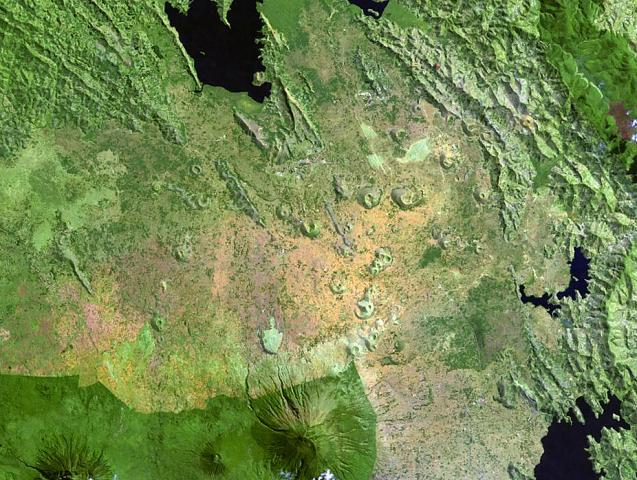
The Bufumbira Volcanic Field in SW Uganda consists of a group of about 40 cinder cones over an area of about 320 km2 extending 20 km N of the large stratovolcanoes of the NE portion of the Virunga Mountains. The rocks are noted for their unusual ultrapotassic chemistry, including silica undersaturated and vesicular basalts (Barifaijo et al., 2010). The cinder cones occur in clusters, were erupted along lineaments, and are typically breached on one side by lava flows. The youngest 40Ar/39Ar dated samples reported by Pitcavage et al. (2021) were about 21 ka.
— Smithsonian Institution, Global Volcanism Program
0 Recorded Eruptions
No eruption records available for Bufumbira Volcanic Field.
Real-Time Data
Frequently Asked Questions About Bufumbira Volcanic Field
Is Bufumbira Volcanic Field an active volcano?+
Bufumbira Volcanic Field is not currently classified as active. Its activity evidence is listed as "unknown." No recorded eruptions have been documented. However, no volcano is ever considered permanently extinct.
How high is Bufumbira Volcanic Field?+
Bufumbira Volcanic Field has a summit elevation of 2,100 meters (6,890 feet) above sea level. At 2,100 meters, it is comparable in height to many significant mountain peaks and stands well above the tree line.
What type of volcano is Bufumbira Volcanic Field?+
Bufumbira Volcanic Field is classified as a Volcanic field. Volcanic fields consist of clusters of small volcanic vents and cinder cones spread across a region. Rather than a single central vent, eruptions can occur at many points across the field.
Where is Bufumbira Volcanic Field located?+
Bufumbira Volcanic Field is located in Uganda, in the Eastern Africa Volcanic Regions. More specifically, it lies within the Albertine Rift Volcanic Province. Its exact coordinates are -1.304° latitude, 29.683° longitude.
Is it safe to visit Bufumbira Volcanic Field?+
Bufumbira Volcanic Field can generally be visited, but as with any volcano, visitors should check local conditions and any advisory notices before traveling. Uganda may have specific regulations for accessing volcanic areas. Guided tours are often the safest and most informative way to experience a volcano.