About Muhavura
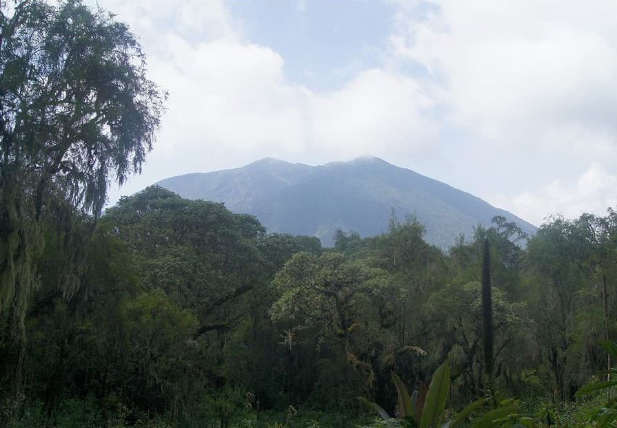
Muhavura is a stratovolcano rising to 4,103 meters (13,462 feet) in Uganda-Rwanda's Eastern Africa Volcanic Regions. No historical eruptions have been recorded, though the volcano is classified based on geological evidence of past activity.
Geography & Climate
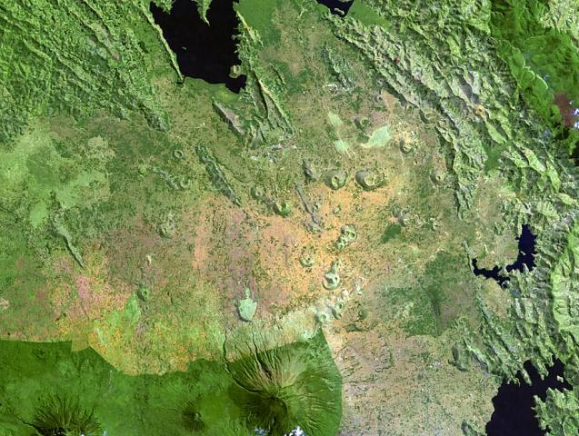
Muhavura is located in Uganda-Rwanda, within the Albertine Rift Volcanic Province of the broader Eastern Africa Volcanic Regions. Situated at 1.38° S, 29.68° E in the Southern Hemisphere, the volcano lies within a tropical climate zone. Standing at 4,103 meters above sea level, Muhavura towers above the alpine zone, where vegetation gives way to bare rock, snow, and ice for much of the year. The high elevation means the upper slopes experience significantly colder temperatures than surrounding lowlands. The volcanic landform is characterized as a composite, which describes the physical shape and structure of the volcanic edifice as observed from the surface.
GVP Reference Summary
Muhavura (or Muhabura) volcano, at the NE end of the Virunga Range, is a stratovolcano with a 40-m-wide lake in its summit crater. The smaller Mgahinga volcano is about 3.5 km E across a broad saddle. The two volcanoes have produced basanitic-to-trachyandesitic lavas.
— Smithsonian Institution, Global Volcanism Program
0 Recorded Eruptions
No eruption records available for Muhavura.
Real-Time Data
Frequently Asked Questions About Muhavura
Is Muhavura an active volcano?+
Muhavura is not currently classified as active. Its activity evidence is listed as "unknown." No recorded eruptions have been documented. However, no volcano is ever considered permanently extinct.
How high is Muhavura?+
Muhavura has a summit elevation of 4,103 meters (13,462 feet) above sea level. At 4,103 meters, it stands taller than Mount Rainier (4,392m) and is among the world's major volcanic peaks.
What type of volcano is Muhavura?+
Muhavura is classified as a Stratovolcano. Stratovolcanoes (also called composite volcanoes) are steep, conical volcanoes built up by many layers of hardened lava, tephra, and volcanic ash. They are among the most common and dangerous types, known for explosive eruptions.
Where is Muhavura located?+
Muhavura is located in Uganda-Rwanda, in the Eastern Africa Volcanic Regions. More specifically, it lies within the Albertine Rift Volcanic Province. Its exact coordinates are -1.383° latitude, 29.678° longitude.
Is it safe to visit Muhavura?+
Muhavura can generally be visited, but as with any volcano, visitors should check local conditions and any advisory notices before traveling. Uganda-Rwanda may have specific regulations for accessing volcanic areas. Guided tours are often the safest and most informative way to experience a volcano.