About Whakaari/White Island
Whakaari/White Island is a stratovolcano(es) rising to 294 meters (965 feet) in New Zealand's Tonga-Kermadec Volcanic Regions. The volcano is currently active, with its most recent eruption in 2025 CE. The volcano has produced 20 recorded eruptions, with a maximum Volcanic Explosivity Index (VEI) of 3.
Geography & Climate
Whakaari/White Island is located in New Zealand, within the Taupo Volcanic Arc of the broader Tonga-Kermadec Volcanic Regions. Situated at 37.52° S, 177.18° E in the Southern Hemisphere, the volcano lies within a temperate climate zone. At just 294 meters above sea level, Whakaari/White Island is a relatively low-elevation volcanic feature. Despite its modest height, it remains an active geological formation with the same underlying magmatic processes as its taller counterparts. The volcanic landform is characterized as a composite, which describes the physical shape and structure of the volcanic edifice as observed from the surface.
Geological Context
Whakaari/White Island sits in a subduction zone, where one tectonic plate dives beneath another, creating intense heat and pressure that generates magma. Subduction zones are responsible for many of the world's most explosive volcanoes and deadliest eruptions. For communities in New Zealand near Whakaari/White Island, this tectonic setting means the volcano is capable of producing powerful explosive eruptions, pyroclastic flows, and lahars that can threaten populated areas within tens of kilometers of the summit. The dominant rock type is andesite / basaltic andesite, a dark, fine-grained volcanic rock that forms from rapidly cooling, low-viscosity lava. Basaltic eruptions tend to be less explosive and produce fluid lava flows that can travel long distances. While less immediately dangerous than explosive eruptions, basaltic lava flows can destroy structures and infrastructure in their path, and volcanic gases released during these eruptions can affect air quality over a wide area.
Eruption History Summary
Whakaari/White Island has 20 recorded eruptions in the geological database, spanning from 1968 CE to 2025 CE. The most powerful recorded event was a severe eruption capable of regional ash fall and pyroclastic flows in 2000 CE, reaching VEI 3 on the Volcanic Explosivity Index. Notable eruptions include 2000 CE (VEI 3), 1986 CE (VEI 3), 1976 CE (VEI 3). With an average interval of roughly 3 years between eruptions over a span of 57 years, this is one of the more frequently active volcanoes in the database. This persistent activity suggests a robust and well-supplied magma system beneath the volcano. With eruptive activity as recently as 2025 CE, Whakaari/White Island remains an actively monitored volcano.
Significance
With a maximum recorded VEI of 3, Whakaari/White Island has produced eruptions capable of generating pyroclastic flows and significant ash fall in the surrounding area. While not among the largest eruptions globally, VEI 3 events pose serious hazards to local populations and can disrupt regional air travel. Its 20 recorded eruptions make it one of the most prolific volcanoes in our database, reflecting a persistent and well-documented eruptive history that has provided volcanologists with extensive data for understanding eruption patterns and forecasting future activity. Given its recent activity, Whakaari/White Island is closely monitored by geological survey organizations to provide early warning of future unrest.
GVP Reference Summary
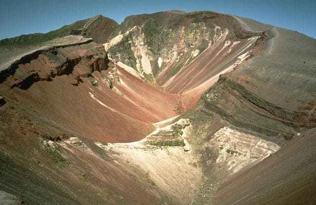
The uninhabited Whakaari/White Island is the 2 x 2.4 km emergent summit of a 16 x 18 km submarine volcano in the Bay of Plenty about 50 km offshore of North Island. The island consists of two overlapping andesitic-to-dacitic stratovolcanoes. The SE side of the crater is open at sea level, with the recent activity centered about 1 km from the shore close to the rear crater wall. Volckner Rocks, sea stacks that are remnants of a lava dome, lie 5 km NW. Descriptions of volcanism since 1826 have included intermittent moderate phreatic, phreatomagmatic, and Strombolian eruptions; activity there also forms a prominent part of Maori legends. The formation of many new vents during the 19th and 20th centuries caused rapid changes in crater floor topography. Collapse of the crater wall in 1914 produced a debris avalanche that buried buildings and workers at a sulfur-mining project. Explosive activity in December 2019 took place while tourists were present, resulting in many fatalities. The official government name Whakaari/White Island is a combination of the full Maori name of Te Puia o Whakaari ("The Dramatic Volcano") and White Island (referencing the constant steam plume) given by Captain James Cook in 1769.
— Smithsonian Institution, Global Volcanism Program
20 Recorded Eruptions
| Year | VEI | Type | Area |
|---|---|---|---|
| 2025 | — | Confirmed Eruption | — |
| 2024 | 1 | Confirmed Eruption | — |
| 2019 | 2 | Confirmed Eruption | 1978/90 Crater Complex |
| 2016 | 1 | Confirmed Eruption | 1978/90 Crater Complex |
| 2016 | 1 | Confirmed Eruption | 2012 lava dome |
| 2012 | 2 | Confirmed Eruption | 1978/90 Crater Complex |
| 2001 | 2 | Confirmed Eruption | MH vent |
| 2000 | 3 | Confirmed Eruption | MH vent |
| 1998 | 1 | Confirmed Eruption | — |
| 1998 | 2 | Confirmed Eruption | NW corner of 1978/90 crater complex |
| 1995 | 1 | Confirmed Eruption | Wade Crater |
| 1986 | 3 | Confirmed Eruption | Congress and numerous other craters |
| 1983 | 2 | Confirmed Eruption | North margin of 1978 crater complex |
| 1976 | 3 | Confirmed Eruption | Christmas, Gibrus, and 1978 craters |
| 1974 | 2 | Confirmed Eruption | SE of Donald Mound, |
| 1971 | 2 | Confirmed Eruption | Noisy Nellie Crater |
| 1971 | 2 | Confirmed Eruption | South of Rudolf (1971 crater) |
| 1970 | 2 | Confirmed Eruption | Rudolf vent |
| 1969 | 2 | Confirmed Eruption | Rudolf vent |
| 1968 | 3 | Confirmed Eruption | Rudolf vent (back wall of 1933 crater) |
Real-Time Data
Frequently Asked Questions About Whakaari/White Island
Is Whakaari/White Island an active volcano?+
Yes, Whakaari/White Island is considered an active volcano. Its most recent eruption was in 2025 CE. The volcano is monitored by geological agencies, and its activity status is based on observed eruptions within recorded history.
When did Whakaari/White Island last erupt?+
The most recent recorded eruption of Whakaari/White Island occurred in 2025 CE. The eruption was classified as a "Confirmed Eruption." Whakaari/White Island has 20 recorded eruptions in total.
How high is Whakaari/White Island?+
Whakaari/White Island has a summit elevation of 294 meters (965 feet) above sea level. At 294 meters, it is a relatively low-elevation volcano.
What type of volcano is Whakaari/White Island?+
Whakaari/White Island is classified as a Stratovolcano(es). Stratovolcano(es) volcanoes have distinct geological characteristics that set them apart from other volcanic types.
Where is Whakaari/White Island located?+
Whakaari/White Island is located in New Zealand, in the Tonga-Kermadec Volcanic Regions. More specifically, it lies within the Taupo Volcanic Arc. Its exact coordinates are -37.520° latitude, 177.180° longitude.
Is it safe to visit Whakaari/White Island?+
Visiting Whakaari/White Island requires checking current volcanic activity and alert levels. As an active volcano with eruptions as recent as 2025 CE, conditions can change rapidly. Always consult local geological authorities and follow official warnings before visiting. Many active volcanoes have designated safe viewing areas and guided tour options.