About Elmenteita Badlands
Elmenteita Badlands is a pyroclastic cone(s) rising to 2,126 meters (6,975 feet) in Kenya's Eastern Africa Volcanic Regions. No historical eruptions have been recorded, though the volcano is classified based on geological evidence of past activity.
Geography & Climate
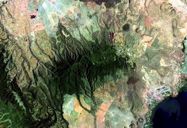
Elmenteita Badlands is located in Kenya, within the Kenyan Rift Volcanic Province of the broader Eastern Africa Volcanic Regions. Situated at 0.55° S, 36.25° E in the Southern Hemisphere, the volcano lies within a tropical climate zone. At 2,126 meters above sea level, Elmenteita Badlands rises above the surrounding terrain into montane or subalpine conditions. The elevation creates distinct ecological zones along its flanks, from forested lower slopes to exposed rocky terrain near the summit. The volcanic landform is characterized as a cluster, which describes the physical shape and structure of the volcanic edifice as observed from the surface.
Geological Context
Elmenteita Badlands is situated along a rift zone, where tectonic plates are pulling apart. As the crust thins and fractures, magma rises to fill the gap, creating volcanic activity. Rift volcanism typically produces more fluid lava flows rather than explosive blasts, which means communities near Elmenteita Badlands in Kenya generally face slower-moving hazards like lava flows and ground fissures rather than sudden pyroclastic events. However, rift volcanoes can still generate significant ash emissions and gas releases that affect local air quality. The dominant rock type is basalt / picro-basalt, a dark, fine-grained volcanic rock that forms from rapidly cooling, low-viscosity lava. Basaltic eruptions tend to be less explosive and produce fluid lava flows that can travel long distances. While less immediately dangerous than explosive eruptions, basaltic lava flows can destroy structures and infrastructure in their path, and volcanic gases released during these eruptions can affect air quality over a wide area.
GVP Reference Summary
The Elmenteita Badlands, located between Lake Elmenteita (N) and Eburru volcano (S), is an area of pyroclastic cones and lava flows of varying ages. Large basaltic lava flows and ash cones post-date the 10,000-year-old high-stand of Lake Elmenteita (Thomson and Dodson, 1963).
— Smithsonian Institution, Global Volcanism Program
0 Recorded Eruptions
No eruption records available for Elmenteita Badlands.
Real-Time Data
Frequently Asked Questions About Elmenteita Badlands
Is Elmenteita Badlands an active volcano?+
Elmenteita Badlands is classified as active based on credible evidence of past eruptions. Although its last known eruption was in prehistoric times, volcanologists consider it capable of erupting again.
How high is Elmenteita Badlands?+
Elmenteita Badlands has a summit elevation of 2,126 meters (6,975 feet) above sea level. At 2,126 meters, it is comparable in height to many significant mountain peaks and stands well above the tree line.
What type of volcano is Elmenteita Badlands?+
Elmenteita Badlands is classified as a Pyroclastic cone(s). Pyroclastic cones (or cinder cones) are small, steep-sided volcanic cones built from fragments of lava blasted into the air. They are the simplest type of volcano and often form in groups.
Where is Elmenteita Badlands located?+
Elmenteita Badlands is located in Kenya, in the Eastern Africa Volcanic Regions. More specifically, it lies within the Kenyan Rift Volcanic Province. Its exact coordinates are -0.546° latitude, 36.249° longitude.
Is it safe to visit Elmenteita Badlands?+
Elmenteita Badlands can generally be visited, but as with any volcano, visitors should check local conditions and any advisory notices before traveling. Kenya may have specific regulations for accessing volcanic areas. Guided tours are often the safest and most informative way to experience a volcano.