About Menengai
Menengai is a shield rising to 2,278 meters (7,474 feet) in Kenya's Eastern Africa Volcanic Regions. The volcano is currently active, with its most recent eruption in 6050 BCE. The volcano has produced 2 recorded eruptions, with a maximum Volcanic Explosivity Index (VEI) of 6.
Geography & Climate
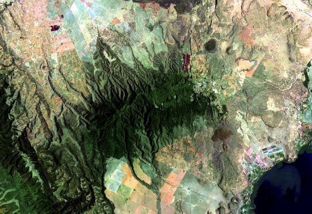
Menengai is located in Kenya, within the Kenyan Rift Volcanic Province of the broader Eastern Africa Volcanic Regions. Situated at 0.20° S, 36.07° E in the Southern Hemisphere, the volcano lies within a tropical climate zone. At 2,278 meters above sea level, Menengai rises above the surrounding terrain into montane or subalpine conditions. The elevation creates distinct ecological zones along its flanks, from forested lower slopes to exposed rocky terrain near the summit. The volcanic landform is characterized as a shield, which describes the physical shape and structure of the volcanic edifice as observed from the surface.
Geological Context
Menengai is situated along a rift zone, where tectonic plates are pulling apart. As the crust thins and fractures, magma rises to fill the gap, creating volcanic activity. Rift volcanism typically produces more fluid lava flows rather than explosive blasts, which means communities near Menengai in Kenya generally face slower-moving hazards like lava flows and ground fissures rather than sudden pyroclastic events. However, rift volcanoes can still generate significant ash emissions and gas releases that affect local air quality. The dominant rock type is trachyte / trachydacite, an intermediate to silica-rich volcanic rock. This composition typically produces more viscous magma, leading to more explosive eruptions with ash columns and pyroclastic flows. Andesitic and dacitic magmas build pressure before erupting, which is why volcanoes with this rock chemistry are often associated with Plinian-style eruptions that can send ash tens of kilometers into the atmosphere and disrupt aviation across entire regions.
Eruption History Summary
Menengai has 2 recorded eruptions in the geological database, spanning from 7350 BCE to 6050 BCE. The most powerful recorded event was a colossal eruption capable of affecting global climate for years in 6050 BCE, reaching VEI 6 on the Volcanic Explosivity Index. These eruptions span roughly 1,300 years of volcanic history.
Significance
Menengai has produced at least one eruption of VEI 6 or higher, placing it among the most powerful volcanic systems on Earth. Eruptions of this magnitude inject massive quantities of sulfur dioxide into the stratosphere, affecting global climate by lowering average temperatures for one to three years after the event.
GVP Reference Summary
The massive Menengai shield volcano occupies the floor of the East African Rift. Construction of a 30 km3 shield volcano beginning about 200,000 years ago was followed by the eruption of two voluminous ash-flow tuffs, each preceded by major pumice falls. The first took place about 29,000 years ago and produced a large caldera. The second, producing about 30 km3 of compositionally zoned peralkaline trachytic magma about 8000 years ago, was associated with formation of the present-day 8 x 12 km summit caldera. More than 70 post-caldera lava flows cover the caldera floor, the youngest of which may be only a few hundred years old. No historical eruptions are known. Fumarolic activity is restricted to the caldera.
— Smithsonian Institution, Global Volcanism Program
2 Recorded Eruptions
| Year | VEI | Type | Area |
|---|---|---|---|
| 6050 BCE | 6 | Confirmed Eruption | — |
| 7350 BCE | — | Confirmed Eruption | — |
Real-Time Data
Frequently Asked Questions About Menengai
Is Menengai an active volcano?+
Menengai is not currently classified as active. Its activity evidence is listed as "Eruption Dated." The last known eruption was in 6050 BCE. However, no volcano is ever considered permanently extinct.
When did Menengai last erupt?+
The most recent recorded eruption of Menengai occurred in 6050 BCE with a Volcanic Explosivity Index (VEI) of 6. The eruption was classified as a "Confirmed Eruption." Menengai has 2 recorded eruptions in total.
How high is Menengai?+
Menengai has a summit elevation of 2,278 meters (7,474 feet) above sea level. At 2,278 meters, it is comparable in height to many significant mountain peaks and stands well above the tree line.
What type of volcano is Menengai?+
Menengai is classified as a Shield. Shield volcanoes have distinct geological characteristics that set them apart from other volcanic types.
Where is Menengai located?+
Menengai is located in Kenya, in the Eastern Africa Volcanic Regions. More specifically, it lies within the Kenyan Rift Volcanic Province. Its exact coordinates are -0.200° latitude, 36.070° longitude.
Is it safe to visit Menengai?+
Menengai can generally be visited, but as with any volcano, visitors should check local conditions and any advisory notices before traveling. Kenya may have specific regulations for accessing volcanic areas. Guided tours are often the safest and most informative way to experience a volcano.