About Patilla Pata
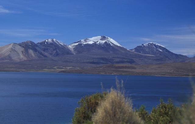
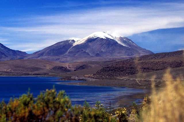
Patilla Pata is a stratovolcano rising to 5,300 meters (17,389 feet) in Bolivia's South America Volcanic Regions. No historical eruptions have been recorded, though the volcano is classified based on geological evidence of past activity.
Geography & Climate
Patilla Pata is located in Bolivia, within the Central Andean Volcanic Arc of the broader South America Volcanic Regions. Situated at 18.05° S, 69.03° W in the Southern Hemisphere, the volcano lies within a tropical climate zone. At 5,300 meters above sea level, Patilla Pata reaches well into the permanent snow and ice zone. Glaciers and snowpack on the upper slopes create the potential for lahars — destructive volcanic mudflows — during eruptions, as heat rapidly melts ice and snow. The volcanic landform is characterized as a composite, which describes the physical shape and structure of the volcanic edifice as observed from the surface.
GVP Reference Summary
The International Association of Volcanology and Chemistry of the Earth's Interior data sheets (1973) classified Patilla Pata volcano in Bolivia NW of Sajama volcano as being active during the past 2000 years, but de Silva (2007 pers. comm.) noted no evidence from analysis of satellite images for Holocene activity in this area. Patilla Pata has undergone extensive glacial erosion. The andesitic stratovolcano has also produced basaltic lava flows.
— Smithsonian Institution, Global Volcanism Program
0 Recorded Eruptions
No eruption records available for Patilla Pata.
Real-Time Data
Frequently Asked Questions About Patilla Pata
Is Patilla Pata an active volcano?+
Patilla Pata is not currently classified as active. Its activity evidence is listed as "unknown." No recorded eruptions have been documented. However, no volcano is ever considered permanently extinct.
How high is Patilla Pata?+
Patilla Pata has a summit elevation of 5,300 meters (17,389 feet) above sea level. At 5,300 meters, it stands taller than Mount Rainier (4,392m) and is among the world's major volcanic peaks.
What type of volcano is Patilla Pata?+
Patilla Pata is classified as a Stratovolcano. Stratovolcanoes (also called composite volcanoes) are steep, conical volcanoes built up by many layers of hardened lava, tephra, and volcanic ash. They are among the most common and dangerous types, known for explosive eruptions.
Where is Patilla Pata located?+
Patilla Pata is located in Bolivia, in the South America Volcanic Regions. More specifically, it lies within the Central Andean Volcanic Arc. Its exact coordinates are -18.050° latitude, -69.030° longitude.
Is it safe to visit Patilla Pata?+
Patilla Pata can generally be visited, but as with any volcano, visitors should check local conditions and any advisory notices before traveling. Bolivia may have specific regulations for accessing volcanic areas. Guided tours are often the safest and most informative way to experience a volcano.