About Hualalai
Hualalai is a shield rising to 2,523 meters (8,278 feet) in United States's Eastern Pacific Volcanic Regions. Its last known eruption was in 1801 CE. The volcano has produced 20 recorded eruptions, with a maximum Volcanic Explosivity Index (VEI) of 2.
Geography & Climate
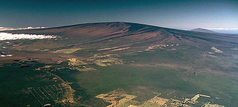
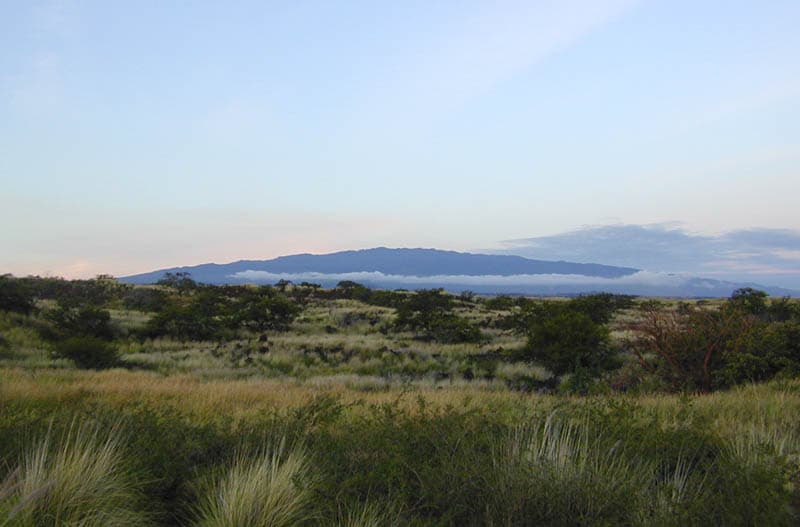
Hualalai is located in United States, within the Hawaiian-Emperor Hotspot Volcano Group of the broader Eastern Pacific Volcanic Regions. Situated at 19.69° N, 155.87° W in the Northern Hemisphere, the volcano lies within a tropical climate zone. At 2,523 meters above sea level, Hualalai rises above the surrounding terrain into montane or subalpine conditions. The elevation creates distinct ecological zones along its flanks, from forested lower slopes to exposed rocky terrain near the summit. The volcanic landform is characterized as a shield, which describes the physical shape and structure of the volcanic edifice as observed from the surface.
Geological Context
Hualalai is an intraplate volcano, meaning it formed away from any plate boundary. These volcanoes are often powered by hotspots — plumes of abnormally hot mantle material rising from deep within the Earth. Hotspot volcanoes like Hualalai tend to produce effusive eruptions with lava flows that can be relatively predictable, giving nearby communities in United States more time to prepare. However, they can also produce explosive phases, particularly when magma interacts with groundwater. The dominant rock type is basalt / picro-basalt, a dark, fine-grained volcanic rock that forms from rapidly cooling, low-viscosity lava. Basaltic eruptions tend to be less explosive and produce fluid lava flows that can travel long distances. While less immediately dangerous than explosive eruptions, basaltic lava flows can destroy structures and infrastructure in their path, and volcanic gases released during these eruptions can affect air quality over a wide area.
Eruption History Summary
Hualalai has 20 recorded eruptions in the geological database, spanning from 4410 BCE to 1800 CE. The most powerful recorded event was an explosive event producing ash plumes up to several kilometers in 1240 CE, reaching VEI 2 on the Volcanic Explosivity Index. With an average interval of roughly 311 years between eruptions over a span of 6,210 years, this is one of the more frequently active volcanoes in the database. This persistent activity suggests a robust and well-supplied magma system beneath the volcano.
Significance
Its 20 recorded eruptions make it one of the most prolific volcanoes in our database, reflecting a persistent and well-documented eruptive history that has provided volcanologists with extensive data for understanding eruption patterns and forecasting future activity.
GVP Reference Summary
The basaltic Hualalai, at the western end of the island, is the third youngest shield volcano on Hawaii. Three rift zones, with numerous cinder cones and spatter cones, trend N, NW, and SE, and converge about 5 km E of the summit. Detailed mapping has shown that 95% of the surface area is of Holocene age, more than half is less than 3,000 years old, and a quarter is less than 1,000 years old. Eruptions at the end of the 18th century and in 1801 produced lava flows from vents on the NW rift zone that reached the sea and buried villages; the 1801 Huehue lava flow underlies part of the airport at Kona. The earlier of the two flows, the Kaupulehu lava flow, is notable for its large quantities of lava-encrusted mafic and ultramafic nodular xenoliths.
— Smithsonian Institution, Global Volcanism Program
20 Recorded Eruptions
| Year | VEI | Type | Area |
|---|---|---|---|
| 1800 | 0 | Confirmed Eruption | NW rift zone (520 m) |
| 1784 | 0 | Confirmed Eruption | NW rift zone (1400-1900 m) |
| 1650 | 1 | Confirmed Eruption | NW rift zone (Luamakami) |
| 1240 | 2 | Confirmed Eruption | SSE rift zone (Waha Pele) |
| 1150 | 0 | Confirmed Eruption | NW rift zone (Puu Alauawa, Nahaha) |
| 1050 | 1 | Confirmed Eruption | SSE rift zone (3 km NE of Waha Pele) |
| 920 | 0 | Confirmed Eruption | NW rift zone (2 km NW of Luamakami) |
| 770 | 1 | Confirmed Eruption | SSE rift zone (4.5 km NW of Waha Pele |
| 80 BCE | 0 | Confirmed Eruption | North rift zone (1130-1830 m) |
| 350 BCE | 0 | Confirmed Eruption | SE flank (1 km west of Waha Pehe) |
| 400 BCE | 0 | Confirmed Eruption | NW rift zone (Luamakami) |
| 440 BCE | 0 | Confirmed Eruption | North rift zone (3 km NE of Hainoa) |
| 720 BCE | 0 | Confirmed Eruption | North rift zone (700 m ENE of Hainoa) |
| 1080 BCE | 0 | Confirmed Eruption | — |
| 1150 BCE | 0 | Confirmed Eruption | NW rift zone (0.7 km NW of Luamakami) |
| 1650 BCE | 0 | Confirmed Eruption | — |
| 2040 BCE | 0 | Confirmed Eruption | NW rift zone (0.3 km NW of Hainoa) |
| 2440 BCE | 0 | Confirmed Eruption | NW rift zone (1 km W of Hainoa Crater) |
| 2770 BCE | 0 | Confirmed Eruption | — |
| 4410 BCE | 0 | Confirmed Eruption | SE rift zone (1.6 km SE of Hainoa) |
Real-Time Data
Frequently Asked Questions About Hualalai
Is Hualalai an active volcano?+
Hualalai is classified as active based on credible evidence of past eruptions. Although its last known eruption was in 1801 CE, volcanologists consider it capable of erupting again.
When did Hualalai last erupt?+
The most recent recorded eruption of Hualalai occurred in 1800 CE with a Volcanic Explosivity Index (VEI) of 0. The eruption was classified as a "Confirmed Eruption." Hualalai has 20 recorded eruptions in total.
How high is Hualalai?+
Hualalai has a summit elevation of 2,523 meters (8,278 feet) above sea level. At 2,523 meters, it is comparable in height to many significant mountain peaks and stands well above the tree line.
What type of volcano is Hualalai?+
Hualalai is classified as a Shield. Shield volcanoes have distinct geological characteristics that set them apart from other volcanic types.
Where is Hualalai located?+
Hualalai is located in United States, in the Eastern Pacific Volcanic Regions. More specifically, it lies within the Hawaiian-Emperor Hotspot Volcano Group. Its exact coordinates are 19.692° latitude, -155.870° longitude.
Is it safe to visit Hualalai?+
Hualalai can generally be visited, but as with any volcano, visitors should check local conditions and any advisory notices before traveling. United States may have specific regulations for accessing volcanic areas. Guided tours are often the safest and most informative way to experience a volcano.