About Kama'ehuakanaloa
Kama'ehuakanaloa is a shield rising to -975 meters (-3,199 feet) in United States's Eastern Pacific Volcanic Regions. It last erupted in 1996 CE, and volcanologists consider it an active volcanic system. The volcano has produced 8 recorded eruptions.
Geography & Climate
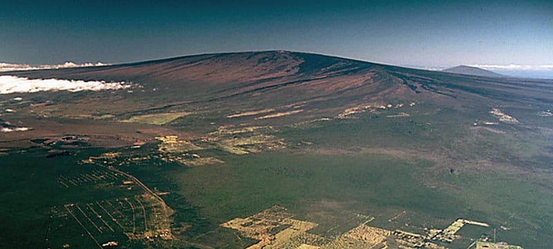
Kama'ehuakanaloa is located in United States, within the Hawaiian-Emperor Hotspot Volcano Group of the broader Eastern Pacific Volcanic Regions. Situated at 18.92° N, 155.27° W in the Northern Hemisphere, the volcano lies within a tropical climate zone. With an elevation of -975 meters — below sea level — Kama'ehuakanaloa is a submarine or submerged volcanic feature. Submarine volcanoes make up the majority of Earth's volcanic activity, though most eruptions go unobserved beneath the ocean surface. The volcanic landform is characterized as a shield, which describes the physical shape and structure of the volcanic edifice as observed from the surface.
Geological Context
Kama'ehuakanaloa is an intraplate volcano, meaning it formed away from any plate boundary. These volcanoes are often powered by hotspots — plumes of abnormally hot mantle material rising from deep within the Earth. Hotspot volcanoes like Kama'ehuakanaloa tend to produce effusive eruptions with lava flows that can be relatively predictable, giving nearby communities in United States more time to prepare. However, they can also produce explosive phases, particularly when magma interacts with groundwater. The dominant rock type is basalt / picro-basalt, a dark, fine-grained volcanic rock that forms from rapidly cooling, low-viscosity lava. Basaltic eruptions tend to be less explosive and produce fluid lava flows that can travel long distances. While less immediately dangerous than explosive eruptions, basaltic lava flows can destroy structures and infrastructure in their path, and volcanic gases released during these eruptions can affect air quality over a wide area.
Eruption History Summary
Kama'ehuakanaloa has 8 recorded eruptions in the geological database, spanning from 7050 BCE to 1996 CE. This eruption frequency indicates a moderately active volcanic system with periodic reawakenings. The most recent eruption in 1996 CE places this volcano within the modern era of volcanological observation.
Significance
With 8 recorded eruptions on file, Kama'ehuakanaloa has enough documented activity to help scientists identify patterns in its eruptive behavior. Given its recent activity, Kama'ehuakanaloa is closely monitored by geological survey organizations to provide early warning of future unrest.
GVP Reference Summary
The Kama’ehuakanaloa seamount, previously known as Loihi, lies about 35 km off the SE coast of the island of Hawaii. This youngest volcano of the Hawaiian chain has an elongated morphology dominated by two curving rift zones extending north and south of the summit. The summit region contains a caldera about 3 x 4 km and exhibits numerous lava cones, the highest of which is about 975 m below the ocean surface. The summit platform also includes two well-defined pit craters, sediment-free glassy lava, and low-temperature hydrothermal venting. An arcuate chain of small cones on the western edge of the summit extends north and south of the pit craters and merges into the crests prominent rift zones. Seismicity indicates a magmatic system distinct from that of Kilauea. During 1996 a new pit crater formed at the summit, and lava flows were erupted. Continued volcanism is expected to eventually build a new island; time estimates for the summit to reach the ocean surface range from roughly 10,000 to 100,000 years.
— Smithsonian Institution, Global Volcanism Program
8 Recorded Eruptions
| Year | VEI | Type | Area |
|---|---|---|---|
| 1996 | 0 | Confirmed Eruption | — |
| 1986 | 0 | Uncertain Eruption | — |
| 1984 | 0 | Uncertain Eruption | — |
| 1975 | 0 | Uncertain Eruption | — |
| 1971 | 0 | Uncertain Eruption | — |
| 50 BCE | 0 | Confirmed Eruption | — |
| 5050 BCE | 0 | Confirmed Eruption | — |
| 7050 BCE | 0 | Confirmed Eruption | East flank? |
Real-Time Data
Frequently Asked Questions About Kama'ehuakanaloa
Is Kama'ehuakanaloa an active volcano?+
Yes, Kama'ehuakanaloa is considered an active volcano. Its most recent eruption was in 1996 CE. The volcano is monitored by geological agencies, and its activity status is based on observed eruptions within recorded history.
When did Kama'ehuakanaloa last erupt?+
The most recent recorded eruption of Kama'ehuakanaloa occurred in 1996 CE with a Volcanic Explosivity Index (VEI) of 0. The eruption was classified as a "Confirmed Eruption." Kama'ehuakanaloa has 8 recorded eruptions in total.
How high is Kama'ehuakanaloa?+
Kama'ehuakanaloa has a summit elevation of -975 meters (-3,199 feet) above sea level. With an elevation of -975 meters (below sea level), this is a submarine or submerged volcanic feature.
What type of volcano is Kama'ehuakanaloa?+
Kama'ehuakanaloa is classified as a Shield. Shield volcanoes have distinct geological characteristics that set them apart from other volcanic types.
Where is Kama'ehuakanaloa located?+
Kama'ehuakanaloa is located in United States, in the Eastern Pacific Volcanic Regions. More specifically, it lies within the Hawaiian-Emperor Hotspot Volcano Group. Its exact coordinates are 18.920° latitude, -155.270° longitude.
Is it safe to visit Kama'ehuakanaloa?+
Visiting Kama'ehuakanaloa requires checking current volcanic activity and alert levels. As an active volcano with eruptions as recent as 1996 CE, conditions can change rapidly. Always consult local geological authorities and follow official warnings before visiting. Many active volcanoes have designated safe viewing areas and guided tour options.