About Mauna Loa
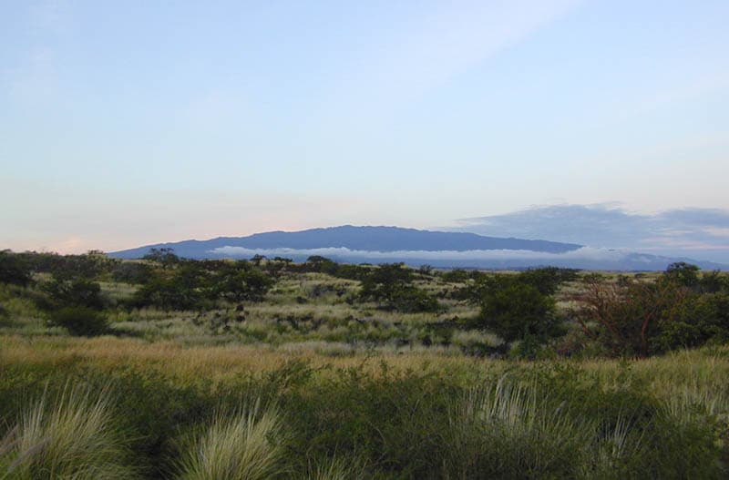
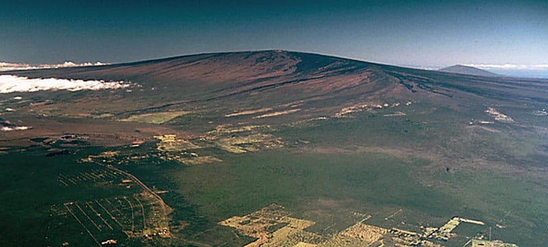
Mauna Loa is a shield rising to 4,170 meters (13,682 feet) in United States's Eastern Pacific Volcanic Regions. The volcano is currently active, with its most recent eruption in 2022 CE. The volcano has produced 111 recorded eruptions, with a maximum Volcanic Explosivity Index (VEI) of 2.
Geography & Climate
Mauna Loa is located in United States, within the Hawaiian-Emperor Hotspot Volcano Group of the broader Eastern Pacific Volcanic Regions. Situated at 19.48° N, 155.61° W in the Northern Hemisphere, the volcano lies within a tropical climate zone. Standing at 4,170 meters above sea level, Mauna Loa towers above the alpine zone, where vegetation gives way to bare rock, snow, and ice for much of the year. The high elevation means the upper slopes experience significantly colder temperatures than surrounding lowlands. The volcanic landform is characterized as a shield, which describes the physical shape and structure of the volcanic edifice as observed from the surface.
Geological Context
Mauna Loa is an intraplate volcano, meaning it formed away from any plate boundary. These volcanoes are often powered by hotspots — plumes of abnormally hot mantle material rising from deep within the Earth. Hotspot volcanoes like Mauna Loa tend to produce effusive eruptions with lava flows that can be relatively predictable, giving nearby communities in United States more time to prepare. However, they can also produce explosive phases, particularly when magma interacts with groundwater. The dominant rock type is basalt / picro-basalt, a dark, fine-grained volcanic rock that forms from rapidly cooling, low-viscosity lava. Basaltic eruptions tend to be less explosive and produce fluid lava flows that can travel long distances. While less immediately dangerous than explosive eruptions, basaltic lava flows can destroy structures and infrastructure in their path, and volcanic gases released during these eruptions can affect air quality over a wide area.
Eruption History Summary
Mauna Loa has 111 recorded eruptions in the geological database, spanning from 8050 BCE to 2022 CE. The most powerful recorded event was an explosive event producing ash plumes up to several kilometers in 1868 CE, reaching VEI 2 on the Volcanic Explosivity Index. With an average interval of roughly 91 years between eruptions over a span of 10,072 years, this is one of the more frequently active volcanoes in the database. This persistent activity suggests a robust and well-supplied magma system beneath the volcano. With eruptive activity as recently as 2022 CE, Mauna Loa remains an actively monitored volcano.
Significance
Its 111 recorded eruptions make it one of the most prolific volcanoes in the entire global volcanic record, reflecting an exceptionally persistent magma supply system that has sustained near-continuous eruptive activity over millennia. Given its recent activity, Mauna Loa is closely monitored by geological survey organizations to provide early warning of future unrest.
GVP Reference Summary
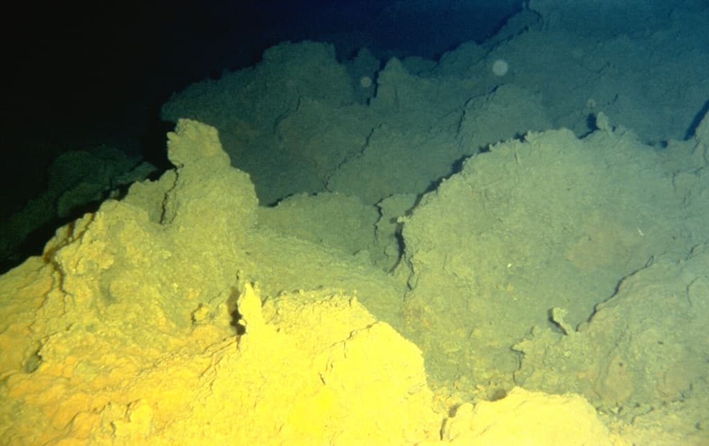
Massive Mauna Loa is a basaltic shield volcano that rises almost 9 km from the ocean floor to form the world's largest Holocene volcano. Flank eruptions typically occur from the lengthy NE and SW rift zones, and from the Moku'aweoweo summit is caldera, which is within an older and larger 6 x 8 km caldera. Two of the youngest large debris avalanches documented in Hawaii traveled nearly 100 km from Mauna Loa; the second of the Alika avalanches was emplaced about 105,000 years ago (Moore et al., 1989). Almost 90% of the surface of the volcano is covered by lavas less than 4,000 years old (Lockwood and Lipman, 1987). Beginning about 1,500 years ago, a series of voluminous overflows from a summit lava lake covered about 25% of the volcano's surface. Over the last 750 years, from shortly after the formation of Moku'aweoweo caldera until the present, an additional 25% of the volcano has been covered with lava flows, mainly from summit and NW rift zone vents.
— Smithsonian Institution, Global Volcanism Program
111 Recorded Eruptions
How Mauna Loa's 111 size-rated eruptions break down by Volcanic Explosivity Index. Select a bar to see what that size means.
Effusive — gentle lava flows with little to no explosion.
Of Mauna Loa's 111 size-rated eruptions on record, the most common was VEI 0 (102 of 111, 92%). It is overwhelmingly effusive, erupting gently at nearly the same small size again and again — classic shield-building behaviour. No eruption on record exceeded VEI 2.
Based on the Smithsonian GVP eruption record. This describes Mauna Loa's past eruptions only — it does not predict future activity. What is the VEI? · Most explosive volcanoes
| Year | VEI | Type | Area |
|---|---|---|---|
| 2022 | 0 | Confirmed Eruption | Moku‘aweoweo, Northeast Rift Zone |
| 1984 | 0 | Confirmed Eruption | Moku'aweoweo, SW and NE rift zones |
| 1975 | 0 | Confirmed Eruption | Mokuaweoweo and NE and SW rift zones, |
| 1950 | 0 | Confirmed Eruption | SW rift zone (2440 m) |
| 1949 | 0 | Confirmed Eruption | Mokuaweoweo and SW rift zone |
| 1942 | 0 | Confirmed Eruption | NE rift zone (2800 m) and Mokuaweoweo |
| 1940 | 0 | Confirmed Eruption | Mokuaweoweo and SW rift zone |
| 1935 – 1936 | 0 | Confirmed Eruption | NE rift zone (3690 m) and Mokuaweoweo |
| 1933 | 0 | Confirmed Eruption | Mokuaweoweo |
| 1926 | 0 | Confirmed Eruption | SW rift (2320 m) |
| 1919 | 0 | Confirmed Eruption | SW rift zone (3450 and 2350 m) |
| 1916 | 0 | Confirmed Eruption | SW rift zone (3000 and 2250 m) |
| 1914 – 1915 | 0 | Confirmed Eruption | Mokuaweoweo |
| 1907 | 0 | Confirmed Eruption | SW rift zone (1890 m) and Mokuaweoweo |
| 1903 | 0 | Confirmed Eruption | Mokuaweoweo |
| 1899 | 1 | Confirmed Eruption | NE rift zone (3260 m) and Mokuaweoweo |
| 1896 | 0 | Confirmed Eruption | Mokuaweoweo |
| 1892 | 0 | Confirmed Eruption | Mokuaweoweo |
| 1887 | 0 | Confirmed Eruption | SW rift zone (1740 m) and Mokuaweoweo |
| 1880 | 1 | Confirmed Eruption | Mokuaweoweo |
| 1880 – 1881 | 1 | Confirmed Eruption | NE rift zone (3170 m) |
| 1879 | 0 | Confirmed Eruption | Mokuaweoweo |
| 1877 | 0 | Confirmed Eruption | Mokuaweoweo, submarine west flank |
| 1876 | 0 | Confirmed Eruption | Mokuaweoweo |
| 1875 | 0 | Confirmed Eruption | Mokuaweoweo |
| 1875 | 0 | Confirmed Eruption | Mokuaweoweo |
| 1873 | 0 | Confirmed Eruption | Mokuaweoweo |
| 1873 – 1874 | 1 | Confirmed Eruption | Mokuaweoweo |
| 1872 | 1 | Confirmed Eruption | Mokuaweoweo |
| 1871 | 0 | Confirmed Eruption | Mokuaweoweo |
| 1870 | 0 | Uncertain Eruption | Mokuaweoweo |
| 1868 | 2 | Confirmed Eruption | SW rift zone (1000 m) and Mokuaweoweo |
| 1865 – 1866 | 0 | Confirmed Eruption | Mokuaweoweo |
| 1859 | 1 | Confirmed Eruption | North flank (2800 m) and Mokuaweoweo |
| 1855 – 1856 | 1 | Confirmed Eruption | NE rift zone (3200 m) and Mokuaweoweo |
| 1852 | 2 | Confirmed Eruption | NE rift zone (2560 m) and Mokuaweoweo |
| 1851 | 0 | Confirmed Eruption | Mokuaweoweo and SW rift zone |
| 1849 | 0 | Confirmed Eruption | Mokuaweoweo |
| 1843 | 0 | Confirmed Eruption | North flank, Mokuaweoweo and NE rift |
| 1832 | 0 | Confirmed Eruption | Mokuaweoweo and adjacent vents |
| 1750 | 0 | Confirmed Eruption | North flank (2380 m) and SW rift zone? |
| 1730 | 0 | Confirmed Eruption | NE rift zone |
| 1685 | 0 | Confirmed Eruption | NE rift zone |
| 1680 | 0 | Confirmed Eruption | NW flank |
| 1650 | 0 | Confirmed Eruption | NE rift zone |
| 1640 | 0 | Confirmed Eruption | NE rift zone |
| 1540 | 0 | Confirmed Eruption | NE rift zone |
| 1510 | 0 | Confirmed Eruption | NE rift zone |
| 1500 | 0 | Confirmed Eruption | NE rift zone |
| 1470 | 0 | Confirmed Eruption | NE rift zone |
| 1440 | 0 | Confirmed Eruption | NE rift zone and NW flank |
| 1390 | 0 | Confirmed Eruption | NE rift zone |
| 1370 | 0 | Confirmed Eruption | NE rift zone and Mokuaweoweo |
| 1360 | 0 | Confirmed Eruption | NE rift zone |
| 1310 | 0 | Confirmed Eruption | SW rift zone |
| 1190 | 0 | Confirmed Eruption | NE rift zone and Mokuaweoweo |
| 1170 | 0 | Confirmed Eruption | NE rift zone |
| 1130 | 0 | Confirmed Eruption | SW rift zone |
| 1070 | 0 | Confirmed Eruption | NE rift zone |
| 1040 | 0 | Confirmed Eruption | NE rift zone |
| 940 | 0 | Confirmed Eruption | NE rift zone |
| 830 | 0 | Confirmed Eruption | Mokuaweoweo and NW flank |
| 810 | 0 | Confirmed Eruption | Mokuaweoweo |
| 680 | 0 | Confirmed Eruption | Mokuaweoweo |
| 630 | 0 | Confirmed Eruption | NE rift zone |
| 600 | 0 | Confirmed Eruption | Mokuaweoweo |
| 550 | 0 | Confirmed Eruption | Mokuaweoweo |
| 480 | 0 | Confirmed Eruption | Mokuaweoweo |
| 450 | 0 | Confirmed Eruption | NE rift zone |
| 350 | 0 | Confirmed Eruption | Mokuaweoweo |
| 300 | 0 | Confirmed Eruption | NE rift zone |
| 200 | 0 | Confirmed Eruption | Mokuaweoweo |
| 150 | 0 | Confirmed Eruption | SE rift zone |
| 100 | 0 | Confirmed Eruption | SE rift zone |
| 50 | 0 | Confirmed Eruption | NE rift zone |
| 30 BCE | 0 | Confirmed Eruption | NE and SW rift zones |
| 60 BCE | 0 | Confirmed Eruption | Mokuaweoweo |
| 80 BCE | 0 | Confirmed Eruption | SE rift zone |
| 200 BCE | 0 | Confirmed Eruption | NE rift zone |
| 300 BCE | 0 | Confirmed Eruption | NE rift zone |
| 400 BCE | 0 | Confirmed Eruption | SW rift zone |
| 500 BCE | 0 | Confirmed Eruption | SW rift zone |
| 600 BCE | 0 | Confirmed Eruption | NE rift zone |
| 950 BCE | 0 | Confirmed Eruption | Mokuaweoweo |
| 1300 BCE | 0 | Confirmed Eruption | Mokuaweoweo and NE rift zone |
| 1650 BCE | 0 | Confirmed Eruption | NE and SW rift zones |
| 1700 BCE | 0 | Confirmed Eruption | SW rift zone |
| 1750 BCE | 0 | Confirmed Eruption | NE rift zone |
| 1800 BCE | 0 | Confirmed Eruption | NW and SW rift zones |
| 1900 BCE | 0 | Confirmed Eruption | SW rift zone |
| 2000 BCE | 0 | Confirmed Eruption | SW rift zone |
| 2050 BCE | 0 | Confirmed Eruption | Mokuaweoweo |
| 2150 BCE | 0 | Confirmed Eruption | NE rift zone |
| 2250 BCE | 0 | Confirmed Eruption | NE rift zone |
| 2350 BCE | 0 | Confirmed Eruption | Mokuaweoweo |
| 2750 BCE | 0 | Confirmed Eruption | NE and SW rift zones |
| 3250 BCE | 0 | Confirmed Eruption | SW rift zone |
| 3350 BCE | 0 | Confirmed Eruption | NE rift zone |
| 3750 BCE | 0 | Confirmed Eruption | NE rift zone |
| 4250 BCE | 0 | Confirmed Eruption | SW rift zone |
| 5350 BCE | 0 | Confirmed Eruption | SW rift zone |
| 5650 BCE | 0 | Confirmed Eruption | SW rift zone |
| 5850 BCE | 0 | Confirmed Eruption | NE and SW rift zones |
| 6250 BCE | 0 | Confirmed Eruption | NE rift zone |
| 6550 BCE | 0 | Confirmed Eruption | Mokuaweoweo |
| 6650 BCE | 0 | Confirmed Eruption | NE rift zone |
| 7150 BCE | 0 | Confirmed Eruption | NE and SW rift zones |
| 7350 BCE | 0 | Confirmed Eruption | SW rift zone |
| 7550 BCE | 0 | Confirmed Eruption | NE rift zone |
| 7850 BCE | 0 | Confirmed Eruption | NE rift zone |
| 8050 BCE | 0 | Confirmed Eruption | NE rift zone |
Real-Time Data
Frequently Asked Questions About Mauna Loa
Is Mauna Loa an active volcano?+
Yes, Mauna Loa is considered an active volcano. Its most recent eruption was in 2022 CE. The volcano is monitored by geological agencies, and its activity status is based on observed eruptions within recorded history.
When did Mauna Loa last erupt?+
The most recent recorded eruption of Mauna Loa occurred in 2022 CE with a Volcanic Explosivity Index (VEI) of 0. The eruption was classified as a "Confirmed Eruption." Mauna Loa has 111 recorded eruptions in total.
How high is Mauna Loa?+
Mauna Loa has a summit elevation of 4,170 meters (13,682 feet) above sea level. At 4,170 meters, it stands taller than Mount Rainier (4,392m) and is among the world's major volcanic peaks.
What type of volcano is Mauna Loa?+
Mauna Loa is classified as a Shield. Shield volcanoes have distinct geological characteristics that set them apart from other volcanic types.
Where is Mauna Loa located?+
Mauna Loa is located in United States, in the Eastern Pacific Volcanic Regions. More specifically, it lies within the Hawaiian-Emperor Hotspot Volcano Group. Its exact coordinates are 19.475° latitude, -155.608° longitude.
Is it safe to visit Mauna Loa?+
Visiting Mauna Loa requires checking current volcanic activity and alert levels. As an active volcano with eruptions as recent as 2022 CE, conditions can change rapidly. Always consult local geological authorities and follow official warnings before visiting. Many active volcanoes have designated safe viewing areas and guided tour options.