About Mauna Kea
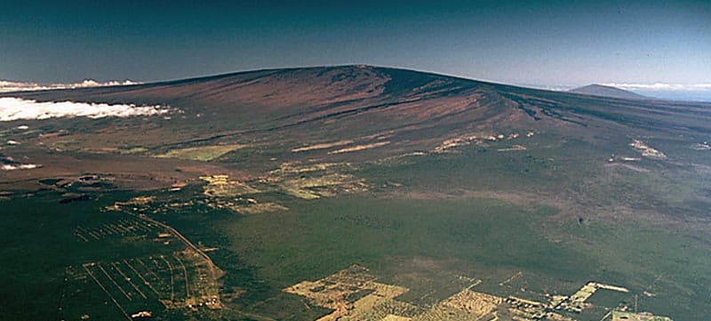
Mauna Kea is a shield rising to 4,205 meters (13,797 feet) in United States's Eastern Pacific Volcanic Regions. The volcano is currently active, with its most recent eruption in 2460 BCE. The volcano has produced 6 recorded eruptions.
Geography & Climate
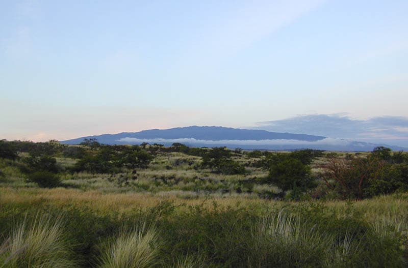
Mauna Kea is located in United States, within the Hawaiian-Emperor Hotspot Volcano Group of the broader Eastern Pacific Volcanic Regions. Situated at 19.82° N, 155.47° W in the Northern Hemisphere, the volcano lies within a tropical climate zone. Standing at 4,205 meters above sea level, Mauna Kea towers above the alpine zone, where vegetation gives way to bare rock, snow, and ice for much of the year. The high elevation means the upper slopes experience significantly colder temperatures than surrounding lowlands. The volcanic landform is characterized as a shield, which describes the physical shape and structure of the volcanic edifice as observed from the surface.
Geological Context
Mauna Kea is an intraplate volcano, meaning it formed away from any plate boundary. These volcanoes are often powered by hotspots — plumes of abnormally hot mantle material rising from deep within the Earth. Hotspot volcanoes like Mauna Kea tend to produce effusive eruptions with lava flows that can be relatively predictable, giving nearby communities in United States more time to prepare. However, they can also produce explosive phases, particularly when magma interacts with groundwater. The dominant rock type is basalt / picro-basalt, a dark, fine-grained volcanic rock that forms from rapidly cooling, low-viscosity lava. Basaltic eruptions tend to be less explosive and produce fluid lava flows that can travel long distances. While less immediately dangerous than explosive eruptions, basaltic lava flows can destroy structures and infrastructure in their path, and volcanic gases released during these eruptions can affect air quality over a wide area.
Eruption History Summary
Mauna Kea has 6 recorded eruptions in the geological database, spanning from 5150 BCE to 2460 BCE. This eruption frequency indicates a moderately active volcanic system with periodic reawakenings.
Significance
With 6 recorded eruptions on file, Mauna Kea has enough documented activity to help scientists identify patterns in its eruptive behavior.
GVP Reference Summary
Mauna Kea, Hawaii's highest volcano, reaches 4205 m, only 35 m above its neighbor, Mauna Loa. In contrast to Mauna Loa, Mauna Kea lacks a summit caldera and is capped by a profusion of cinder cones and pyroclastic deposits. It's rift zones are less pronounced than on neighboring volcanoes, and the eruption of voluminous, late-stage pyroclastic material has buried much of the early basaltic shield volcano, creating a steeper and more irregular profile. This transition took place about 200,000 to 250,000 years ago, and much of Mauna Kea, whose Hawaiian name means "White Mountain," was constructed during the Pleistocene. Its age and high altitude make it the only Hawaiian volcano with glacial moraines. A road that reaches a cluster of astronomical observatories on the summit also provides access to seasonal tropical skiing. The latest eruptions produced a series of cinder cones and lava flows from vents on the northern and southern flanks during the early- to mid-Holocene.
— Smithsonian Institution, Global Volcanism Program
6 Recorded Eruptions
| Year | VEI | Type | Area |
|---|---|---|---|
| 2460 BCE | — | Confirmed Eruption | NE flank (Puu Lehu, 3130 m) |
| 2540 BCE | — | Confirmed Eruption | South rift zone (Puu Kole) |
| 2750 BCE | — | Confirmed Eruption | NE flank (Puu Kanakaleonui, 2930 m) |
| 3370 BCE | — | Confirmed Eruption | SE flank (near Hale Pohaku, 2740 m) |
| 3680 BCE | — | Confirmed Eruption | South rift zone (Puu Kalaieha) |
| 5150 BCE | — | Confirmed Eruption | North flank (Puu Kole) |
Real-Time Data
Frequently Asked Questions About Mauna Kea
Is Mauna Kea an active volcano?+
Mauna Kea is not currently classified as active. Its activity evidence is listed as "Eruption Dated." The last known eruption was in 2460 BCE. However, no volcano is ever considered permanently extinct.
When did Mauna Kea last erupt?+
The most recent recorded eruption of Mauna Kea occurred in 2460 BCE. The eruption was classified as a "Confirmed Eruption." Mauna Kea has 6 recorded eruptions in total.
How high is Mauna Kea?+
Mauna Kea has a summit elevation of 4,205 meters (13,797 feet) above sea level. At 4,205 meters, it stands taller than Mount Rainier (4,392m) and is among the world's major volcanic peaks.
What type of volcano is Mauna Kea?+
Mauna Kea is classified as a Shield. Shield volcanoes have distinct geological characteristics that set them apart from other volcanic types.
Where is Mauna Kea located?+
Mauna Kea is located in United States, in the Eastern Pacific Volcanic Regions. More specifically, it lies within the Hawaiian-Emperor Hotspot Volcano Group. Its exact coordinates are 19.820° latitude, -155.470° longitude.
Is it safe to visit Mauna Kea?+
Mauna Kea can generally be visited, but as with any volcano, visitors should check local conditions and any advisory notices before traveling. United States may have specific regulations for accessing volcanic areas. Guided tours are often the safest and most informative way to experience a volcano.