Jackies Butte
Volcanic field · 1,418m · United States
About Jackies Butte
Jackies Butte is a volcanic field rising to 1,418 meters (4,652 feet) in United States's North America Volcanic Regions. No historical eruptions have been recorded, though the volcano is classified based on geological evidence of past activity.
Geography & Climate
Jackies Butte is located in United States, within the High Lava Plains Volcanic Province of the broader North America Volcanic Regions. Situated at 42.61° N, 117.59° W in the Northern Hemisphere, the volcano lies within a temperate climate zone. With a summit elevation of 1,418 meters above sea level, Jackies Butte is a moderately sized peak that remains accessible to hikers and researchers for much of the year. The volcanic landform is characterized as a cluster, which describes the physical shape and structure of the volcanic edifice as observed from the surface.
GVP Reference Summary
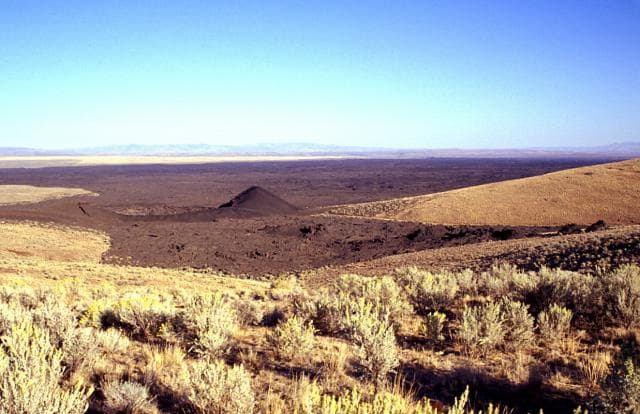
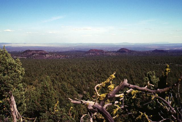
Jackies Butte, sometimes referred to as Bowden Crater, is a small, relatively unstudied basaltic volcanic field located near the SE corner of Oregon with two small shield volcanoes and two cinder cones. Lava flows cover an area of about 325 km2 E of the Bowden Hills, SE of Burns Junction on Highway 95, and SW of Owyhee Canyon. Smith et al. (1978) estimated a probable age of less than 10,000 years, but no precise age dates have been obtained. Sarna-Wojciki et al. (1983) did not include Jackies Butte in a list of Holocene volcanic fields.
— Smithsonian Institution, Global Volcanism Program
0 Recorded Eruptions
No eruption records available for Jackies Butte.
Real-Time Data
Frequently Asked Questions About Jackies Butte
Is Jackies Butte an active volcano?+
Jackies Butte is not currently classified as active. Its activity evidence is listed as "unknown." No recorded eruptions have been documented. However, no volcano is ever considered permanently extinct.
How high is Jackies Butte?+
Jackies Butte has a summit elevation of 1,418 meters (4,652 feet) above sea level. At 1,418 meters, it is a moderately sized volcanic peak, roughly comparable to Mount Vesuvius (1,281m).
What type of volcano is Jackies Butte?+
Jackies Butte is classified as a Volcanic field. Volcanic fields consist of clusters of small volcanic vents and cinder cones spread across a region. Rather than a single central vent, eruptions can occur at many points across the field.
Where is Jackies Butte located?+
Jackies Butte is located in United States, in the North America Volcanic Regions. More specifically, it lies within the High Lava Plains Volcanic Province. Its exact coordinates are 42.606° latitude, -117.589° longitude.
Is it safe to visit Jackies Butte?+
Jackies Butte can generally be visited, but as with any volcano, visitors should check local conditions and any advisory notices before traveling. United States may have specific regulations for accessing volcanic areas. Guided tours are often the safest and most informative way to experience a volcano.