About Edziza
Edziza is a stratovolcano rising to 2,786 meters (9,141 feet) in Canada's North America Volcanic Regions. Its last known eruption was in 950 CE. The volcano has produced 4 recorded eruptions, with a maximum Volcanic Explosivity Index (VEI) of 3.
Geography & Climate
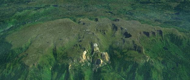
Edziza is located in Canada, within the Northern Cordilleran Volcanic Province of the broader North America Volcanic Regions. Situated at 57.72° N, 130.63° W in the Northern Hemisphere, the volcano lies within a subarctic climate zone. At 2,786 meters above sea level, Edziza rises above the surrounding terrain into montane or subalpine conditions. The elevation creates distinct ecological zones along its flanks, from forested lower slopes to exposed rocky terrain near the summit. The volcanic landform is characterized as a composite, which describes the physical shape and structure of the volcanic edifice as observed from the surface.
Geological Context
Edziza is an intraplate volcano, meaning it formed away from any plate boundary. These volcanoes are often powered by hotspots — plumes of abnormally hot mantle material rising from deep within the Earth. Hotspot volcanoes like Edziza tend to produce effusive eruptions with lava flows that can be relatively predictable, giving nearby communities in Canada more time to prepare. However, they can also produce explosive phases, particularly when magma interacts with groundwater. The dominant rock type is trachyte / trachydacite, an intermediate to silica-rich volcanic rock. This composition typically produces more viscous magma, leading to more explosive eruptions with ash columns and pyroclastic flows. Andesitic and dacitic magmas build pressure before erupting, which is why volcanoes with this rock chemistry are often associated with Plinian-style eruptions that can send ash tens of kilometers into the atmosphere and disrupt aviation across entire regions.
Eruption History Summary
Edziza has 4 recorded eruptions in the geological database, spanning from 6520 BCE to 950 CE. The most powerful recorded event was a severe eruption capable of regional ash fall and pyroclastic flows in 950 CE, reaching VEI 3 on the Volcanic Explosivity Index. These eruptions span roughly 7,470 years of volcanic history.
Significance
With a maximum recorded VEI of 3, Edziza has produced eruptions capable of generating pyroclastic flows and significant ash fall in the surrounding area. While not among the largest eruptions globally, VEI 3 events pose serious hazards to local populations and can disrupt regional air travel.
GVP Reference Summary
The composite felsic stratovolcano Mount Edziza and associated satellitic lava domes and pyroclastic cones were constructed over the past 7.5 million years during five magmatic cycles beginning with eruption of alkali basalts and ending with felsic and basaltic eruptions as late about 1,000 years ago. The 7.5 million-year-old (Ma) Armadillo Peak stratovolcano at the south end of the complex is overlapped by the Ice Peak central volcano, which was formed during the early Pleistocene, and contains a caldera largely destroyed by glaciers. The Mount Edziza stratovolcano on the north was formed about 1.0-0.9 Ma. A 2-km-wide, ice-filled caldera truncates its summit; lava domes were subsequently emplaced around its periphery and lava lakes ponded within the caldera and overflowed its rim. Numerous ice-contact features and products of subglacial eruptions are found in the Mount Edziza complex. More than 30 Holocene pyroclastic cones, primarily of basaltic composition, are located on Mount Edziza and the adjacent Spectrum Range, some of which are younger than about 1,300 years before present. Large areas of Holocene lava flows of the postglacial Big Raven Formation are located north of Mount Edziza, forming the Desolation Lava Field, and south and SW of Ice Peak, forming the Snowshoe Lava Field.
— Smithsonian Institution, Global Volcanism Program
4 Recorded Eruptions
| Year | VEI | Type | Area |
|---|---|---|---|
| 950 | 3 | Confirmed Eruption | SW flank of Ice Peak |
| 630 | — | Confirmed Eruption | NNE flank (Williams Cone) |
| 750 BCE | — | Confirmed Eruption | — |
| 6520 BCE | — | Confirmed Eruption | North flank? |
Real-Time Data
Frequently Asked Questions About Edziza
Is Edziza an active volcano?+
Edziza is not currently classified as active. Its activity evidence is listed as "Eruption Dated." The last known eruption was in 950 CE. However, no volcano is ever considered permanently extinct.
When did Edziza last erupt?+
The most recent recorded eruption of Edziza occurred in 950 CE with a Volcanic Explosivity Index (VEI) of 3. The eruption was classified as a "Confirmed Eruption." Edziza has 4 recorded eruptions in total.
How high is Edziza?+
Edziza has a summit elevation of 2,786 meters (9,141 feet) above sea level. At 2,786 meters, it is comparable in height to many significant mountain peaks and stands well above the tree line.
What type of volcano is Edziza?+
Edziza is classified as a Stratovolcano. Stratovolcanoes (also called composite volcanoes) are steep, conical volcanoes built up by many layers of hardened lava, tephra, and volcanic ash. They are among the most common and dangerous types, known for explosive eruptions.
Where is Edziza located?+
Edziza is located in Canada, in the North America Volcanic Regions. More specifically, it lies within the Northern Cordilleran Volcanic Province. Its exact coordinates are 57.720° latitude, -130.630° longitude.
Is it safe to visit Edziza?+
Edziza can generally be visited, but as with any volcano, visitors should check local conditions and any advisory notices before traveling. Canada may have specific regulations for accessing volcanic areas. Guided tours are often the safest and most informative way to experience a volcano.