About Wrangell
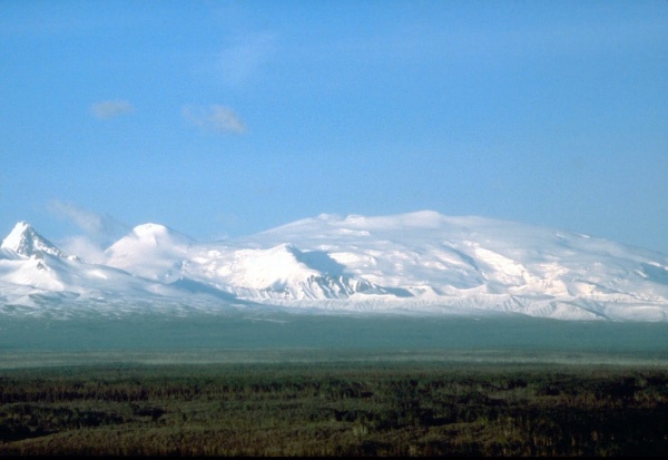
Wrangell is a shield rising to 4,278 meters (14,036 feet) in United States's North America Volcanic Regions. It last erupted in 1912 CE, and volcanologists consider it an active volcanic system. The volcano has produced 14 recorded eruptions, with a maximum Volcanic Explosivity Index (VEI) of 4.
Geography & Climate
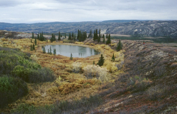
Wrangell is located in United States, within the Wrangell Volcanic Arc of the broader North America Volcanic Regions. Situated at 62.01° N, 144.02° W in the Northern Hemisphere, the volcano lies within a subarctic climate zone. Standing at 4,278 meters above sea level, Wrangell towers above the alpine zone, where vegetation gives way to bare rock, snow, and ice for much of the year. The high elevation means the upper slopes experience significantly colder temperatures than surrounding lowlands. The volcanic landform is characterized as a shield, which describes the physical shape and structure of the volcanic edifice as observed from the surface.
Geological Context
Wrangell is an intraplate volcano, meaning it formed away from any plate boundary. These volcanoes are often powered by hotspots — plumes of abnormally hot mantle material rising from deep within the Earth. Hotspot volcanoes like Wrangell tend to produce effusive eruptions with lava flows that can be relatively predictable, giving nearby communities in United States more time to prepare. However, they can also produce explosive phases, particularly when magma interacts with groundwater. The dominant rock type is andesite / basaltic andesite, a dark, fine-grained volcanic rock that forms from rapidly cooling, low-viscosity lava. Basaltic eruptions tend to be less explosive and produce fluid lava flows that can travel long distances. While less immediately dangerous than explosive eruptions, basaltic lava flows can destroy structures and infrastructure in their path, and volcanic gases released during these eruptions can affect air quality over a wide area.
Eruption History Summary
Wrangell has 14 recorded eruptions in the geological database, spanning from 190 CE to 2002 CE. The most powerful recorded event was a cataclysmic eruption with ash columns reaching the stratosphere in 190 CE, reaching VEI 4 on the Volcanic Explosivity Index. This level of eruptive frequency indicates a persistently active volcanic system that warrants ongoing monitoring. With eruptive activity as recently as 2002 CE, Wrangell remains an actively monitored volcano.
Significance
With a maximum recorded VEI of 4, Wrangell has demonstrated the capacity for significant explosive eruptions that can impact regional aviation, agriculture, and communities tens of kilometers from the summit. VEI 4 eruptions produce ash columns reaching 15-25 kilometers into the atmosphere. With 14 recorded eruptions, Wrangell has a substantial eruptive history that provides valuable data for understanding volcanic behavior and assessing future hazards in the North America Volcanic Regions region. Given its recent activity, Wrangell is closely monitored by geological survey organizations to provide early warning of future unrest.
GVP Reference Summary
Mount Wrangell is one of the world's largest continental-margin volcanoes, with a diameter of 30 km at 2,000 m elevation. The andesitic shield volcano has produced fluid lava flows as long as 58 km and contains an ice-filled caldera 4-6 km in diameter and 1 km deep, located within an older 15-km-wide caldera. Most of the edifice was constructed during eruptions between about 600,000 and 200,000 years ago. Formation of the summit caldera followed sometime between about 200,000 and 50,000 years ago. Three post-caldera craters are located at the broad summit, along the northern and western caldera rim. A steep-sided flank cinder cone, Mount Zanetti, is located 6 km NW of the summit. The westernmost cone has been the source of infrequent eruptions beginning in the 18th century. Increased heat flux in recent years has melted large volumes of ice in the northern crater.
— Smithsonian Institution, Global Volcanism Program
14 Recorded Eruptions
| Year | VEI | Type | Area |
|---|---|---|---|
| 2002 | 1 | Uncertain Eruption | — |
| 1999 | 1 | Uncertain Eruption | — |
| 1969 | 1 | Uncertain Eruption | West Crater |
| 1930 | — | Uncertain Eruption | — |
| 1921 | — | Uncertain Eruption | North flank? |
| 1911 | 1 | Confirmed Eruption | — |
| 1907 | — | Uncertain Eruption | — |
| 1902 | 2 | Confirmed Eruption | West Crater |
| 1900 | 2 | Confirmed Eruption | — |
| 1899 | 2 | Confirmed Eruption | — |
| 1884 | 2 | Uncertain Eruption | — |
| 1819 | 2 | Uncertain Eruption | — |
| 1784 | 2 | Uncertain Eruption | — |
| 190 | 4 | Confirmed Eruption | — |
Real-Time Data
Frequently Asked Questions About Wrangell
Is Wrangell an active volcano?+
Yes, Wrangell is considered an active volcano. Its most recent eruption was in 1912 CE. The volcano is monitored by geological agencies, and its activity status is based on observed eruptions within recorded history.
When did Wrangell last erupt?+
The most recent recorded eruption of Wrangell occurred in 2002 CE with a Volcanic Explosivity Index (VEI) of 1. The eruption was classified as a "Uncertain Eruption." Wrangell has 14 recorded eruptions in total.
How high is Wrangell?+
Wrangell has a summit elevation of 4,278 meters (14,036 feet) above sea level. At 4,278 meters, it stands taller than Mount Rainier (4,392m) and is among the world's major volcanic peaks.
What type of volcano is Wrangell?+
Wrangell is classified as a Shield. Shield volcanoes have distinct geological characteristics that set them apart from other volcanic types.
Where is Wrangell located?+
Wrangell is located in United States, in the North America Volcanic Regions. More specifically, it lies within the Wrangell Volcanic Arc. Its exact coordinates are 62.006° latitude, -144.017° longitude.
Is it safe to visit Wrangell?+
Visiting Wrangell requires checking current volcanic activity and alert levels. As an active volcano with eruptions as recent as 1912 CE, conditions can change rapidly. Always consult local geological authorities and follow official warnings before visiting. Many active volcanoes have designated safe viewing areas and guided tour options.