About Sanford
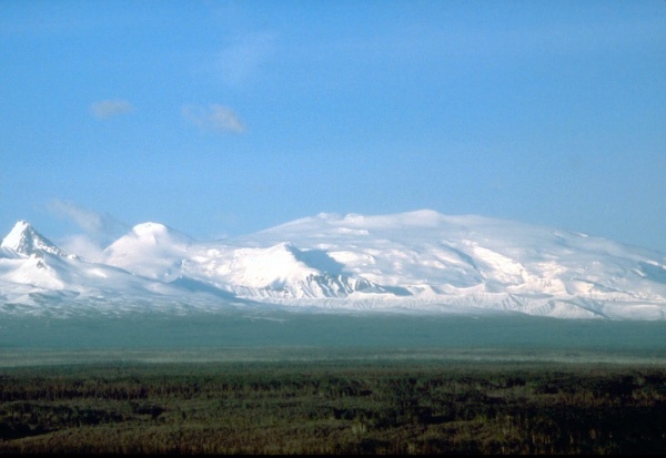
Sanford is a shield rising to 4,959 meters (16,270 feet) in United States's North America Volcanic Regions. No historical eruptions have been recorded, though the volcano is classified based on geological evidence of past activity.
Geography & Climate
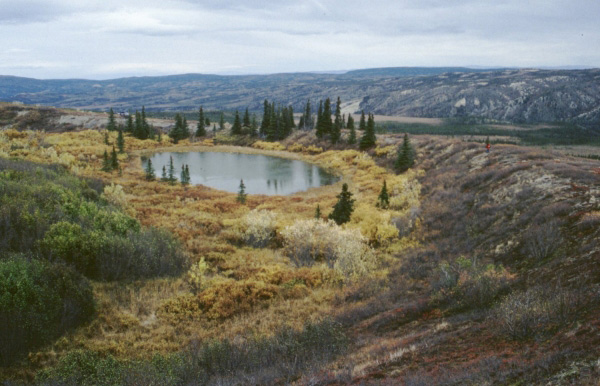
Sanford is located in United States, within the Wrangell Volcanic Arc of the broader North America Volcanic Regions. Situated at 62.21° N, 144.13° W in the Northern Hemisphere, the volcano lies within a subarctic climate zone. Standing at 4,959 meters above sea level, Sanford towers above the alpine zone, where vegetation gives way to bare rock, snow, and ice for much of the year. The high elevation means the upper slopes experience significantly colder temperatures than surrounding lowlands. The volcanic landform is characterized as a shield, which describes the physical shape and structure of the volcanic edifice as observed from the surface.
GVP Reference Summary
Massive dissected Mount Sanford shield volcano is one of the highest Quaternary volcanoes in the United States. The glacier-covered andesitic volcano towers above the Copper River and has a broad, bulbous top that is surrounded by massive, glacially excavated cirques, most prominent on the SW and SE sides of the summit. The upper part of this little-studied, ice-covered volcano is possibly of Holocene age (Richter, in Wood and Kienle, 1990) and developed on a base of three coalescing andesitic shield volcanoes south, NW and NNW of the summit that began to form about 900,000 years ago. A massive mid-Pleistocene rhyolitic lava flow from a NE-flank vent traveled more than 18 km to the NE. Basaltic lava flows that were erupted from a NE-flank rift zone about 320,000 years ago mark the latest radiometrically dated activity.
— Smithsonian Institution, Global Volcanism Program
0 Recorded Eruptions
No eruption records available for Sanford.
Real-Time Data
Frequently Asked Questions About Sanford
Is Sanford an active volcano?+
Sanford is not currently classified as active. Its activity evidence is listed as "unknown." No recorded eruptions have been documented. However, no volcano is ever considered permanently extinct.
How high is Sanford?+
Sanford has a summit elevation of 4,959 meters (16,270 feet) above sea level. At 4,959 meters, it stands taller than Mount Rainier (4,392m) and is among the world's major volcanic peaks.
What type of volcano is Sanford?+
Sanford is classified as a Shield. Shield volcanoes have distinct geological characteristics that set them apart from other volcanic types.
Where is Sanford located?+
Sanford is located in United States, in the North America Volcanic Regions. More specifically, it lies within the Wrangell Volcanic Arc. Its exact coordinates are 62.213° latitude, -144.130° longitude.
Is it safe to visit Sanford?+
Sanford can generally be visited, but as with any volcano, visitors should check local conditions and any advisory notices before traveling. United States may have specific regulations for accessing volcanic areas. Guided tours are often the safest and most informative way to experience a volcano.