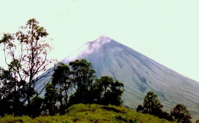
About Inierie
Inierie is a stratovolcano rising to 2,245 meters (7,366 feet) in Indonesia's Sunda-Banda Volcanic Regions. The volcano is currently active, with its most recent eruption in 8050 BCE. The volcano has produced 1 recorded eruption.
Geography & Climate
Inierie is located in Indonesia, within the Sunda Volcanic Arc of the broader Sunda-Banda Volcanic Regions. Situated at 8.88° S, 120.95° E in the Southern Hemisphere, the volcano lies within a tropical climate zone. At 2,245 meters above sea level, Inierie rises above the surrounding terrain into montane or subalpine conditions. The elevation creates distinct ecological zones along its flanks, from forested lower slopes to exposed rocky terrain near the summit. The volcanic landform is characterized as a composite, which describes the physical shape and structure of the volcanic edifice as observed from the surface.
Geological Context
Inierie sits in a subduction zone, where one tectonic plate dives beneath another, creating intense heat and pressure that generates magma. Subduction zones are responsible for many of the world's most explosive volcanoes and deadliest eruptions. For communities in Indonesia near Inierie, this tectonic setting means the volcano is capable of producing powerful explosive eruptions, pyroclastic flows, and lahars that can threaten populated areas within tens of kilometers of the summit. The dominant rock type is andesite / basaltic andesite, a dark, fine-grained volcanic rock that forms from rapidly cooling, low-viscosity lava. Basaltic eruptions tend to be less explosive and produce fluid lava flows that can travel long distances. While less immediately dangerous than explosive eruptions, basaltic lava flows can destroy structures and infrastructure in their path, and volcanic gases released during these eruptions can affect air quality over a wide area.
Eruption History Summary
Inierie has 1 recorded eruption in the geological database, spanning from 8050 BCE to 8050 BCE.
GVP Reference Summary
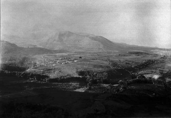
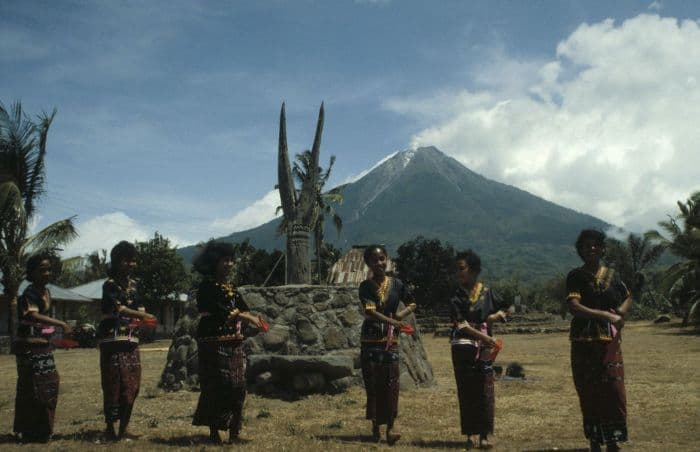
The symmetrical Gunung Inierie stratovolcano in south-central Flores overlooks the Sawu Sea, and is the highest volcano on the island. A small steep-walled crater is oriented E-W immediately east of the summit, whose upper slopes are unvegetated. A somma wall lies west and NW of Inierie (also known as Rokka Peak). A NNW-SSE-trending chain of volcanoes is just to the NE, including Wolo Bobo; these are part of the Pleistocene Bajawa cinder cone complex. A column of "smoke" is sometimes visible from the crater, as occurred in June 1911. The age of the latest eruption is not known, although the volcano was mapped as Holocene, and an eruption of Wolo Bobo was radiocarbon dated at about 10,000 years ago (Nasution et al., 2000). Hot springs are located on the northern flank of the volcano, and additional geothermal areas are located to the E and NE.
— Smithsonian Institution, Global Volcanism Program
1 Recorded Eruption
| Year | VEI | Type | Area |
|---|---|---|---|
| 8050 BCE | — | Confirmed Eruption | NE side (Wolo Bobo) |
Real-Time Data
Frequently Asked Questions About Inierie
Is Inierie an active volcano?+
Inierie is not currently classified as active. Its activity evidence is listed as "Eruption Dated." The last known eruption was in 8050 BCE. However, no volcano is ever considered permanently extinct.
When did Inierie last erupt?+
The most recent recorded eruption of Inierie occurred in 8050 BCE. The eruption was classified as a "Confirmed Eruption." Inierie has 1 recorded eruption in total.
How high is Inierie?+
Inierie has a summit elevation of 2,245 meters (7,366 feet) above sea level. At 2,245 meters, it is comparable in height to many significant mountain peaks and stands well above the tree line.
What type of volcano is Inierie?+
Inierie is classified as a Stratovolcano. Stratovolcanoes (also called composite volcanoes) are steep, conical volcanoes built up by many layers of hardened lava, tephra, and volcanic ash. They are among the most common and dangerous types, known for explosive eruptions.
Where is Inierie located?+
Inierie is located in Indonesia, in the Sunda-Banda Volcanic Regions. More specifically, it lies within the Sunda Volcanic Arc. Its exact coordinates are -8.875° latitude, 120.950° longitude.
Is it safe to visit Inierie?+
Inierie can generally be visited, but as with any volcano, visitors should check local conditions and any advisory notices before traveling. Indonesia may have specific regulations for accessing volcanic areas. Guided tours are often the safest and most informative way to experience a volcano.