About Inielika
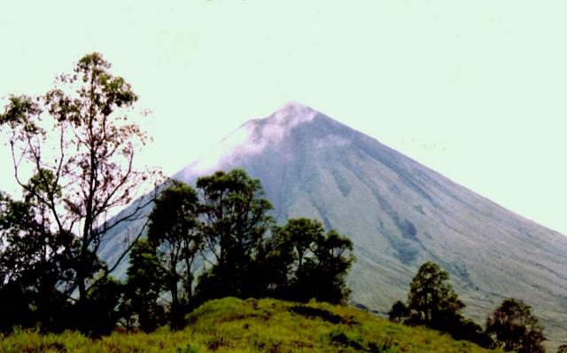
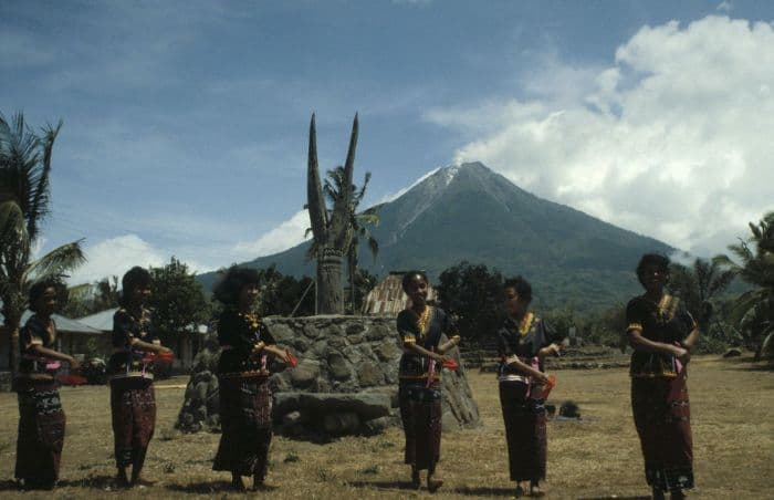
Inielika is a complex rising to 1,559 meters (5,115 feet) in Indonesia's Sunda-Banda Volcanic Regions. It has been active in recent decades, with its last eruption in 2001 CE. The volcano has produced 2 recorded eruptions, with a maximum Volcanic Explosivity Index (VEI) of 2.
Geography & Climate
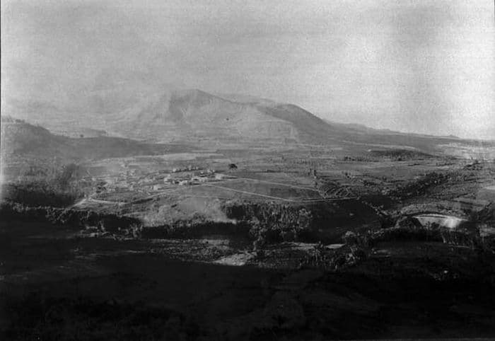
Inielika is located in Indonesia, within the Sunda Volcanic Arc of the broader Sunda-Banda Volcanic Regions. Situated at 8.73° S, 120.98° E in the Southern Hemisphere, the volcano lies within a tropical climate zone. With a summit elevation of 1,559 meters above sea level, Inielika is a moderately sized peak that remains accessible to hikers and researchers for much of the year. The volcanic landform is characterized as a composite, which describes the physical shape and structure of the volcanic edifice as observed from the surface.
Geological Context
Inielika sits in a subduction zone, where one tectonic plate dives beneath another, creating intense heat and pressure that generates magma. Subduction zones are responsible for many of the world's most explosive volcanoes and deadliest eruptions. For communities in Indonesia near Inielika, this tectonic setting means the volcano is capable of producing powerful explosive eruptions, pyroclastic flows, and lahars that can threaten populated areas within tens of kilometers of the summit. The dominant rock type is andesite / basaltic andesite, a dark, fine-grained volcanic rock that forms from rapidly cooling, low-viscosity lava. Basaltic eruptions tend to be less explosive and produce fluid lava flows that can travel long distances. While less immediately dangerous than explosive eruptions, basaltic lava flows can destroy structures and infrastructure in their path, and volcanic gases released during these eruptions can affect air quality over a wide area.
Eruption History Summary
Inielika has 2 recorded eruptions in the geological database, spanning from 1905 CE to 2001 CE. The most powerful recorded event was an explosive event producing ash plumes up to several kilometers in 2001 CE, reaching VEI 2 on the Volcanic Explosivity Index. These eruptions span roughly 96 years of volcanic history. With eruptive activity as recently as 2001 CE, Inielika remains an actively monitored volcano.
GVP Reference Summary
Inielika is a broad, low volcano in central Flores Island that was constructed within the Lobobutu caldera. The complex summit contains ten craters, some of which are lake filled, in a 5 km2 area north of the city of Bajawa. The largest of these, Wolo Runu and Wolo Lega North, are 750 m wide. A phreatic explosion in 1905 formed a new crater, and was the volcano's only eruption during the 20th century. Another eruption took place about a century later, in 2001. A chain of Pleistocene cinder cones, the Bajawa cinder cone complex, extends southward to Inierie.
— Smithsonian Institution, Global Volcanism Program
2 Recorded Eruptions
| Year | VEI | Type | Area |
|---|---|---|---|
| 2001 | 2 | Confirmed Eruption | Summit crater complex |
| 1905 | 2 | Confirmed Eruption | — |
Real-Time Data
Frequently Asked Questions About Inielika
Is Inielika an active volcano?+
Yes, Inielika is considered an active volcano. Its most recent eruption was in 2001 CE. The volcano is monitored by geological agencies, and its activity status is based on observed eruptions within recorded history.
When did Inielika last erupt?+
The most recent recorded eruption of Inielika occurred in 2001 CE with a Volcanic Explosivity Index (VEI) of 2. The eruption was classified as a "Confirmed Eruption." Inielika has 2 recorded eruptions in total.
How high is Inielika?+
Inielika has a summit elevation of 1,559 meters (5,115 feet) above sea level. At 1,559 meters, it is a moderately sized volcanic peak, roughly comparable to Mount Vesuvius (1,281m).
What type of volcano is Inielika?+
Inielika is classified as a Complex. Complex volcanoes have distinct geological characteristics that set them apart from other volcanic types.
Where is Inielika located?+
Inielika is located in Indonesia, in the Sunda-Banda Volcanic Regions. More specifically, it lies within the Sunda Volcanic Arc. Its exact coordinates are -8.730° latitude, 120.980° longitude.
Is it safe to visit Inielika?+
Visiting Inielika requires checking current volcanic activity and alert levels. As an active volcano with eruptions as recent as 2001 CE, conditions can change rapidly. Always consult local geological authorities and follow official warnings before visiting. Many active volcanoes have designated safe viewing areas and guided tour options.