About Kembar
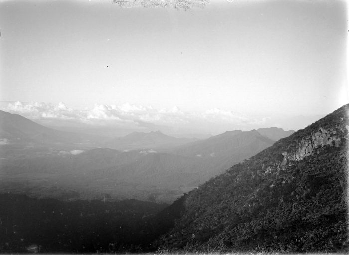
Kembar is a shield rising to 2,245 meters (7,366 feet) in Indonesia's Sunda-Banda Volcanic Regions. No historical eruptions have been recorded, though the volcano is classified based on geological evidence of past activity.
Geography & Climate
Kembar is located in Indonesia, within the Sunda Volcanic Arc of the broader Sunda-Banda Volcanic Regions. Situated at 3.85° N, 97.66° E in the Northern Hemisphere, the volcano lies within a tropical climate zone. At 2,245 meters above sea level, Kembar rises above the surrounding terrain into montane or subalpine conditions. The elevation creates distinct ecological zones along its flanks, from forested lower slopes to exposed rocky terrain near the summit. The volcanic landform is characterized as a shield, which describes the physical shape and structure of the volcanic edifice as observed from the surface.
GVP Reference Summary
The Gayolesten fumarole field is located on the flanks of the Pleistocene Gunung Kembar volcano. The Kembar complex, located at the junction of two fault systems, is an andesitic shield volcano capped by a complex of craters and cones (Cameron et al. 1982). Gayolesten was included in the Catalog of Active Volcanoes of the World (Neumann van Padang 1951) based on its geothermal activity. Active fumaroles and hot springs are present at several locations.
— Smithsonian Institution, Global Volcanism Program
0 Recorded Eruptions
No eruption records available for Kembar.
Real-Time Data
Frequently Asked Questions About Kembar
Is Kembar an active volcano?+
Kembar is not currently classified as active. Its activity evidence is listed as "unknown." No recorded eruptions have been documented. However, no volcano is ever considered permanently extinct.
How high is Kembar?+
Kembar has a summit elevation of 2,245 meters (7,366 feet) above sea level. At 2,245 meters, it is comparable in height to many significant mountain peaks and stands well above the tree line.
What type of volcano is Kembar?+
Kembar is classified as a Shield. Shield volcanoes have distinct geological characteristics that set them apart from other volcanic types.
Where is Kembar located?+
Kembar is located in Indonesia, in the Sunda-Banda Volcanic Regions. More specifically, it lies within the Sunda Volcanic Arc. Its exact coordinates are 3.850° latitude, 97.664° longitude.
Is it safe to visit Kembar?+
Kembar can generally be visited, but as with any volcano, visitors should check local conditions and any advisory notices before traveling. Indonesia may have specific regulations for accessing volcanic areas. Guided tours are often the safest and most informative way to experience a volcano.

