Tshibinda Volcanic Field
Pyroclastic cone(s) · 1,460m · DR Congo
About Tshibinda Volcanic Field
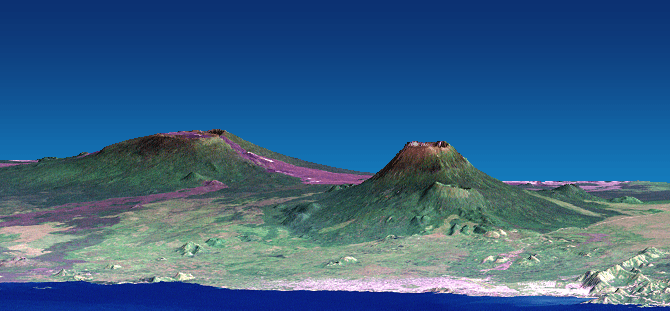
Tshibinda Volcanic Field is a pyroclastic cone(s) rising to 1,460 meters (4,790 feet) in DR Congo's Eastern Africa Volcanic Regions. No historical eruptions have been recorded, though the volcano is classified based on geological evidence of past activity.
Geography & Climate
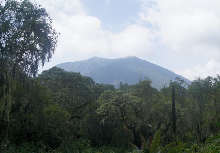
Tshibinda Volcanic Field is located in DR Congo, within the Albertine Rift Volcanic Province of the broader Eastern Africa Volcanic Regions. Situated at 2.32° S, 28.75° E in the Southern Hemisphere, the volcano lies within a tropical climate zone. With a summit elevation of 1,460 meters above sea level, Tshibinda Volcanic Field is a moderately sized peak that remains accessible to hikers and researchers for much of the year. The volcanic landform is characterized as a cluster, which describes the physical shape and structure of the volcanic edifice as observed from the surface.
GVP Reference Summary
The Tshibinda Volcanic Field is described by Pouclet et al. (2016) as consisting of numerous well-preserved scoria cones and lava flows at the border of the Tshibinda step. The elongate SSW-NNE field is 33 km long, extending from Tshibinda to Leymera. Mapping revealed sixty cones, 50-150 m high, with most of them being a source of lava flows, primarily down the fault scarp and spreading towards the eastern lowlands. Previous work dated the activity from 1.9 to 1.6 Ma (Bellon and Pouclet, 1980).
— Smithsonian Institution, Global Volcanism Program
0 Recorded Eruptions
No eruption records available for Tshibinda Volcanic Field.
Real-Time Data
Frequently Asked Questions About Tshibinda Volcanic Field
Is Tshibinda Volcanic Field an active volcano?+
Tshibinda Volcanic Field is not currently classified as active. Its activity evidence is listed as "unknown." No recorded eruptions have been documented. However, no volcano is ever considered permanently extinct.
How high is Tshibinda Volcanic Field?+
Tshibinda Volcanic Field has a summit elevation of 1,460 meters (4,790 feet) above sea level. At 1,460 meters, it is a moderately sized volcanic peak, roughly comparable to Mount Vesuvius (1,281m).
What type of volcano is Tshibinda Volcanic Field?+
Tshibinda Volcanic Field is classified as a Pyroclastic cone(s). Pyroclastic cones (or cinder cones) are small, steep-sided volcanic cones built from fragments of lava blasted into the air. They are the simplest type of volcano and often form in groups.
Where is Tshibinda Volcanic Field located?+
Tshibinda Volcanic Field is located in DR Congo, in the Eastern Africa Volcanic Regions. More specifically, it lies within the Albertine Rift Volcanic Province. Its exact coordinates are -2.320° latitude, 28.750° longitude.
Is it safe to visit Tshibinda Volcanic Field?+
Tshibinda Volcanic Field can generally be visited, but as with any volcano, visitors should check local conditions and any advisory notices before traveling. DR Congo may have specific regulations for accessing volcanic areas. Guided tours are often the safest and most informative way to experience a volcano.