About Tavui
Tavui is a caldera rising to 200 meters (656 feet) in Papua New Guinea's Southwestern Pacific Volcanic Regions. The volcano is currently active, with its most recent eruption in 4946 BCE. The volcano has produced 1 recorded eruption, with a maximum Volcanic Explosivity Index (VEI) of 5.
Geography & Climate
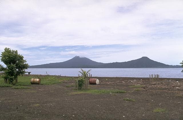
Tavui is located in Papua New Guinea, within the Bismarck Volcanic Arc of the broader Southwestern Pacific Volcanic Regions. Situated at 4.11° S, 152.21° E in the Southern Hemisphere, the volcano lies within a tropical climate zone. At just 200 meters above sea level, Tavui is a relatively low-elevation volcanic feature. Despite its modest height, it remains an active geological formation with the same underlying magmatic processes as its taller counterparts. The volcanic landform is characterized as a caldera, which describes the physical shape and structure of the volcanic edifice as observed from the surface.
Geological Context
Tavui sits in a subduction zone, where one tectonic plate dives beneath another, creating intense heat and pressure that generates magma. Subduction zones are responsible for many of the world's most explosive volcanoes and deadliest eruptions. For communities in Papua New Guinea near Tavui, this tectonic setting means the volcano is capable of producing powerful explosive eruptions, pyroclastic flows, and lahars that can threaten populated areas within tens of kilometers of the summit. The dominant rock type is rhyolite, a silica-rich volcanic rock associated with highly viscous magma. Rhyolitic eruptions can be extremely explosive and are responsible for some of the largest volcanic events in Earth's history, including supervolcanic caldera-forming eruptions. The high silica content traps dissolved gases, building enormous pressure that can lead to catastrophic explosive releases.
Eruption History Summary
Tavui has 1 recorded eruption in the geological database, spanning from 4946 BCE to 4946 BCE. The most powerful recorded event was a paroxysmal eruption with devastating regional consequences in 4946 BCE, reaching VEI 5 on the Volcanic Explosivity Index.
Significance
With a maximum recorded VEI of 5, Tavui has demonstrated the capacity for paroxysmal eruptions comparable to the 1980 eruption of Mount St. Helens. Eruptions of this scale can devastate areas within 20-30 kilometers and produce ash fall that disrupts aviation and agriculture across hundreds of kilometers.
GVP Reference Summary
The mostly submarine Tavui caldera lies off the NE tip of the Gazelle Peninsula north of Rabaul caldera. The caldera was first discovered during a bathymetric cruise in 1985. The SW wall of the roughly 10 x 12 km caldera cuts the NE end of the peninsula and extends from Tavui Point at the northern tip of the peninsula SE to Laweo Point. The 7,100-year-old Raluan Ignimbrite, initially thought to have originated from Rabaul, is now thought to have been produced by an eruption of Tavui. A basaltic scoria layer immediately underlies the rhyolitic ignimbrite, and the introduction of basaltic magma was considered to have triggered the rhyolitic eruption. The lack of a major low-velocity region detectable beneath the caldera during a seismic tomography survey suggests that it is not currently active.
— Smithsonian Institution, Global Volcanism Program
1 Recorded Eruption
| Year | VEI | Type | Area |
|---|---|---|---|
| 4946 BCE | 5 | Confirmed Eruption | — |
Real-Time Data
Frequently Asked Questions About Tavui
Is Tavui an active volcano?+
Tavui is not currently classified as active. Its activity evidence is listed as "Eruption Dated." The last known eruption was in 4946 BCE. However, no volcano is ever considered permanently extinct.
When did Tavui last erupt?+
The most recent recorded eruption of Tavui occurred in 4946 BCE with a Volcanic Explosivity Index (VEI) of 5. The eruption was classified as a "Confirmed Eruption." Tavui has 1 recorded eruption in total.
How high is Tavui?+
Tavui has a summit elevation of 200 meters (656 feet) above sea level. At 200 meters, it is a relatively low-elevation volcano.
What type of volcano is Tavui?+
Tavui is classified as a Caldera. Calderas are large volcanic depressions formed when a volcano erupts so powerfully that its magma chamber collapses, creating a basin that can be kilometers wide. They are often sites of some of Earth's largest eruptions.
Where is Tavui located?+
Tavui is located in Papua New Guinea, in the Southwestern Pacific Volcanic Regions. More specifically, it lies within the Bismarck Volcanic Arc. Its exact coordinates are -4.109° latitude, 152.213° longitude.
Is it safe to visit Tavui?+
Tavui can generally be visited, but as with any volcano, visitors should check local conditions and any advisory notices before traveling. Papua New Guinea may have specific regulations for accessing volcanic areas. Guided tours are often the safest and most informative way to experience a volcano.