Redondo, Cerro
Shield(s) · 764m · El Salvador-Guatemala
About Redondo, Cerro
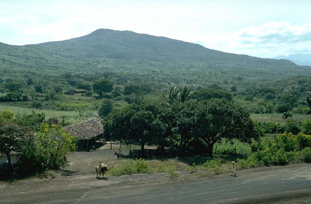
Redondo, Cerro is a shield(s) rising to 764 meters (2,507 feet) in El Salvador-Guatemala's Middle America-Caribbean Volcanic Regions. No historical eruptions have been recorded, though the volcano is classified based on geological evidence of past activity.
Geography & Climate
Redondo, Cerro is located in El Salvador-Guatemala, within the Central America Volcanic Arc of the broader Middle America-Caribbean Volcanic Regions. Situated at 14.26° N, 89.61° W in the Northern Hemisphere, the volcano lies within a tropical climate zone. With a summit elevation of 764 meters above sea level, Redondo, Cerro is a moderately sized peak that remains accessible to hikers and researchers for much of the year. The volcanic landform is characterized as a shield, which describes the physical shape and structure of the volcanic edifice as observed from the surface.
GVP Reference Summary
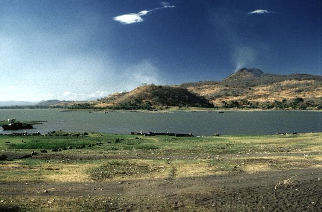
Cerro Redondo is the central feature of a Quaternary volcanic field immediately W of Lake Guija near the border with El Salvador. Two overlapping basaltic shield volcanoes were constructed along a N-S line west of the lake. Small lava fields, capped by cinder cones and small lava domes, are located E, W, and NE of the shield volcanoes. Unlike in other volcanic fields in SE Guatemala, many of the cones in this area show random orientations unrelated to regional trends.
— Smithsonian Institution, Global Volcanism Program
0 Recorded Eruptions
No eruption records available for Redondo, Cerro.
Real-Time Data
Frequently Asked Questions About Redondo, Cerro
Is Redondo, Cerro an active volcano?+
Redondo, Cerro is not currently classified as active. Its activity evidence is listed as "unknown." No recorded eruptions have been documented. However, no volcano is ever considered permanently extinct.
How high is Redondo, Cerro?+
Redondo, Cerro has a summit elevation of 764 meters (2,507 feet) above sea level. At 764 meters, it is a relatively low-elevation volcano.
What type of volcano is Redondo, Cerro?+
Redondo, Cerro is classified as a Shield(s). Shield volcanoes are broad, gently sloping volcanoes built by fluid lava flows. They produce less explosive eruptions compared to stratovolcanoes and tend to have effusive lava rather than violent blasts.
Where is Redondo, Cerro located?+
Redondo, Cerro is located in El Salvador-Guatemala, in the Middle America-Caribbean Volcanic Regions. More specifically, it lies within the Central America Volcanic Arc. Its exact coordinates are 14.263° latitude, -89.609° longitude.
Is it safe to visit Redondo, Cerro?+
Redondo, Cerro can generally be visited, but as with any volcano, visitors should check local conditions and any advisory notices before traveling. El Salvador-Guatemala may have specific regulations for accessing volcanic areas. Guided tours are often the safest and most informative way to experience a volcano.