About Ixtepeque
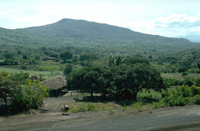
Ixtepeque is a lava dome(s) rising to 1,292 meters (4,239 feet) in Guatemala's Middle America-Caribbean Volcanic Regions. No historical eruptions have been recorded, though the volcano is classified based on geological evidence of past activity.
Geography & Climate
Ixtepeque is located in Guatemala, within the Central America Volcanic Arc of the broader Middle America-Caribbean Volcanic Regions. Situated at 14.42° N, 89.68° W in the Northern Hemisphere, the volcano lies within a tropical climate zone. With a summit elevation of 1,292 meters above sea level, Ixtepeque is a moderately sized peak that remains accessible to hikers and researchers for much of the year. The volcanic landform is characterized as a cluster, which describes the physical shape and structure of the volcanic edifice as observed from the surface.
Geological Context
Ixtepeque sits in a subduction zone, where one tectonic plate dives beneath another, creating intense heat and pressure that generates magma. Subduction zones are responsible for many of the world's most explosive volcanoes and deadliest eruptions. For communities in Guatemala near Ixtepeque, this tectonic setting means the volcano is capable of producing powerful explosive eruptions, pyroclastic flows, and lahars that can threaten populated areas within tens of kilometers of the summit. The dominant rock type is rhyolite, a silica-rich volcanic rock associated with highly viscous magma. Rhyolitic eruptions can be extremely explosive and are responsible for some of the largest volcanic events in Earth's history, including supervolcanic caldera-forming eruptions. The high silica content traps dissolved gases, building enormous pressure that can lead to catastrophic explosive releases.
GVP Reference Summary
Ixtepeque volcano, which takes its name from the Aztec word for obsidian, is perhaps the largest obsidian field in North America. A 4 x 5 km rhyolitic obsidian lava field was erupted within the Ipala graben from a craterless vent along a NE-trending fissure that passes through adjacent rhyolitic lava domes and basaltic cinder cones. Obsidian from Ixtepeque has shown up at archaeological sites across Central America. Flat-lying pumice beds produced by explosive eruptions preceding lava effusion are found locally around the volcano. Other obsidian flows originated from lava domes NE of Ixtepeque. These rhyolitic vents are interspersed with basaltic cinder cones and lava flows. Laguna de Obrajuelo is a complex cone cut by a large crater more than a km in diameter. Initial basaltic eruptions were followed by the extrusion of obsidian flows and the eruption of rhyolitic pumice that were considered by Williams et al. (1964) to be only a few thousand years old.
— Smithsonian Institution, Global Volcanism Program
0 Recorded Eruptions
No eruption records available for Ixtepeque.
Real-Time Data
Frequently Asked Questions About Ixtepeque
Is Ixtepeque an active volcano?+
Ixtepeque is classified as active based on credible evidence of past eruptions. Although its last known eruption was in prehistoric times, volcanologists consider it capable of erupting again.
How high is Ixtepeque?+
Ixtepeque has a summit elevation of 1,292 meters (4,239 feet) above sea level. At 1,292 meters, it is a moderately sized volcanic peak, roughly comparable to Mount Vesuvius (1,281m).
What type of volcano is Ixtepeque?+
Ixtepeque is classified as a Lava dome(s). Lava domes are mounds of viscous lava that pile up around a volcanic vent. They grow by expansion from within and can collapse to produce dangerous pyroclastic flows.
Where is Ixtepeque located?+
Ixtepeque is located in Guatemala, in the Middle America-Caribbean Volcanic Regions. More specifically, it lies within the Central America Volcanic Arc. Its exact coordinates are 14.420° latitude, -89.680° longitude.
Is it safe to visit Ixtepeque?+
Ixtepeque can generally be visited, but as with any volcano, visitors should check local conditions and any advisory notices before traveling. Guatemala may have specific regulations for accessing volcanic areas. Guided tours are often the safest and most informative way to experience a volcano.
