About Suchitan
Suchitan is a stratovolcano(es) rising to 2,042 meters (6,700 feet) in Guatemala's Middle America-Caribbean Volcanic Regions. No historical eruptions have been recorded, though the volcano is classified based on geological evidence of past activity. The volcano has produced 1 recorded eruption.
Geography & Climate
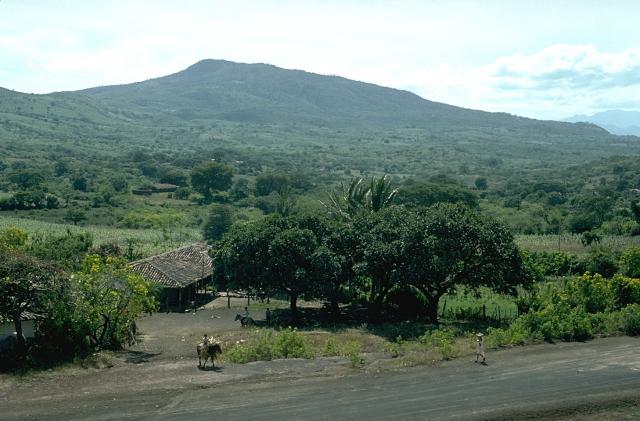
Suchitan is located in Guatemala, within the Central America Volcanic Arc of the broader Middle America-Caribbean Volcanic Regions. Situated at 14.40° N, 89.78° W in the Northern Hemisphere, the volcano lies within a tropical climate zone. At 2,042 meters above sea level, Suchitan rises above the surrounding terrain into montane or subalpine conditions. The elevation creates distinct ecological zones along its flanks, from forested lower slopes to exposed rocky terrain near the summit. The volcanic landform is characterized as a composite, which describes the physical shape and structure of the volcanic edifice as observed from the surface.
Geological Context
Suchitan sits in a subduction zone, where one tectonic plate dives beneath another, creating intense heat and pressure that generates magma. Subduction zones are responsible for many of the world's most explosive volcanoes and deadliest eruptions. For communities in Guatemala near Suchitan, this tectonic setting means the volcano is capable of producing powerful explosive eruptions, pyroclastic flows, and lahars that can threaten populated areas within tens of kilometers of the summit. The dominant rock type is andesite / basaltic andesite, a dark, fine-grained volcanic rock that forms from rapidly cooling, low-viscosity lava. Basaltic eruptions tend to be less explosive and produce fluid lava flows that can travel long distances. While less immediately dangerous than explosive eruptions, basaltic lava flows can destroy structures and infrastructure in their path, and volcanic gases released during these eruptions can affect air quality over a wide area.
Eruption History Summary
Suchitan has 1 recorded eruption in the geological database, spanning from 1469 CE to 1469 CE.
GVP Reference Summary
The summit of the andesitic-to-basaltic Volcán Suchitán stratovolcano, NE of the city of Jutiapa, is elongated N-S. Several large canyons cut the slopes of the dominantly andesitic edifice. A large cone, Cerro Mataltepe, is located on the upper N flank; two smaller cones are located on the lower N flank. Two Holocene basaltic lava flows are also present on the N and NW flanks (Williams et al., 1964), and many flank vents are basaltic. The volcano was constructed immediately E of the 5-km-wide basaltic-to-dacitic Retana caldera, formed in part in association with the eruption of a dacitic pumice deposit. Steep walls 60-250 m high rise above the flat caldera floor. One of the latest basaltic lava flows went through a low notch in the eastern caldera rim. Several lava cones and a maar are located along a N-S line N of Retana caldera. A reported eruption in 1469 CE is considered to have actually been from Atitlán volcano in the Guatemalan highlands.
— Smithsonian Institution, Global Volcanism Program
1 Recorded Eruption
| Year | VEI | Type | Area |
|---|---|---|---|
| 1469 | — | Uncertain Eruption | — |
Real-Time Data
Frequently Asked Questions About Suchitan
Is Suchitan an active volcano?+
Suchitan is classified as active based on credible evidence of past eruptions. Although its last known eruption was in prehistoric times, volcanologists consider it capable of erupting again.
When did Suchitan last erupt?+
The most recent recorded eruption of Suchitan occurred in 1469 CE. The eruption was classified as a "Uncertain Eruption." Suchitan has 1 recorded eruption in total.
How high is Suchitan?+
Suchitan has a summit elevation of 2,042 meters (6,700 feet) above sea level. At 2,042 meters, it is comparable in height to many significant mountain peaks and stands well above the tree line.
What type of volcano is Suchitan?+
Suchitan is classified as a Stratovolcano(es). Stratovolcano(es) volcanoes have distinct geological characteristics that set them apart from other volcanic types.
Where is Suchitan located?+
Suchitan is located in Guatemala, in the Middle America-Caribbean Volcanic Regions. More specifically, it lies within the Central America Volcanic Arc. Its exact coordinates are 14.400° latitude, -89.780° longitude.
Is it safe to visit Suchitan?+
Suchitan can generally be visited, but as with any volcano, visitors should check local conditions and any advisory notices before traveling. Guatemala may have specific regulations for accessing volcanic areas. Guided tours are often the safest and most informative way to experience a volcano.