About Ipala
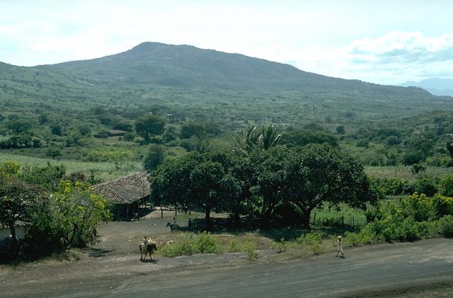
Ipala is a stratovolcano rising to 1,650 meters (5,414 feet) in Guatemala's Middle America-Caribbean Volcanic Regions. No historical eruptions have been recorded, though the volcano is classified based on geological evidence of past activity.
Geography & Climate
Ipala is located in Guatemala, within the Central America Volcanic Arc of the broader Middle America-Caribbean Volcanic Regions. Situated at 14.56° N, 89.64° W in the Northern Hemisphere, the volcano lies within a tropical climate zone. With a summit elevation of 1,650 meters above sea level, Ipala is a moderately sized peak that remains accessible to hikers and researchers for much of the year. The volcanic landform is characterized as a composite, which describes the physical shape and structure of the volcanic edifice as observed from the surface.
GVP Reference Summary
Ipala is a small stratovolcano that extends across the Ipala graben and rises 750 m above the graben floor. Its summit is truncated by a 1-km-wide crater whose steep, 150-m-high walls contain a lake. A prominent cone, Monte Rico, is located on the S flank; it and other cones on the N flank lie along a N-S-trending fracture that continues well beyond the volcano's S flank. The E flank is cut by a 17-km-long, NNE-SSW fissure that produced a line of cinder cones and basaltic lava flows covering about 20 km2. Diaz reported that in 1865 CE Ipala ejected ash from 24 January to June; he listed no source and the report seems improbable (Incer, 1988 unpublished manuscript).
— Smithsonian Institution, Global Volcanism Program
0 Recorded Eruptions
No eruption records available for Ipala.
Real-Time Data
Frequently Asked Questions About Ipala
Is Ipala an active volcano?+
Ipala is not currently classified as active. Its activity evidence is listed as "unknown." No recorded eruptions have been documented. However, no volcano is ever considered permanently extinct.
How high is Ipala?+
Ipala has a summit elevation of 1,650 meters (5,414 feet) above sea level. At 1,650 meters, it is a moderately sized volcanic peak, roughly comparable to Mount Vesuvius (1,281m).
What type of volcano is Ipala?+
Ipala is classified as a Stratovolcano. Stratovolcanoes (also called composite volcanoes) are steep, conical volcanoes built up by many layers of hardened lava, tephra, and volcanic ash. They are among the most common and dangerous types, known for explosive eruptions.
Where is Ipala located?+
Ipala is located in Guatemala, in the Middle America-Caribbean Volcanic Regions. More specifically, it lies within the Central America Volcanic Arc. Its exact coordinates are 14.557° latitude, -89.640° longitude.
Is it safe to visit Ipala?+
Ipala can generally be visited, but as with any volcano, visitors should check local conditions and any advisory notices before traveling. Guatemala may have specific regulations for accessing volcanic areas. Guided tours are often the safest and most informative way to experience a volcano.