About Chiquimula Volcanic Field
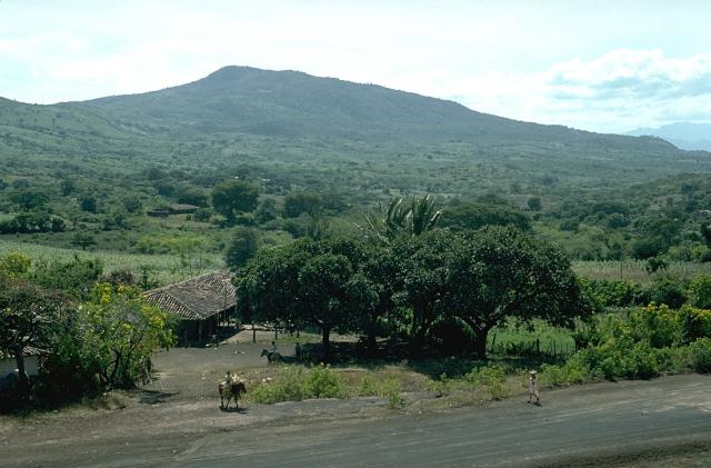
Chiquimula Volcanic Field is a volcanic field rising to 1,192 meters (3,911 feet) in Guatemala's Middle America-Caribbean Volcanic Regions. No historical eruptions have been recorded, though the volcano is classified based on geological evidence of past activity.
Geography & Climate
Chiquimula Volcanic Field is located in Guatemala, within the Central America Volcanic Arc of the broader Middle America-Caribbean Volcanic Regions. Situated at 14.83° N, 89.55° W in the Northern Hemisphere, the volcano lies within a tropical climate zone. With a summit elevation of 1,192 meters above sea level, Chiquimula Volcanic Field is a moderately sized peak that remains accessible to hikers and researchers for much of the year. The volcanic landform is characterized as a cluster, which describes the physical shape and structure of the volcanic edifice as observed from the surface.
GVP Reference Summary
The Chiquimula volcanic field occupies a fault-bounded basin underlain by Cretaceous plutonic rocks in the Chiquimula Valley of SE Guatemala. Initial eruptions during the Pleistocene produced basaltic lava flow fields along the N-S-trending fault, forming the eastern edge of the Ipala graben. These were followed by the eruption of widespread lava flows NW of Chiquimula town that covered about 12 km2. The most recent eruptions produced basaltic cinder cones and lava flows near the northern edge of Chiquimula town. The cinder cones were constructed along a N-S-trending fracture, with Cerro Grande, the largest, at the northern end and Cerro Chiquito, the youngest, at the southern end. The sparsely vegetated lava flows from Cerro Chiquito were considered by Williams et al. (1964) to be possibly less than 1,000 years old based on their appearance; there are no reports of eruptive activity and no radiometric ages are known.
— Smithsonian Institution, Global Volcanism Program
0 Recorded Eruptions
No eruption records available for Chiquimula Volcanic Field.
Real-Time Data
Frequently Asked Questions About Chiquimula Volcanic Field
Is Chiquimula Volcanic Field an active volcano?+
Chiquimula Volcanic Field is not currently classified as active. Its activity evidence is listed as "unknown." No recorded eruptions have been documented. However, no volcano is ever considered permanently extinct.
How high is Chiquimula Volcanic Field?+
Chiquimula Volcanic Field has a summit elevation of 1,192 meters (3,911 feet) above sea level. At 1,192 meters, it is a moderately sized volcanic peak, roughly comparable to Mount Vesuvius (1,281m).
What type of volcano is Chiquimula Volcanic Field?+
Chiquimula Volcanic Field is classified as a Volcanic field. Volcanic fields consist of clusters of small volcanic vents and cinder cones spread across a region. Rather than a single central vent, eruptions can occur at many points across the field.
Where is Chiquimula Volcanic Field located?+
Chiquimula Volcanic Field is located in Guatemala, in the Middle America-Caribbean Volcanic Regions. More specifically, it lies within the Central America Volcanic Arc. Its exact coordinates are 14.830° latitude, -89.550° longitude.
Is it safe to visit Chiquimula Volcanic Field?+
Chiquimula Volcanic Field can generally be visited, but as with any volcano, visitors should check local conditions and any advisory notices before traveling. Guatemala may have specific regulations for accessing volcanic areas. Guided tours are often the safest and most informative way to experience a volcano.