About Marchena
Marchena is a shield rising to 343 meters (1,125 feet) in Ecuador's Eastern Pacific Volcanic Regions. It last erupted in 1991 CE, and volcanologists consider it an active volcanic system. The volcano has produced 1 recorded eruption, with a maximum Volcanic Explosivity Index (VEI) of 2.
Geography & Climate
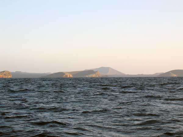
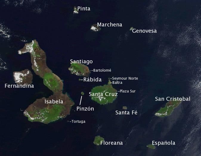
Marchena is located in Ecuador, within the Northern Galapagos Volcanic Province of the broader Eastern Pacific Volcanic Regions. Situated at 0.33° N, 90.47° W in the Northern Hemisphere, the volcano lies within a tropical climate zone. At just 343 meters above sea level, Marchena is a relatively low-elevation volcanic feature. Despite its modest height, it remains an active geological formation with the same underlying magmatic processes as its taller counterparts. The volcanic landform is characterized as a shield, which describes the physical shape and structure of the volcanic edifice as observed from the surface.
Geological Context
Marchena is situated along a rift zone, where tectonic plates are pulling apart. As the crust thins and fractures, magma rises to fill the gap, creating volcanic activity. Rift volcanism typically produces more fluid lava flows rather than explosive blasts, which means communities near Marchena in Ecuador generally face slower-moving hazards like lava flows and ground fissures rather than sudden pyroclastic events. However, rift volcanoes can still generate significant ash emissions and gas releases that affect local air quality. The dominant rock type is basalt / picro-basalt, a dark, fine-grained volcanic rock that forms from rapidly cooling, low-viscosity lava. Basaltic eruptions tend to be less explosive and produce fluid lava flows that can travel long distances. While less immediately dangerous than explosive eruptions, basaltic lava flows can destroy structures and infrastructure in their path, and volcanic gases released during these eruptions can affect air quality over a wide area.
Eruption History Summary
Marchena has 1 recorded eruption in the geological database, spanning from 1991 CE to 1991 CE. The most powerful recorded event was an explosive event producing ash plumes up to several kilometers in 1991 CE, reaching VEI 2 on the Volcanic Explosivity Index. The most recent eruption in 1991 CE places this volcano within the modern era of volcanological observation.
GVP Reference Summary
The low shield volcano forming Marchena Island contains one of the largest calderas of the Galápagos Islands. The 6 x 7 km caldera and its outer flanks have been largely buried by a cluster of pyroclastic cones and associated lava flows. Its first historical eruption occurred in 1991. Other young lava flows, some of which may be only a few thousand, or even a few hundred years old, filled the caldera and flowed down its outer forested flanks, in some cases to the sea.
— Smithsonian Institution, Global Volcanism Program
1 Recorded Eruption
| Year | VEI | Type | Area |
|---|---|---|---|
| 1991 | 2 | Confirmed Eruption | West to SW caldera rim |
Real-Time Data
Frequently Asked Questions About Marchena
Is Marchena an active volcano?+
Yes, Marchena is considered an active volcano. Its most recent eruption was in 1991 CE. The volcano is monitored by geological agencies, and its activity status is based on observed eruptions within recorded history.
When did Marchena last erupt?+
The most recent recorded eruption of Marchena occurred in 1991 CE with a Volcanic Explosivity Index (VEI) of 2. The eruption was classified as a "Confirmed Eruption." Marchena has 1 recorded eruption in total.
How high is Marchena?+
Marchena has a summit elevation of 343 meters (1,125 feet) above sea level. At 343 meters, it is a relatively low-elevation volcano.
What type of volcano is Marchena?+
Marchena is classified as a Shield. Shield volcanoes have distinct geological characteristics that set them apart from other volcanic types.
Where is Marchena located?+
Marchena is located in Ecuador, in the Eastern Pacific Volcanic Regions. More specifically, it lies within the Northern Galapagos Volcanic Province. Its exact coordinates are 0.330° latitude, -90.470° longitude.
Is it safe to visit Marchena?+
Visiting Marchena requires checking current volcanic activity and alert levels. As an active volcano with eruptions as recent as 1991 CE, conditions can change rapidly. Always consult local geological authorities and follow official warnings before visiting. Many active volcanoes have designated safe viewing areas and guided tour options.