About Nejapa-Miraflores
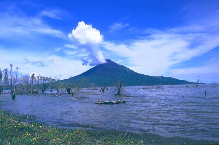
Nejapa-Miraflores is a fissure vent(s) rising to 360 meters (1,181 feet) in Nicaragua's Middle America-Caribbean Volcanic Regions. Its last known eruption was in 1060 CE. The volcano has produced 8 recorded eruptions, with a maximum Volcanic Explosivity Index (VEI) of 3.
Geography & Climate
Nejapa-Miraflores is located in Nicaragua, within the Central America Volcanic Arc of the broader Middle America-Caribbean Volcanic Regions. Situated at 12.12° N, 86.32° W in the Northern Hemisphere, the volcano lies within a tropical climate zone. At just 360 meters above sea level, Nejapa-Miraflores is a relatively low-elevation volcanic feature. Despite its modest height, it remains an active geological formation with the same underlying magmatic processes as its taller counterparts. The volcanic landform is characterized as a cluster, which describes the physical shape and structure of the volcanic edifice as observed from the surface.
Geological Context
Nejapa-Miraflores sits in a subduction zone, where one tectonic plate dives beneath another, creating intense heat and pressure that generates magma. Subduction zones are responsible for many of the world's most explosive volcanoes and deadliest eruptions. For communities in Nicaragua near Nejapa-Miraflores, this tectonic setting means the volcano is capable of producing powerful explosive eruptions, pyroclastic flows, and lahars that can threaten populated areas within tens of kilometers of the summit. The dominant rock type is basalt / picro-basalt, a dark, fine-grained volcanic rock that forms from rapidly cooling, low-viscosity lava. Basaltic eruptions tend to be less explosive and produce fluid lava flows that can travel long distances. While less immediately dangerous than explosive eruptions, basaltic lava flows can destroy structures and infrastructure in their path, and volcanic gases released during these eruptions can affect air quality over a wide area.
Eruption History Summary
Nejapa-Miraflores has 8 recorded eruptions in the geological database, spanning from 7430 BCE to 1060 CE. The most powerful recorded event was a severe eruption capable of regional ash fall and pyroclastic flows in 1060 CE, reaching VEI 3 on the Volcanic Explosivity Index. This eruption frequency indicates a moderately active volcanic system with periodic reawakenings.
Significance
With a maximum recorded VEI of 3, Nejapa-Miraflores has produced eruptions capable of generating pyroclastic flows and significant ash fall in the surrounding area. While not among the largest eruptions globally, VEI 3 events pose serious hazards to local populations and can disrupt regional air travel. With 8 recorded eruptions on file, Nejapa-Miraflores has enough documented activity to help scientists identify patterns in its eruptive behavior.
GVP Reference Summary
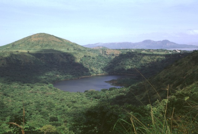
The N-S-trending Nejapa-Miraflores alignment, located near the western margin of the Nicaraguan graben, cuts through the western part of Nicaragua's capital city, Managua. This alignment, which has erupted tholeiitic basaltic rocks similar to those from mid-ocean ridges, marks the right-lateral offset of the Nicaraguan volcanic chain. A series of pit craters and fissure vents extends into Lake Managua and is continuous with the volcanic vents on the Chiltepe peninsula. An area of maars and tuff cones perpendicular to the N-S trend of the lineament forms the scalloped shoreline of Lake Managua. Laguna Tiscapa crater is located several kilometers to the east near the central part of the city of Managua. The elongated Nejapa and Ticoma pit craters are surrounded by small basaltic cinder cones and tuff cones. The Nejapa-Miraflores alignment (also known as Nejapa-Ticoma) has been the site of about 40 eruptions during the past 30,000 years, the most recent of which (from Asososca maar) occurred about 1250 years ago.
— Smithsonian Institution, Global Volcanism Program
8 Recorded Eruptions
| Year | VEI | Type | Area |
|---|---|---|---|
| 1060 | 3 | Confirmed Eruption | Nejapa maar |
| 550 BCE | — | Confirmed Eruption | — |
| 3050 BCE | — | Confirmed Eruption | — |
| 4390 BCE | — | Confirmed Eruption | El Hormigón |
| 5230 BCE | — | Confirmed Eruption | — |
| 5350 BCE | — | Confirmed Eruption | — |
| 7300 BCE | — | Confirmed Eruption | — |
| 7430 BCE | — | Confirmed Eruption | Refinería crater |
Real-Time Data
Frequently Asked Questions About Nejapa-Miraflores
Is Nejapa-Miraflores an active volcano?+
Nejapa-Miraflores is not currently classified as active. Its activity evidence is listed as "Eruption Dated." The last known eruption was in 1060 CE. However, no volcano is ever considered permanently extinct.
When did Nejapa-Miraflores last erupt?+
The most recent recorded eruption of Nejapa-Miraflores occurred in 1060 CE with a Volcanic Explosivity Index (VEI) of 3. The eruption was classified as a "Confirmed Eruption." Nejapa-Miraflores has 8 recorded eruptions in total.
How high is Nejapa-Miraflores?+
Nejapa-Miraflores has a summit elevation of 360 meters (1,181 feet) above sea level. At 360 meters, it is a relatively low-elevation volcano.
What type of volcano is Nejapa-Miraflores?+
Nejapa-Miraflores is classified as a Fissure vent(s). Fissure vent(s) volcanoes have distinct geological characteristics that set them apart from other volcanic types.
Where is Nejapa-Miraflores located?+
Nejapa-Miraflores is located in Nicaragua, in the Middle America-Caribbean Volcanic Regions. More specifically, it lies within the Central America Volcanic Arc. Its exact coordinates are 12.120° latitude, -86.320° longitude.
Is it safe to visit Nejapa-Miraflores?+
Nejapa-Miraflores can generally be visited, but as with any volcano, visitors should check local conditions and any advisory notices before traveling. Nicaragua may have specific regulations for accessing volcanic areas. Guided tours are often the safest and most informative way to experience a volcano.