About Masaya
Masaya is a caldera rising to 594 meters (1,949 feet) in Nicaragua's Middle America-Caribbean Volcanic Regions. The volcano is currently active, with its most recent eruption in 2025 CE. The volcano has produced 20 recorded eruptions, with a maximum Volcanic Explosivity Index (VEI) of 2.
Geography & Climate
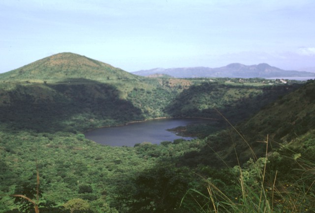
Masaya is located in Nicaragua, within the Central America Volcanic Arc of the broader Middle America-Caribbean Volcanic Regions. Situated at 11.98° N, 86.17° W in the Northern Hemisphere, the volcano lies within a tropical climate zone. With a summit elevation of 594 meters above sea level, Masaya is a moderately sized peak that remains accessible to hikers and researchers for much of the year. The volcanic landform is characterized as a caldera, which describes the physical shape and structure of the volcanic edifice as observed from the surface.
Geological Context
Masaya sits in a subduction zone, where one tectonic plate dives beneath another, creating intense heat and pressure that generates magma. Subduction zones are responsible for many of the world's most explosive volcanoes and deadliest eruptions. For communities in Nicaragua near Masaya, this tectonic setting means the volcano is capable of producing powerful explosive eruptions, pyroclastic flows, and lahars that can threaten populated areas within tens of kilometers of the summit. The dominant rock type is basalt / picro-basalt, a dark, fine-grained volcanic rock that forms from rapidly cooling, low-viscosity lava. Basaltic eruptions tend to be less explosive and produce fluid lava flows that can travel long distances. While less immediately dangerous than explosive eruptions, basaltic lava flows can destroy structures and infrastructure in their path, and volcanic gases released during these eruptions can affect air quality over a wide area.
Eruption History Summary
Masaya has 20 recorded eruptions in the geological database, spanning from 1925 CE to 2015 CE. The most powerful recorded event was an explosive event producing ash plumes up to several kilometers in 1925 CE, reaching VEI 2 on the Volcanic Explosivity Index. With an average interval of roughly 5 years between eruptions over a span of 90 years, this is one of the more frequently active volcanoes in the database. This persistent activity suggests a robust and well-supplied magma system beneath the volcano. With eruptive activity as recently as 2015 CE, Masaya remains an actively monitored volcano.
Significance
Its 20 recorded eruptions make it one of the most prolific volcanoes in our database, reflecting a persistent and well-documented eruptive history that has provided volcanologists with extensive data for understanding eruption patterns and forecasting future activity. Given its recent activity, Masaya is closely monitored by geological survey organizations to provide early warning of future unrest.
GVP Reference Summary
Masaya volcano in Nicaragua has erupted frequently since the time of the Spanish Conquistadors, when an active lava lake prompted attempts to extract the volcano's molten "gold" until it was found to be basalt rock upon cooling. It lies within the massive Pleistocene Las Sierras caldera and is itself a broad, 6 x 11 km basaltic caldera with steep-sided walls up to 300 m high. The caldera is filled on its NW end by more than a dozen vents that erupted along a circular, 4-km-diameter fracture system. The Nindirí and Masaya cones, the source of observed eruptions, were constructed at the southern end of the fracture system and contain multiple summit craters, including the currently active Santiago crater. A major basaltic Plinian tephra erupted from Masaya about 6,500 years ago. Recent lava flows cover much of the caldera floor and there is a lake at the far eastern end. A lava flow from the 1670 eruption overtopped the north caldera rim. Periods of long-term vigorous gas emission at roughly quarter-century intervals have caused health hazards and crop damage.
— Smithsonian Institution, Global Volcanism Program
20 Recorded Eruptions
| Year | VEI | Type | Area |
|---|---|---|---|
| 2015 | 1 | Confirmed Eruption | Santiago crater |
| 2013 | 0 | Uncertain Eruption | — |
| 2012 | 1 | Confirmed Eruption | Santiago Crater |
| 2008 | 1 | Confirmed Eruption | Santiago |
| 2006 | 1 | Confirmed Eruption | Santiago |
| 2005 | 1 | Confirmed Eruption | Santiago |
| 2004 | 1 | Uncertain Eruption | Santiago |
| 2003 | 1 | Confirmed Eruption | Santiago |
| 2001 | 1 | Confirmed Eruption | Santiago |
| 1999 | 1 | Confirmed Eruption | Santiago |
| 1998 | 1 | Confirmed Eruption | Santiago |
| 1997 | 1 | Confirmed Eruption | Santiago |
| 1996 | 1 | Confirmed Eruption | Santiago |
| 1993 | 1 | Confirmed Eruption | Santiago |
| 1989 | 1 | Confirmed Eruption | Santiago |
| 1987 | 1 | Confirmed Eruption | Santiago |
| 1965 | 1 | Confirmed Eruption | Santiago |
| 1948 | 1 | Confirmed Eruption | Santiago |
| 1946 | 1 | Confirmed Eruption | Santiago |
| 1925 | 2 | Confirmed Eruption | Santiago |
Real-Time Data
Frequently Asked Questions About Masaya
Is Masaya an active volcano?+
Yes, Masaya is considered an active volcano. Its most recent eruption was in 2025 CE. The volcano is monitored by geological agencies, and its activity status is based on observed eruptions within recorded history.
When did Masaya last erupt?+
The most recent recorded eruption of Masaya occurred in 2015 CE with a Volcanic Explosivity Index (VEI) of 1. The eruption was classified as a "Confirmed Eruption." Masaya has 20 recorded eruptions in total.
How high is Masaya?+
Masaya has a summit elevation of 594 meters (1,949 feet) above sea level. At 594 meters, it is a relatively low-elevation volcano.
What type of volcano is Masaya?+
Masaya is classified as a Caldera. Calderas are large volcanic depressions formed when a volcano erupts so powerfully that its magma chamber collapses, creating a basin that can be kilometers wide. They are often sites of some of Earth's largest eruptions.
Where is Masaya located?+
Masaya is located in Nicaragua, in the Middle America-Caribbean Volcanic Regions. More specifically, it lies within the Central America Volcanic Arc. Its exact coordinates are 11.984° latitude, -86.169° longitude.
Is it safe to visit Masaya?+
Visiting Masaya requires checking current volcanic activity and alert levels. As an active volcano with eruptions as recent as 2025 CE, conditions can change rapidly. Always consult local geological authorities and follow official warnings before visiting. Many active volcanoes have designated safe viewing areas and guided tour options.