About Chichon, El
Chichon, El is a lava dome(s) rising to 1,150 meters (3,773 feet) in Mexico's Middle America-Caribbean Volcanic Regions. It last erupted in 1982 CE, and volcanologists consider it an active volcanic system. The volcano has produced 13 recorded eruptions, with a maximum Volcanic Explosivity Index (VEI) of 5.
Geography & Climate
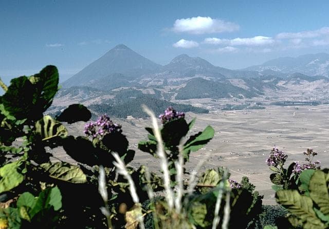
Chichon, El is located in Mexico, within the Chiapanecan Volcanic Arc of the broader Middle America-Caribbean Volcanic Regions. Situated at 17.36° N, 93.23° W in the Northern Hemisphere, the volcano lies within a tropical climate zone. With a summit elevation of 1,150 meters above sea level, Chichon, El is a moderately sized peak that remains accessible to hikers and researchers for much of the year. The volcanic landform is characterized as a composite, which describes the physical shape and structure of the volcanic edifice as observed from the surface.
Geological Context
Chichon, El sits in a subduction zone, where one tectonic plate dives beneath another, creating intense heat and pressure that generates magma. Subduction zones are responsible for many of the world's most explosive volcanoes and deadliest eruptions. For communities in Mexico near Chichon, El, this tectonic setting means the volcano is capable of producing powerful explosive eruptions, pyroclastic flows, and lahars that can threaten populated areas within tens of kilometers of the summit. The dominant rock type is trachyandesite / basaltic trachyandesite, a dark, fine-grained volcanic rock that forms from rapidly cooling, low-viscosity lava. Basaltic eruptions tend to be less explosive and produce fluid lava flows that can travel long distances. While less immediately dangerous than explosive eruptions, basaltic lava flows can destroy structures and infrastructure in their path, and volcanic gases released during these eruptions can affect air quality over a wide area.
Eruption History Summary
Chichon, El has 13 recorded eruptions in the geological database, spanning from 6510 BCE to 1982 CE. The most powerful recorded event was a paroxysmal eruption with devastating regional consequences in 1982 CE, reaching VEI 5 on the Volcanic Explosivity Index. Notable eruptions include 1982 CE (VEI 5), 1360 CE (VEI 5), 1190 CE (VEI 4). This level of eruptive frequency indicates a persistently active volcanic system that warrants ongoing monitoring. The most recent eruption in 1982 CE places this volcano within the modern era of volcanological observation.
Significance
With a maximum recorded VEI of 5, Chichon, El has demonstrated the capacity for paroxysmal eruptions comparable to the 1980 eruption of Mount St. Helens. Eruptions of this scale can devastate areas within 20-30 kilometers and produce ash fall that disrupts aviation and agriculture across hundreds of kilometers. With 13 recorded eruptions, Chichon, El has a substantial eruptive history that provides valuable data for understanding volcanic behavior and assessing future hazards in the Middle America-Caribbean Volcanic Regions region. Given its recent activity, Chichon, El is closely monitored by geological survey organizations to provide early warning of future unrest.
GVP Reference Summary
El Chichón is a small trachyandesitic tuff cone and lava dome complex in an isolated part of the Chiapas region in SE México. Prior to 1982, this relatively unknown volcano was heavily forested and of no greater height than adjacent non-volcanic peaks. The largest dome, the former summit of the volcano, was constructed within a 1.6 x 2 km summit crater created about 220,000 years ago. Two other large craters are located on the SW and SE flanks; a lava dome fills the SW crater, and an older dome is located on the NW flank. More than ten large explosive eruptions have occurred since the mid-Holocene. The powerful 1982 explosive eruptions of high-sulfur, anhydrite-bearing magma destroyed the summit lava dome and were accompanied by pyroclastic flows and surges that devastated an area extending about 8 km around the volcano. The eruptions created a new 1-km-wide, 300-m-deep crater that now contains an acidic crater lake.
— Smithsonian Institution, Global Volcanism Program
13 Recorded Eruptions
| Year | VEI | Type | Area |
|---|---|---|---|
| 1982 | 5 | Confirmed Eruption | — |
| 1850 | — | Confirmed Eruption | — |
| 1360 | 5 | Confirmed Eruption | — |
| 1190 | 4 | Confirmed Eruption | — |
| 780 | 5 | Confirmed Eruption | — |
| 590 | 3 | Confirmed Eruption | — |
| 480 | — | Confirmed Eruption | — |
| 190 | — | Confirmed Eruption | — |
| 20 BCE | — | Confirmed Eruption | — |
| 700 BCE | — | Confirmed Eruption | — |
| 1340 BCE | — | Confirmed Eruption | — |
| 2030 BCE | 5 | Confirmed Eruption | — |
| 6510 BCE | — | Confirmed Eruption | — |
Real-Time Data
Frequently Asked Questions About Chichon, El
Is Chichon, El an active volcano?+
Yes, Chichon, El is considered an active volcano. Its most recent eruption was in 1982 CE. The volcano is monitored by geological agencies, and its activity status is based on observed eruptions within recorded history.
When did Chichon, El last erupt?+
The most recent recorded eruption of Chichon, El occurred in 1982 CE with a Volcanic Explosivity Index (VEI) of 5. The eruption was classified as a "Confirmed Eruption." Chichon, El has 13 recorded eruptions in total.
How high is Chichon, El?+
Chichon, El has a summit elevation of 1,150 meters (3,773 feet) above sea level. At 1,150 meters, it is a moderately sized volcanic peak, roughly comparable to Mount Vesuvius (1,281m).
What type of volcano is Chichon, El?+
Chichon, El is classified as a Lava dome(s). Lava domes are mounds of viscous lava that pile up around a volcanic vent. They grow by expansion from within and can collapse to produce dangerous pyroclastic flows.
Where is Chichon, El located?+
Chichon, El is located in Mexico, in the Middle America-Caribbean Volcanic Regions. More specifically, it lies within the Chiapanecan Volcanic Arc. Its exact coordinates are 17.360° latitude, -93.230° longitude.
Is it safe to visit Chichon, El?+
Visiting Chichon, El requires checking current volcanic activity and alert levels. As an active volcano with eruptions as recent as 1982 CE, conditions can change rapidly. Always consult local geological authorities and follow official warnings before visiting. Many active volcanoes have designated safe viewing areas and guided tour options.