About Almolonga
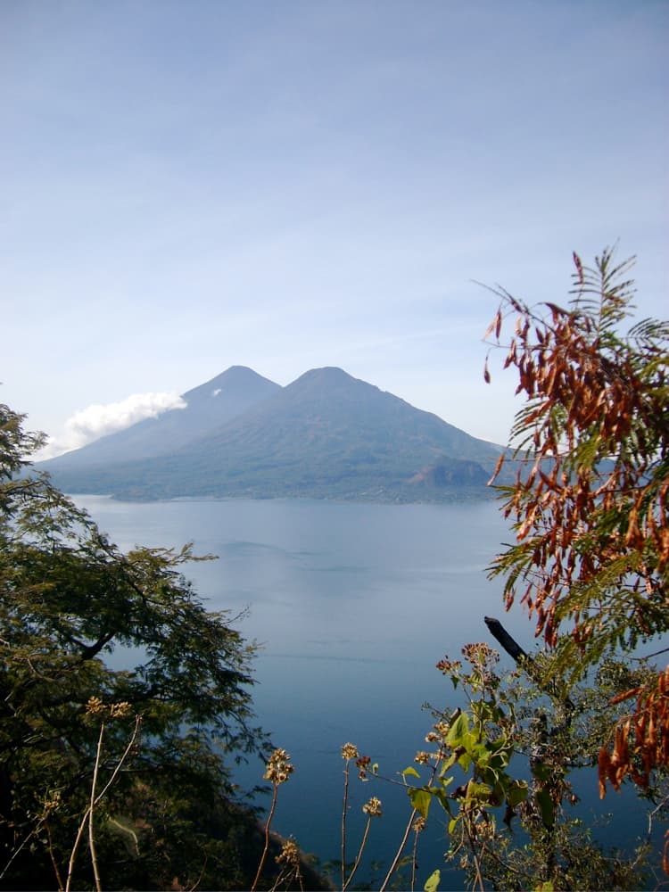
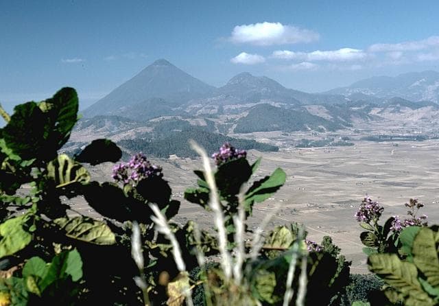
Almolonga is a stratovolcano rising to 3,173 meters (10,411 feet) in Guatemala's Middle America-Caribbean Volcanic Regions. Its last known eruption was in 1818 CE. The volcano has produced 3 recorded eruptions, with a maximum Volcanic Explosivity Index (VEI) of 3.
Geography & Climate
Almolonga is located in Guatemala, within the Central America Volcanic Arc of the broader Middle America-Caribbean Volcanic Regions. Situated at 14.80° N, 91.52° W in the Northern Hemisphere, the volcano lies within a tropical climate zone. At 3,173 meters above sea level, Almolonga rises above the surrounding terrain into montane or subalpine conditions. The elevation creates distinct ecological zones along its flanks, from forested lower slopes to exposed rocky terrain near the summit. The volcanic landform is characterized as a composite, which describes the physical shape and structure of the volcanic edifice as observed from the surface.
Geological Context
Almolonga sits in a subduction zone, where one tectonic plate dives beneath another, creating intense heat and pressure that generates magma. Subduction zones are responsible for many of the world's most explosive volcanoes and deadliest eruptions. For communities in Guatemala near Almolonga, this tectonic setting means the volcano is capable of producing powerful explosive eruptions, pyroclastic flows, and lahars that can threaten populated areas within tens of kilometers of the summit. The dominant rock type is dacite, an intermediate to silica-rich volcanic rock. This composition typically produces more viscous magma, leading to more explosive eruptions with ash columns and pyroclastic flows. Andesitic and dacitic magmas build pressure before erupting, which is why volcanoes with this rock chemistry are often associated with Plinian-style eruptions that can send ash tens of kilometers into the atmosphere and disrupt aviation across entire regions.
Eruption History Summary
Almolonga has 3 recorded eruptions in the geological database, spanning from 800 CE to 1818 CE. The most powerful recorded event was a severe eruption capable of regional ash fall and pyroclastic flows in 800 CE, reaching VEI 3 on the Volcanic Explosivity Index. These eruptions span roughly 1,018 years of volcanic history.
Significance
With a maximum recorded VEI of 3, Almolonga has produced eruptions capable of generating pyroclastic flows and significant ash fall in the surrounding area. While not among the largest eruptions globally, VEI 3 events pose serious hazards to local populations and can disrupt regional air travel.
GVP Reference Summary
Volcán de Almolonga is an andesitic stratovolcano with a 3.3-km-wide late-Pleistocene central caldera that is located along the Zunil fault zone. The caldera is surrounded by a ring-dike configuration of dacitic and rhyolitic lava domes. The youngest and only historically active dome complex is Cerro Quemado (whose name means Burned Peak), located immediately south of Guatemala's second largest city, Quezaltenango. About 1200 radiocarbon years ago, part of the andesitic-to-dacitic Cerro Quemado dome collapsed, producing a debris avalanche and an associated lateral explosion that swept across the valley to the west as far as the flanks of Siete Orejas volcano. The latest eruption in 1818 produced a blocky 2.5-km-long lava flow. Hot springs are located on the northern and eastern flanks of Cerro Quemado, and the Zuníl geothermal field, the site of a geothermal exploration project, lies on the SE flank of Cerro Quemado.
— Smithsonian Institution, Global Volcanism Program
3 Recorded Eruptions
| Year | VEI | Type | Area |
|---|---|---|---|
| 1818 | 2 | Confirmed Eruption | East flank of Cerro Quemado |
| 1765 | 2 | Confirmed Eruption | Cerro Quemado |
| 800 | 3 | Confirmed Eruption | Cerro Quemado |
Real-Time Data
Frequently Asked Questions About Almolonga
Is Almolonga an active volcano?+
Almolonga is classified as active based on credible evidence of past eruptions. Although its last known eruption was in 1818 CE, volcanologists consider it capable of erupting again.
When did Almolonga last erupt?+
The most recent recorded eruption of Almolonga occurred in 1818 CE with a Volcanic Explosivity Index (VEI) of 2. The eruption was classified as a "Confirmed Eruption." Almolonga has 3 recorded eruptions in total.
How high is Almolonga?+
Almolonga has a summit elevation of 3,173 meters (10,411 feet) above sea level. At 3,173 meters, it is comparable in height to many significant mountain peaks and stands well above the tree line.
What type of volcano is Almolonga?+
Almolonga is classified as a Stratovolcano. Stratovolcanoes (also called composite volcanoes) are steep, conical volcanoes built up by many layers of hardened lava, tephra, and volcanic ash. They are among the most common and dangerous types, known for explosive eruptions.
Where is Almolonga located?+
Almolonga is located in Guatemala, in the Middle America-Caribbean Volcanic Regions. More specifically, it lies within the Central America Volcanic Arc. Its exact coordinates are 14.797° latitude, -91.519° longitude.
Is it safe to visit Almolonga?+
Almolonga can generally be visited, but as with any volcano, visitors should check local conditions and any advisory notices before traveling. Guatemala may have specific regulations for accessing volcanic areas. Guided tours are often the safest and most informative way to experience a volcano.