About San Pedro
San Pedro is a stratovolcano rising to 3,020 meters (9,909 feet) in Guatemala's Middle America-Caribbean Volcanic Regions. No historical eruptions have been recorded, though the volcano is classified based on geological evidence of past activity.
Geography & Climate
San Pedro is located in Guatemala, within the Central America Volcanic Arc of the broader Middle America-Caribbean Volcanic Regions. Situated at 14.66° N, 91.27° W in the Northern Hemisphere, the volcano lies within a tropical climate zone. At 3,020 meters above sea level, San Pedro rises above the surrounding terrain into montane or subalpine conditions. The elevation creates distinct ecological zones along its flanks, from forested lower slopes to exposed rocky terrain near the summit. The volcanic landform is characterized as a composite, which describes the physical shape and structure of the volcanic edifice as observed from the surface.
GVP Reference Summary
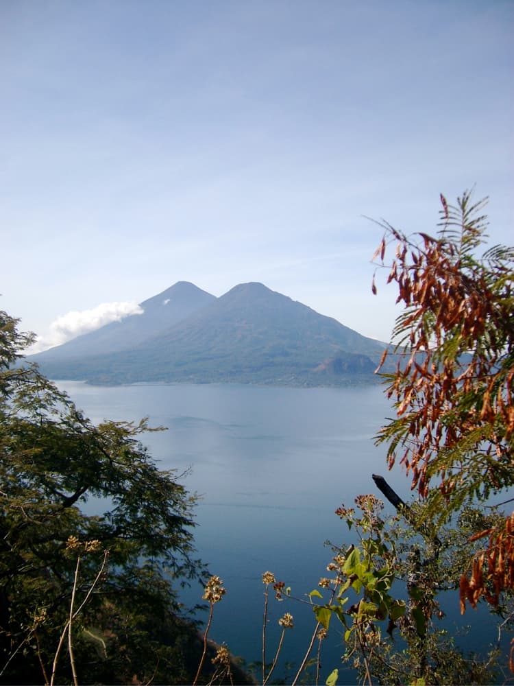
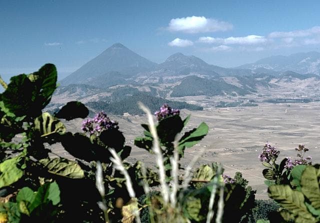
Volcán San Pedro is the oldest of three stratovolcanoes constructed within the roughly 85,000-year-old Atitlán III caldera, with a forested cone that rises above the SW side of Lake Atitlán. Santiago bay, a narrow 8-km-long inlet of Lake Atitlán, separates the eastern flank of San Pedro from the slopes of Volcán Tolimán. The shallow summit crater is breached to the NW and partially filled by lava. Two cinder cones were constructed in the moat between San Pedro and the SW Atitlán caldera wall. The age of the most recent activity of San Pedro is unknown, although it is more vegetated and erosionally modified than the Tolimán and Atitlán volcanoes, and does not display evidence of fumarolic activity.
— Smithsonian Institution, Global Volcanism Program
0 Recorded Eruptions
No eruption records available for San Pedro.
Real-Time Data
Frequently Asked Questions About San Pedro
Is San Pedro an active volcano?+
San Pedro is not currently classified as active. Its activity evidence is listed as "unknown." No recorded eruptions have been documented. However, no volcano is ever considered permanently extinct.
How high is San Pedro?+
San Pedro has a summit elevation of 3,020 meters (9,909 feet) above sea level. At 3,020 meters, it is comparable in height to many significant mountain peaks and stands well above the tree line.
What type of volcano is San Pedro?+
San Pedro is classified as a Stratovolcano. Stratovolcanoes (also called composite volcanoes) are steep, conical volcanoes built up by many layers of hardened lava, tephra, and volcanic ash. They are among the most common and dangerous types, known for explosive eruptions.
Where is San Pedro located?+
San Pedro is located in Guatemala, in the Middle America-Caribbean Volcanic Regions. More specifically, it lies within the Central America Volcanic Arc. Its exact coordinates are 14.656° latitude, -91.267° longitude.
Is it safe to visit San Pedro?+
San Pedro can generally be visited, but as with any volcano, visitors should check local conditions and any advisory notices before traveling. Guatemala may have specific regulations for accessing volcanic areas. Guided tours are often the safest and most informative way to experience a volcano.