About Cofre de Perote
Cofre de Perote is a compound rising to 4,282 meters (14,049 feet) in Mexico's Middle America-Caribbean Volcanic Regions. Its last known eruption was in 1150 CE. The volcano has produced 1 recorded eruption, with a maximum Volcanic Explosivity Index (VEI) of 2.
Geography & Climate
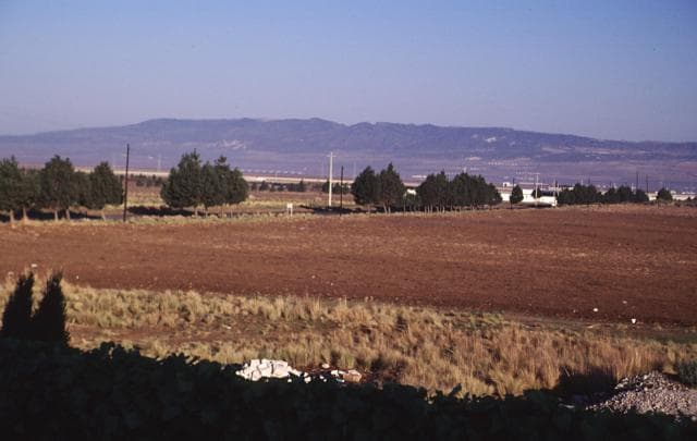
Cofre de Perote is located in Mexico, within the Trans-Mexican Volcanic Arc of the broader Middle America-Caribbean Volcanic Regions. Situated at 19.49° N, 97.15° W in the Northern Hemisphere, the volcano lies within a tropical climate zone. Standing at 4,282 meters above sea level, Cofre de Perote towers above the alpine zone, where vegetation gives way to bare rock, snow, and ice for much of the year. The high elevation means the upper slopes experience significantly colder temperatures than surrounding lowlands. The volcanic landform is characterized as a composite, which describes the physical shape and structure of the volcanic edifice as observed from the surface.
Geological Context
Cofre de Perote sits in a subduction zone, where one tectonic plate dives beneath another, creating intense heat and pressure that generates magma. Subduction zones are responsible for many of the world's most explosive volcanoes and deadliest eruptions. For communities in Mexico near Cofre de Perote, this tectonic setting means the volcano is capable of producing powerful explosive eruptions, pyroclastic flows, and lahars that can threaten populated areas within tens of kilometers of the summit. The dominant rock type is andesite / basaltic andesite, a dark, fine-grained volcanic rock that forms from rapidly cooling, low-viscosity lava. Basaltic eruptions tend to be less explosive and produce fluid lava flows that can travel long distances. While less immediately dangerous than explosive eruptions, basaltic lava flows can destroy structures and infrastructure in their path, and volcanic gases released during these eruptions can affect air quality over a wide area.
Eruption History Summary
Cofre de Perote has 1 recorded eruption in the geological database, spanning from 1150 CE to 1150 CE. The most powerful recorded event was an explosive event producing ash plumes up to several kilometers in 1150 CE, reaching VEI 2 on the Volcanic Explosivity Index.
GVP Reference Summary
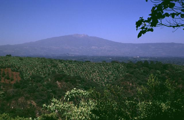
Cofre de Perote is a massive Quaternary andesitic-dacitic volcano at the NNE end of a volcanic chain extending southward to Pico de Orizaba (Citlaltépetl). Lava flows dominated in formation of this broad compound volcano, which is largely of Pleistocene age and morphologically distinct from the steep-sided stratovolcanoes of the Mexican Volcanic Belt. Glaciation at the summit has left a steep box-like peak which is sometimes referred to as the "Treasure Chest of Perote." A large escarpment formed in part by multiple edifice collapses cuts the eastern side of the volcano. Numerous monogenetic cinder cones, likely related to regional volcanism, were erupted through the flanks. A cluster of youthful basaltic cinder cones is located on the NE flank, and young lava flows have traveled eastward to beyond the major city of Xalapa (Jalapa), the capital of the state of Veracruz. The youngest lava flow, from the El Volcancillo vent on the lower NE flank, was radiocarbon dated at about 900 years ago.
— Smithsonian Institution, Global Volcanism Program
1 Recorded Eruption
| Year | VEI | Type | Area |
|---|---|---|---|
| 1150 | 2 | Confirmed Eruption | Lower NE flank (El Volcancillo) |
Real-Time Data
Frequently Asked Questions About Cofre de Perote
Is Cofre de Perote an active volcano?+
Cofre de Perote is not currently classified as active. Its activity evidence is listed as "Eruption Dated." The last known eruption was in 1150 CE. However, no volcano is ever considered permanently extinct.
When did Cofre de Perote last erupt?+
The most recent recorded eruption of Cofre de Perote occurred in 1150 CE with a Volcanic Explosivity Index (VEI) of 2. The eruption was classified as a "Confirmed Eruption." Cofre de Perote has 1 recorded eruption in total.
How high is Cofre de Perote?+
Cofre de Perote has a summit elevation of 4,282 meters (14,049 feet) above sea level. At 4,282 meters, it stands taller than Mount Rainier (4,392m) and is among the world's major volcanic peaks.
What type of volcano is Cofre de Perote?+
Cofre de Perote is classified as a Compound. Compound volcanoes have distinct geological characteristics that set them apart from other volcanic types.
Where is Cofre de Perote located?+
Cofre de Perote is located in Mexico, in the Middle America-Caribbean Volcanic Regions. More specifically, it lies within the Trans-Mexican Volcanic Arc. Its exact coordinates are 19.492° latitude, -97.150° longitude.
Is it safe to visit Cofre de Perote?+
Cofre de Perote can generally be visited, but as with any volcano, visitors should check local conditions and any advisory notices before traveling. Mexico may have specific regulations for accessing volcanic areas. Guided tours are often the safest and most informative way to experience a volcano.