About Baker
Baker is a stratovolcano(es) rising to 3,285 meters (10,778 feet) in United States's North America Volcanic Regions. Its last known eruption was in 1880 CE. The volcano has produced 20 recorded eruptions, with a maximum Volcanic Explosivity Index (VEI) of 3.
Geography & Climate
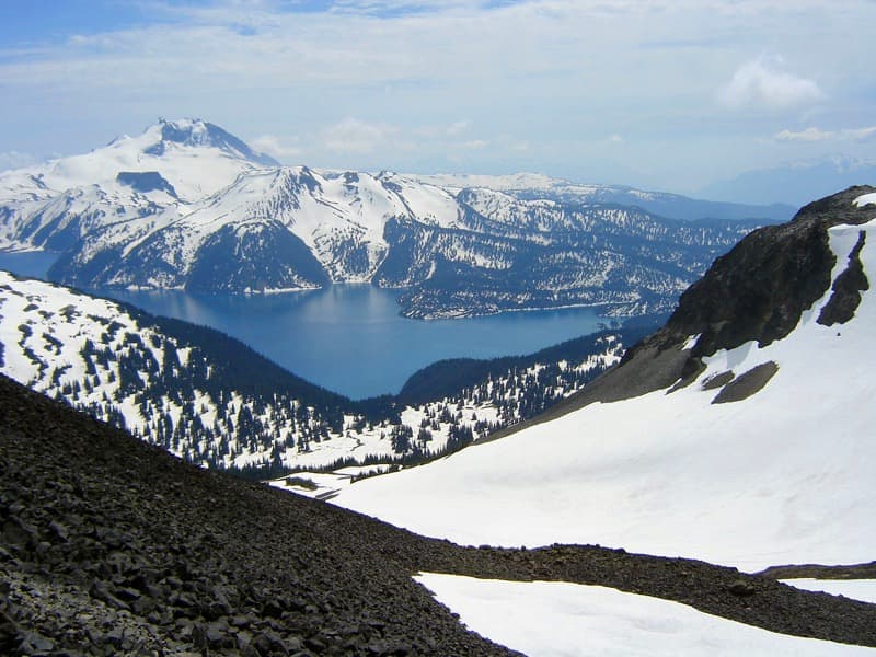
Baker is located in United States, within the Garibaldi Volcanic Arc of the broader North America Volcanic Regions. Situated at 48.78° N, 121.81° W in the Northern Hemisphere, the volcano lies within a temperate climate zone. At 3,285 meters above sea level, Baker rises above the surrounding terrain into montane or subalpine conditions. The elevation creates distinct ecological zones along its flanks, from forested lower slopes to exposed rocky terrain near the summit. The volcanic landform is characterized as a composite, which describes the physical shape and structure of the volcanic edifice as observed from the surface.
Geological Context
Baker sits in a subduction zone, where one tectonic plate dives beneath another, creating intense heat and pressure that generates magma. Subduction zones are responsible for many of the world's most explosive volcanoes and deadliest eruptions. For communities in United States near Baker, this tectonic setting means the volcano is capable of producing powerful explosive eruptions, pyroclastic flows, and lahars that can threaten populated areas within tens of kilometers of the summit. The dominant rock type is andesite / basaltic andesite, a dark, fine-grained volcanic rock that forms from rapidly cooling, low-viscosity lava. Basaltic eruptions tend to be less explosive and produce fluid lava flows that can travel long distances. While less immediately dangerous than explosive eruptions, basaltic lava flows can destroy structures and infrastructure in their path, and volcanic gases released during these eruptions can affect air quality over a wide area.
Eruption History Summary
Baker has 20 recorded eruptions in the geological database, spanning from 7850 BCE to 1884 CE. The most powerful recorded event was a severe eruption capable of regional ash fall and pyroclastic flows in 1843 CE, reaching VEI 3 on the Volcanic Explosivity Index. Notable eruptions include 1843 CE (VEI 3), 4550 BCE (VEI 3). With an average interval of roughly 487 years between eruptions over a span of 9,734 years, this is one of the more frequently active volcanoes in the database. This persistent activity suggests a robust and well-supplied magma system beneath the volcano.
Significance
With a maximum recorded VEI of 3, Baker has produced eruptions capable of generating pyroclastic flows and significant ash fall in the surrounding area. While not among the largest eruptions globally, VEI 3 events pose serious hazards to local populations and can disrupt regional air travel. Its 20 recorded eruptions make it one of the most prolific volcanoes in our database, reflecting a persistent and well-documented eruptive history that has provided volcanologists with extensive data for understanding eruption patterns and forecasting future activity.
GVP Reference Summary
Mount Baker, the northernmost of Washington's volcanoes, is a glacier-clad andesitic stratovolcano constructed above the E flank of the eroded mid-Pleistocene Black Buttes volcano and SW of the early Pleistocene 4.5 x 8 km rhyodacitic Kulshan caldera. With the exception of the Schreibers Meadow cinder cone on the SE flank, which formed about 9,800 years ago, Holocene volcanism has been confined to the central conduit. A major eruption about 6,500 years ago, it's largest eruptive event during the Holocene, was accompanied by a collapse that sent lahars down the Nooksack drainage. Early settlers in the Puget Sound region as far away as Victoria, British Columbia, observed 19th-century activity, all of which consisted of relatively minor phreatic eruptions. Sherman Crater, the historically active crater immediately south of the summit, has been the site of increased steam emission since 1975. The Nooksack Indian Tribe referred to the volcano as Kweq Smaenit, the "White Mountain." The Lummi Nation knew Mount Baker as Koma Kulshan.
— Smithsonian Institution, Global Volcanism Program
20 Recorded Eruptions
| Year | VEI | Type | Area |
|---|---|---|---|
| 1884 | — | Uncertain Eruption | Sherman Crater |
| 1880 | 2 | Confirmed Eruption | Sherman Crater |
| 1870 | 2 | Confirmed Eruption | Sherman Crater |
| 1869 | — | Uncertain Eruption | Sherman Crater |
| 1867 | — | Uncertain Eruption | Sherman Crater |
| 1865 | — | Uncertain Eruption | Sherman Crater |
| 1863 | 2 | Confirmed Eruption | Sherman Crater |
| 1860 | — | Uncertain Eruption | Sherman Crater |
| 1859 | 2 | Confirmed Eruption | Sherman Crater |
| 1858 | 2 | Confirmed Eruption | Sherman Crater |
| 1856 | — | Uncertain Eruption | Sherman Crater |
| 1854 | 2 | Confirmed Eruption | Sherman Crater |
| 1852 | 2 | Confirmed Eruption | Sherman Crater |
| 1850 | — | Uncertain Eruption | Sherman Crater |
| 1846 | — | Uncertain Eruption | — |
| 1843 | 3 | Confirmed Eruption | Sherman Crater |
| 1820 | 2 | Confirmed Eruption | — |
| 1792 | — | Uncertain Eruption | — |
| 4550 BCE | 3 | Confirmed Eruption | Sherman Crater? |
| 7850 BCE | — | Confirmed Eruption | South flank (Schreibers Meadow Cone) |
Real-Time Data
Frequently Asked Questions About Baker
Is Baker an active volcano?+
Baker is classified as active based on credible evidence of past eruptions. Although its last known eruption was in 1880 CE, volcanologists consider it capable of erupting again.
When did Baker last erupt?+
The most recent recorded eruption of Baker occurred in 1884 CE. The eruption was classified as a "Uncertain Eruption." Baker has 20 recorded eruptions in total.
How high is Baker?+
Baker has a summit elevation of 3,285 meters (10,778 feet) above sea level. At 3,285 meters, it is comparable in height to many significant mountain peaks and stands well above the tree line.
What type of volcano is Baker?+
Baker is classified as a Stratovolcano(es). Stratovolcano(es) volcanoes have distinct geological characteristics that set them apart from other volcanic types.
Where is Baker located?+
Baker is located in United States, in the North America Volcanic Regions. More specifically, it lies within the Garibaldi Volcanic Arc. Its exact coordinates are 48.777° latitude, -121.813° longitude.
Is it safe to visit Baker?+
Baker can generally be visited, but as with any volcano, visitors should check local conditions and any advisory notices before traveling. United States may have specific regulations for accessing volcanic areas. Guided tours are often the safest and most informative way to experience a volcano.