About Garibaldi
Garibaldi is a stratovolcano rising to 2,678 meters (8,787 feet) in Canada's North America Volcanic Regions. The volcano is currently active, with its most recent eruption in 8060 BCE. The volcano has produced 1 recorded eruption, with a maximum Volcanic Explosivity Index (VEI) of 3.
Geography & Climate
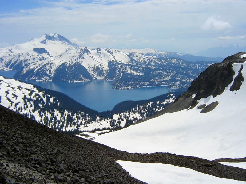
Garibaldi is located in Canada, within the Garibaldi Volcanic Arc of the broader North America Volcanic Regions. Situated at 49.85° N, 123.00° W in the Northern Hemisphere, the volcano lies within a temperate climate zone. At 2,678 meters above sea level, Garibaldi rises above the surrounding terrain into montane or subalpine conditions. The elevation creates distinct ecological zones along its flanks, from forested lower slopes to exposed rocky terrain near the summit. The volcanic landform is characterized as a composite, which describes the physical shape and structure of the volcanic edifice as observed from the surface.
Geological Context
Garibaldi sits in a subduction zone, where one tectonic plate dives beneath another, creating intense heat and pressure that generates magma. Subduction zones are responsible for many of the world's most explosive volcanoes and deadliest eruptions. For communities in Canada near Garibaldi, this tectonic setting means the volcano is capable of producing powerful explosive eruptions, pyroclastic flows, and lahars that can threaten populated areas within tens of kilometers of the summit. The dominant rock type is dacite, an intermediate to silica-rich volcanic rock. This composition typically produces more viscous magma, leading to more explosive eruptions with ash columns and pyroclastic flows. Andesitic and dacitic magmas build pressure before erupting, which is why volcanoes with this rock chemistry are often associated with Plinian-style eruptions that can send ash tens of kilometers into the atmosphere and disrupt aviation across entire regions.
Eruption History Summary
Garibaldi has 1 recorded eruption in the geological database, spanning from 8060 BCE to 8060 BCE. The most powerful recorded event was a severe eruption capable of regional ash fall and pyroclastic flows in 8060 BCE, reaching VEI 3 on the Volcanic Explosivity Index.
Significance
With a maximum recorded VEI of 3, Garibaldi has produced eruptions capable of generating pyroclastic flows and significant ash fall in the surrounding area. While not among the largest eruptions globally, VEI 3 events pose serious hazards to local populations and can disrupt regional air travel.
GVP Reference Summary
Mount Garibaldi at the head of Howe Sound north of Vancouver is a Pleistocene dacitic stratovolcano capped by a lava dome complex. An initial period of volcanism 0.51-0.22 million years ago was followed after a period of quiescence by construction of a conical plug dome and breccia pile at the south summit, Atwell Peak. Retreat of the ice cap left the W flank unsupported, and it collapsed in a series of landslides, exposing the core of the volcano. Lava flows from Dalton Dome north of Atwell Peak subsequently flowed down the scarp. Subglacial flank centers such as Eanastick (Enostuck) Meadow, Glacier Pike, and Paul Ridge were also formed during the late Pleistocene. The final activity formed the Opal Cone on the SE flank and the lengthy Ring Creek lava flow, which filled a glaciated valley on the S flank during the early Holocene (Mathews, 1958; Brooks and Friele, 1992).
— Smithsonian Institution, Global Volcanism Program
1 Recorded Eruption
| Year | VEI | Type | Area |
|---|---|---|---|
| 8060 BCE | 3 | Confirmed Eruption | SE flank (Opal Cone) |
Real-Time Data
Frequently Asked Questions About Garibaldi
Is Garibaldi an active volcano?+
Garibaldi is not currently classified as active. Its activity evidence is listed as "Eruption Dated." The last known eruption was in 8060 BCE. However, no volcano is ever considered permanently extinct.
When did Garibaldi last erupt?+
The most recent recorded eruption of Garibaldi occurred in 8060 BCE with a Volcanic Explosivity Index (VEI) of 3. The eruption was classified as a "Confirmed Eruption." Garibaldi has 1 recorded eruption in total.
How high is Garibaldi?+
Garibaldi has a summit elevation of 2,678 meters (8,787 feet) above sea level. At 2,678 meters, it is comparable in height to many significant mountain peaks and stands well above the tree line.
What type of volcano is Garibaldi?+
Garibaldi is classified as a Stratovolcano. Stratovolcanoes (also called composite volcanoes) are steep, conical volcanoes built up by many layers of hardened lava, tephra, and volcanic ash. They are among the most common and dangerous types, known for explosive eruptions.
Where is Garibaldi located?+
Garibaldi is located in Canada, in the North America Volcanic Regions. More specifically, it lies within the Garibaldi Volcanic Arc. Its exact coordinates are 49.850° latitude, -123.000° longitude.
Is it safe to visit Garibaldi?+
Garibaldi can generally be visited, but as with any volcano, visitors should check local conditions and any advisory notices before traveling. Canada may have specific regulations for accessing volcanic areas. Guided tours are often the safest and most informative way to experience a volcano.