About Fisher
Fisher is a stratovolcano rising to 1,112 meters (3,648 feet) in United States's North America Volcanic Regions. Its last known eruption was in 1830 CE. The volcano has produced 6 recorded eruptions, with a maximum Volcanic Explosivity Index (VEI) of 6.
Geography & Climate
Fisher is located in United States, within the Aleutian Ridge Volcanic Arc of the broader North America Volcanic Regions. Situated at 54.65° N, 164.43° W in the Northern Hemisphere, the volcano lies within a temperate climate zone. With a summit elevation of 1,112 meters above sea level, Fisher is a moderately sized peak that remains accessible to hikers and researchers for much of the year. The volcanic landform is characterized as a composite, which describes the physical shape and structure of the volcanic edifice as observed from the surface.
Geological Context
Fisher sits in a subduction zone, where one tectonic plate dives beneath another, creating intense heat and pressure that generates magma. Subduction zones are responsible for many of the world's most explosive volcanoes and deadliest eruptions. For communities in United States near Fisher, this tectonic setting means the volcano is capable of producing powerful explosive eruptions, pyroclastic flows, and lahars that can threaten populated areas within tens of kilometers of the summit. The dominant rock type is andesite / basaltic andesite, a dark, fine-grained volcanic rock that forms from rapidly cooling, low-viscosity lava. Basaltic eruptions tend to be less explosive and produce fluid lava flows that can travel long distances. While less immediately dangerous than explosive eruptions, basaltic lava flows can destroy structures and infrastructure in their path, and volcanic gases released during these eruptions can affect air quality over a wide area.
Eruption History Summary
Fisher has 6 recorded eruptions in the geological database, spanning from 7420 BCE to 1830 CE. The most powerful recorded event was a colossal eruption capable of affecting global climate for years in 7420 BCE, reaching VEI 6 on the Volcanic Explosivity Index. Notable eruptions include 1826 CE (VEI 3), 3170 BCE (VEI 5), 7420 BCE (VEI 6). This eruption frequency indicates a moderately active volcanic system with periodic reawakenings.
Significance
Fisher has produced at least one eruption of VEI 6 or higher, placing it among the most powerful volcanic systems on Earth. Eruptions of this magnitude inject massive quantities of sulfur dioxide into the stratosphere, affecting global climate by lowering average temperatures for one to three years after the event. With 6 recorded eruptions on file, Fisher has enough documented activity to help scientists identify patterns in its eruptive behavior.
GVP Reference Summary
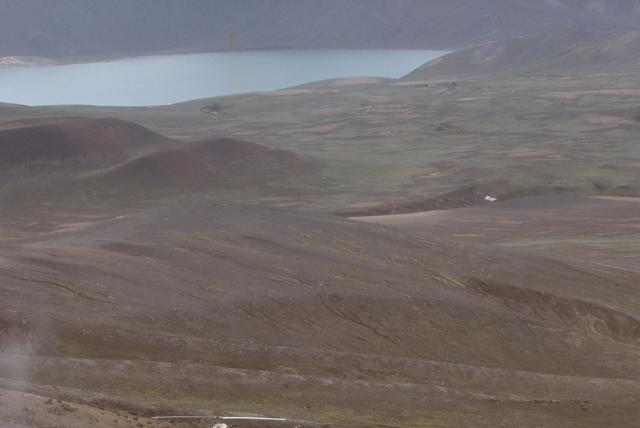
The Fisher caldera, on western Unimak Island NE of Westdahl volcano, is 11 x 18 km elongated in a NE direction It formed around 9,400 years ago, accompanied by emission of large-volume pyroclastic flows that reached the Bering Sea and the Pacific Ocean. Two cones are located below the N rim, NE of its high point at Eickelberg Peak, which rises more than 900 m above three lakes on the caldera floor, one of which drains through a notch in the southern caldera rim. A large composite cone, Mount Finch, is found at the center of the caldera, which also contains a small breached cinder cone. Eruptions have occurred in the 18th and 19th centuries. Low-temperature fumaroles are located on the W flank of Mount Finch, and Turquoise Lake, at the base of the cone, emits hydrogen sulfide gas.
— Smithsonian Institution, Global Volcanism Program
6 Recorded Eruptions
| Year | VEI | Type | Area |
|---|---|---|---|
| 1830 | 2 | Confirmed Eruption | Mount Finch |
| 1826 | 3 | Confirmed Eruption | Mount Finch |
| 1795 | — | Confirmed Eruption | — |
| 400 | — | Confirmed Eruption | Turquoise cone |
| 3170 BCE | 5 | Confirmed Eruption | Turquoise cone |
| 7420 BCE | 6 | Confirmed Eruption | NE and SW parts of Fisher caldera |
Real-Time Data
Frequently Asked Questions About Fisher
Is Fisher an active volcano?+
Fisher is classified as active based on credible evidence of past eruptions. Although its last known eruption was in 1830 CE, volcanologists consider it capable of erupting again.
When did Fisher last erupt?+
The most recent recorded eruption of Fisher occurred in 1830 CE with a Volcanic Explosivity Index (VEI) of 2. The eruption was classified as a "Confirmed Eruption." Fisher has 6 recorded eruptions in total.
How high is Fisher?+
Fisher has a summit elevation of 1,112 meters (3,648 feet) above sea level. At 1,112 meters, it is a moderately sized volcanic peak, roughly comparable to Mount Vesuvius (1,281m).
What type of volcano is Fisher?+
Fisher is classified as a Stratovolcano. Stratovolcanoes (also called composite volcanoes) are steep, conical volcanoes built up by many layers of hardened lava, tephra, and volcanic ash. They are among the most common and dangerous types, known for explosive eruptions.
Where is Fisher located?+
Fisher is located in United States, in the North America Volcanic Regions. More specifically, it lies within the Aleutian Ridge Volcanic Arc. Its exact coordinates are 54.650° latitude, -164.430° longitude.
Is it safe to visit Fisher?+
Fisher can generally be visited, but as with any volcano, visitors should check local conditions and any advisory notices before traveling. United States may have specific regulations for accessing volcanic areas. Guided tours are often the safest and most informative way to experience a volcano.


