About Westdahl
Westdahl is a stratovolcano? rising to 1,563 meters (5,128 feet) in United States's North America Volcanic Regions. It last erupted in 1992 CE, and volcanologists consider it an active volcanic system. The volcano has produced 8 recorded eruptions, with a maximum Volcanic Explosivity Index (VEI) of 4.
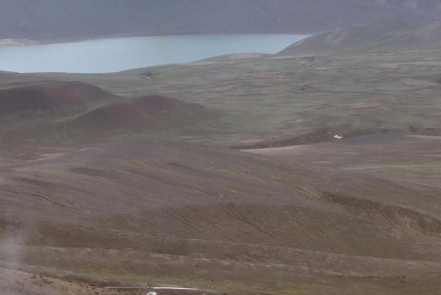
Geography & Climate
Westdahl is located in United States, within the Aleutian Ridge Volcanic Arc of the broader North America Volcanic Regions. Situated at 54.52° N, 164.65° W in the Northern Hemisphere, the volcano lies within a temperate climate zone. With a summit elevation of 1,563 meters above sea level, Westdahl is a moderately sized peak that remains accessible to hikers and researchers for much of the year. The volcanic landform is characterized as a composite, which describes the physical shape and structure of the volcanic edifice as observed from the surface.
Geological Context
Westdahl sits in a subduction zone, where one tectonic plate dives beneath another, creating intense heat and pressure that generates magma. Subduction zones are responsible for many of the world's most explosive volcanoes and deadliest eruptions. For communities in United States near Westdahl, this tectonic setting means the volcano is capable of producing powerful explosive eruptions, pyroclastic flows, and lahars that can threaten populated areas within tens of kilometers of the summit. The dominant rock type is basalt / picro-basalt, a dark, fine-grained volcanic rock that forms from rapidly cooling, low-viscosity lava. Basaltic eruptions tend to be less explosive and produce fluid lava flows that can travel long distances. While less immediately dangerous than explosive eruptions, basaltic lava flows can destroy structures and infrastructure in their path, and volcanic gases released during these eruptions can affect air quality over a wide area.
Eruption History Summary
Westdahl has 8 recorded eruptions in the geological database, spanning from 1795 CE to 1991 CE. The most powerful recorded event was a cataclysmic eruption with ash columns reaching the stratosphere in 1795 CE, reaching VEI 4 on the Volcanic Explosivity Index. Notable eruptions include 1991 CE (VEI 3), 1978 CE (VEI 3), 1795 CE (VEI 4). This eruption frequency indicates a moderately active volcanic system with periodic reawakenings. The most recent eruption in 1991 CE places this volcano within the modern era of volcanological observation.
Significance
With a maximum recorded VEI of 4, Westdahl has demonstrated the capacity for significant explosive eruptions that can impact regional aviation, agriculture, and communities tens of kilometers from the summit. VEI 4 eruptions produce ash columns reaching 15-25 kilometers into the atmosphere. With 8 recorded eruptions on file, Westdahl has enough documented activity to help scientists identify patterns in its eruptive behavior. Given its recent activity, Westdahl is closely monitored by geological survey organizations to provide early warning of future unrest.
GVP Reference Summary
Westdahl is a broad glacier-covered volcano occupying the SW end of Unimak Island. Two peaks protrude from the summit plateau, and a new crater formed in 1978 cuts the summit icecap. The volcano has a somewhat of a shield-like morphology and forms one of the largest volcanoes of the Aleutian Islands. The sharp-topped, conical Pogromni stratovolcano, 6 km N, rises several hundred meters higher than Westdahl, but is moderately glacially dissected and presumably older. Many satellitic cones of postglacial age are located along a NW-SE line cutting across the summit of Westdahl. Some of the historical eruptions attributed to the eroded Pogromni may have originated instead from Westdahl (Miller et al. 1998). The first historical eruption occurred in 1795. An 8-km-long fissure extending east from the summit produced explosive eruptions and lava flows in 1991.
— Smithsonian Institution, Global Volcanism Program
8 Recorded Eruptions
| Year | VEI | Type | Area |
|---|---|---|---|
| 1991 | 3 | Confirmed Eruption | ENE flank (1560-760 m) |
| 1979 | 3 | Uncertain Eruption | — |
| 1978 | 3 | Confirmed Eruption | South of Westdahl Peak (1450 m) |
| 1964 | 2 | Confirmed Eruption | — |
| 1827 | 2 | Confirmed Eruption | Pogromni or (more likely) Westdahl |
| 1820 | 2 | Confirmed Eruption | Pogromni or (more likely) Westdahl |
| 1796 | 0 | Confirmed Eruption | Pogromni or (more likely) Westdahl |
| 1795 | 4 | Confirmed Eruption | Pogromni or (more likely) Westdahl |
Real-Time Data
Frequently Asked Questions About Westdahl
Is Westdahl an active volcano?+
Yes, Westdahl is considered an active volcano. Its most recent eruption was in 1992 CE. The volcano is monitored by geological agencies, and its activity status is based on observed eruptions within recorded history.
When did Westdahl last erupt?+
The most recent recorded eruption of Westdahl occurred in 1991 CE with a Volcanic Explosivity Index (VEI) of 3. The eruption was classified as a "Confirmed Eruption." Westdahl has 8 recorded eruptions in total.
How high is Westdahl?+
Westdahl has a summit elevation of 1,563 meters (5,128 feet) above sea level. At 1,563 meters, it is a moderately sized volcanic peak, roughly comparable to Mount Vesuvius (1,281m).
What type of volcano is Westdahl?+
Westdahl is classified as a Stratovolcano?. Stratovolcano? volcanoes have distinct geological characteristics that set them apart from other volcanic types.
Where is Westdahl located?+
Westdahl is located in United States, in the North America Volcanic Regions. More specifically, it lies within the Aleutian Ridge Volcanic Arc. Its exact coordinates are 54.516° latitude, -164.650° longitude.
Is it safe to visit Westdahl?+
Visiting Westdahl requires checking current volcanic activity and alert levels. As an active volcano with eruptions as recent as 1992 CE, conditions can change rapidly. Always consult local geological authorities and follow official warnings before visiting. Many active volcanoes have designated safe viewing areas and guided tour options.