About Akutan
Akutan is a stratovolcano rising to 1,303 meters (4,275 feet) in United States's North America Volcanic Regions. It last erupted in 1992 CE, and volcanologists consider it an active volcanic system. The volcano has produced 20 recorded eruptions, with a maximum Volcanic Explosivity Index (VEI) of 2.
Geography & Climate
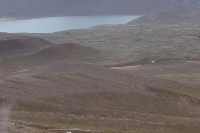
Akutan is located in United States, within the Aleutian Ridge Volcanic Arc of the broader North America Volcanic Regions. Situated at 54.13° N, 165.99° W in the Northern Hemisphere, the volcano lies within a temperate climate zone. With a summit elevation of 1,303 meters above sea level, Akutan is a moderately sized peak that remains accessible to hikers and researchers for much of the year. The volcanic landform is characterized as a composite, which describes the physical shape and structure of the volcanic edifice as observed from the surface.
Geological Context
Akutan sits in a subduction zone, where one tectonic plate dives beneath another, creating intense heat and pressure that generates magma. Subduction zones are responsible for many of the world's most explosive volcanoes and deadliest eruptions. For communities in United States near Akutan, this tectonic setting means the volcano is capable of producing powerful explosive eruptions, pyroclastic flows, and lahars that can threaten populated areas within tens of kilometers of the summit. The dominant rock type is basalt / picro-basalt, a dark, fine-grained volcanic rock that forms from rapidly cooling, low-viscosity lava. Basaltic eruptions tend to be less explosive and produce fluid lava flows that can travel long distances. While less immediately dangerous than explosive eruptions, basaltic lava flows can destroy structures and infrastructure in their path, and volcanic gases released during these eruptions can affect air quality over a wide area.
Eruption History Summary
Akutan has 20 recorded eruptions in the geological database, spanning from 1948 CE to 1992 CE. The most powerful recorded event was an explosive event producing ash plumes up to several kilometers in 1992 CE, reaching VEI 2 on the Volcanic Explosivity Index. With an average interval of roughly 2 years between eruptions over a span of 44 years, this is one of the more frequently active volcanoes in the database. This persistent activity suggests a robust and well-supplied magma system beneath the volcano. The most recent eruption in 1992 CE places this volcano within the modern era of volcanological observation.
Significance
Its 20 recorded eruptions make it one of the most prolific volcanoes in our database, reflecting a persistent and well-documented eruptive history that has provided volcanologists with extensive data for understanding eruption patterns and forecasting future activity. Given its recent activity, Akutan is closely monitored by geological survey organizations to provide early warning of future unrest.
GVP Reference Summary
Akutan contains a 2-km-wide caldera with a large cinder cone in the NE part of the caldera that has been the source of frequent explosive eruptions and occasional lava effusion that covers the caldera floor. An older, largely buried caldera was formed during the late Pleistocene or early Holocene. Two volcanic centers are located on the NW flank. Lava Peak is of Pleistocene age, and a cinder cone lower on the flank produced a lava flow in 1852 that extended the shoreline of the island and forms Lava Point. The 60-365 m deep younger caldera was formed during a major explosive eruption about 1,600 years ago and contains at least three lakes. A lava flow in 1978 traveled through a narrow breach in the north caldera rim almost to the coast. Fumaroles occur at the base of the caldera cinder cone, and hot springs are located NE of the caldera at the head of Hot Springs Bay valley and along the shores of Hot Springs Bay.
— Smithsonian Institution, Global Volcanism Program
20 Recorded Eruptions
| Year | VEI | Type | Area |
|---|---|---|---|
| 1992 | 2 | Confirmed Eruption | — |
| 1992 | 1 | Confirmed Eruption | — |
| 1991 | 2 | Confirmed Eruption | — |
| 1990 | 2 | Confirmed Eruption | — |
| 1990 | 2 | Confirmed Eruption | — |
| 1989 | 2 | Confirmed Eruption | — |
| 1988 | 2 | Confirmed Eruption | — |
| 1987 | 2 | Confirmed Eruption | — |
| 1986 | 2 | Confirmed Eruption | — |
| 1982 | 2 | Confirmed Eruption | — |
| 1980 | 2 | Confirmed Eruption | — |
| 1978 | 2 | Confirmed Eruption | — |
| 1976 | 2 | Confirmed Eruption | — |
| 1974 | 2 | Confirmed Eruption | West flank ? |
| 1973 | 2 | Confirmed Eruption | — |
| 1972 | 2 | Uncertain Eruption | — |
| 1962 | 2 | Confirmed Eruption | — |
| 1953 | 2 | Confirmed Eruption | — |
| 1951 | 2 | Confirmed Eruption | — |
| 1948 | 2 | Confirmed Eruption | — |
Real-Time Data
Frequently Asked Questions About Akutan
Is Akutan an active volcano?+
Yes, Akutan is considered an active volcano. Its most recent eruption was in 1992 CE. The volcano is monitored by geological agencies, and its activity status is based on observed eruptions within recorded history.
When did Akutan last erupt?+
The most recent recorded eruption of Akutan occurred in 1992 CE with a Volcanic Explosivity Index (VEI) of 2. The eruption was classified as a "Confirmed Eruption." Akutan has 20 recorded eruptions in total.
How high is Akutan?+
Akutan has a summit elevation of 1,303 meters (4,275 feet) above sea level. At 1,303 meters, it is a moderately sized volcanic peak, roughly comparable to Mount Vesuvius (1,281m).
What type of volcano is Akutan?+
Akutan is classified as a Stratovolcano. Stratovolcanoes (also called composite volcanoes) are steep, conical volcanoes built up by many layers of hardened lava, tephra, and volcanic ash. They are among the most common and dangerous types, known for explosive eruptions.
Where is Akutan located?+
Akutan is located in United States, in the North America Volcanic Regions. More specifically, it lies within the Aleutian Ridge Volcanic Arc. Its exact coordinates are 54.134° latitude, -165.986° longitude.
Is it safe to visit Akutan?+
Visiting Akutan requires checking current volcanic activity and alert levels. As an active volcano with eruptions as recent as 1992 CE, conditions can change rapidly. Always consult local geological authorities and follow official warnings before visiting. Many active volcanoes have designated safe viewing areas and guided tour options.