About Mariveles
Mariveles is a stratovolcano rising to 1,388 meters (4,554 feet) in Philippines's Western Pacific Volcanic Regions. No historical eruptions have been recorded, though the volcano is classified based on geological evidence of past activity. The volcano has produced 1 recorded eruption.
Geography & Climate
Mariveles is located in Philippines, within the Luzon Volcanic Arc of the broader Western Pacific Volcanic Regions. Situated at 14.53° N, 120.48° E in the Northern Hemisphere, the volcano lies within a tropical climate zone. With a summit elevation of 1,388 meters above sea level, Mariveles is a moderately sized peak that remains accessible to hikers and researchers for much of the year. The volcanic landform is characterized as a composite, which describes the physical shape and structure of the volcanic edifice as observed from the surface.
Eruption History Summary
Mariveles has 1 recorded eruption in the geological database, spanning from 2050 BCE to 2050 BCE.
GVP Reference Summary
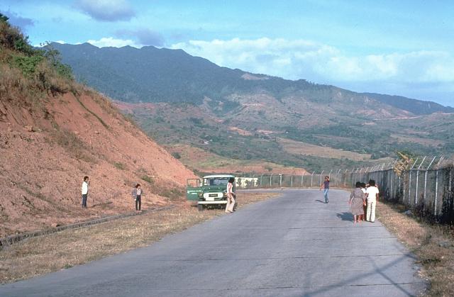
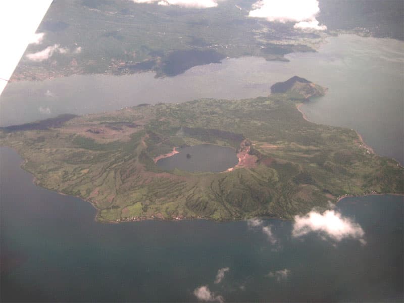
The low Mariveles stratovolcano lies at the southern end of the Bataan Peninsula, on the west side of Manila Bay. This massive, dominantly andesitic, volcano includes a 4-km-wide caldera that drains to the north. Flank cones are located to the NNE (Mount Samat) and E (Mount Limay). Although one source (NRC, 1979) noted an eruption dated at 4,000 years before present, no details were available about the sample or method. Other age determinations (EBASCO, 1977) of lava flow samples ranged from about 3.5 million to 190,000 years old.
— Smithsonian Institution, Global Volcanism Program
1 Recorded Eruption
| Year | VEI | Type | Area |
|---|---|---|---|
| 2050 BCE | — | Uncertain Eruption | — |
Real-Time Data
Frequently Asked Questions About Mariveles
Is Mariveles an active volcano?+
Mariveles is not currently classified as active. Its activity evidence is listed as "unknown." No recorded eruptions have been documented. However, no volcano is ever considered permanently extinct.
When did Mariveles last erupt?+
The most recent recorded eruption of Mariveles occurred in 2050 BCE. The eruption was classified as a "Uncertain Eruption." Mariveles has 1 recorded eruption in total.
How high is Mariveles?+
Mariveles has a summit elevation of 1,388 meters (4,554 feet) above sea level. At 1,388 meters, it is a moderately sized volcanic peak, roughly comparable to Mount Vesuvius (1,281m).
What type of volcano is Mariveles?+
Mariveles is classified as a Stratovolcano. Stratovolcanoes (also called composite volcanoes) are steep, conical volcanoes built up by many layers of hardened lava, tephra, and volcanic ash. They are among the most common and dangerous types, known for explosive eruptions.
Where is Mariveles located?+
Mariveles is located in Philippines, in the Western Pacific Volcanic Regions. More specifically, it lies within the Luzon Volcanic Arc. Its exact coordinates are 14.527° latitude, 120.482° longitude.
Is it safe to visit Mariveles?+
Mariveles can generally be visited, but as with any volcano, visitors should check local conditions and any advisory notices before traveling. Philippines may have specific regulations for accessing volcanic areas. Guided tours are often the safest and most informative way to experience a volcano.