About Utara Wetar
Utara Wetar is a stratovolcano rising to 239 meters (784 feet) in Indonesia's Sunda-Banda Volcanic Regions. No historical eruptions have been recorded, though the volcano is classified based on geological evidence of past activity. The volcano has produced 1 recorded eruption, with a maximum Volcanic Explosivity Index (VEI) of 3.
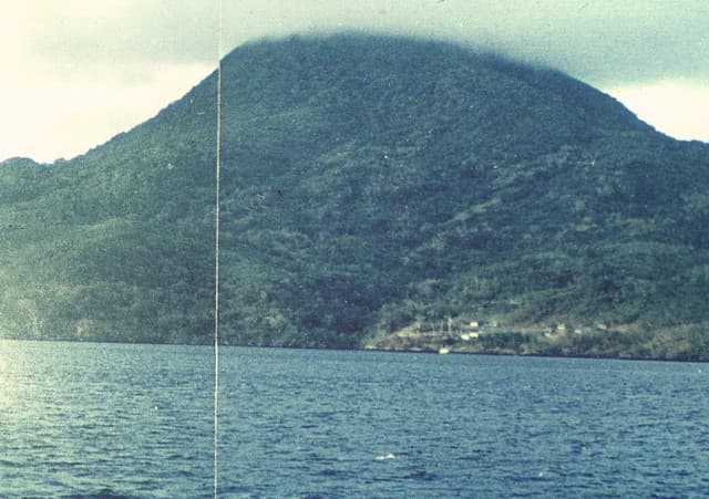
Geography & Climate
Utara Wetar is located in Indonesia, within the Inner Banda Volcanic Arc of the broader Sunda-Banda Volcanic Regions. Situated at 6.63° S, 126.66° E in the Southern Hemisphere, the volcano lies within a tropical climate zone. At just 239 meters above sea level, Utara Wetar is a relatively low-elevation volcanic feature. Despite its modest height, it remains an active geological formation with the same underlying magmatic processes as its taller counterparts. The volcanic landform is characterized as a composite, which describes the physical shape and structure of the volcanic edifice as observed from the surface.
Eruption History Summary
Utara Wetar has 1 recorded eruption in the geological database, spanning from 1699 CE to 1699 CE. The most powerful recorded event was a severe eruption capable of regional ash fall and pyroclastic flows in 1699 CE, reaching VEI 3 on the Volcanic Explosivity Index.
Significance
With a maximum recorded VEI of 3, Utara Wetar has produced eruptions capable of generating pyroclastic flows and significant ash fall in the surrounding area. While not among the largest eruptions globally, VEI 3 events pose serious hazards to local populations and can disrupt regional air travel.
GVP Reference Summary
The island of Gunungapi, or Utara Wetar (North Wetar) is located in the Banda Sea ~100 km N of Wetar Island. The small circular island reaches less than 300 m above the ocean surface but is the summit of a massive stratovolcano that rises 5,000 m above the seafloor. There are three notable landslide scarps, the largest of which forms a prominent embayment on the NE coast, and the others overlapping on the W and SW flanks. Andesite sampled from the island was K-Ar dated by Honthaas et al. (1998) at 420,000 +/- 100,000 years. Observations from 1512 CE of a possible lava flow have been attributed to this island, along with gas-and-steam emissions in 1699 CE. However, in an analysis of documents related to the route taken by Portuguese ships commanded by Abreu in 1512, Sollewijn Gelpke (1995) determined that this was not the erupting volcano described; a drawing of the event showed Sangeang Api.
— Smithsonian Institution, Global Volcanism Program
1 Recorded Eruption
| Year | VEI | Type | Area |
|---|---|---|---|
| 1699 | 3 | Uncertain Eruption | — |
Real-Time Data
Frequently Asked Questions About Utara Wetar
Is Utara Wetar an active volcano?+
Utara Wetar is not currently classified as active. Its activity evidence is listed as "unknown." No recorded eruptions have been documented. However, no volcano is ever considered permanently extinct.
When did Utara Wetar last erupt?+
The most recent recorded eruption of Utara Wetar occurred in 1699 CE with a Volcanic Explosivity Index (VEI) of 3. The eruption was classified as a "Uncertain Eruption." Utara Wetar has 1 recorded eruption in total.
How high is Utara Wetar?+
Utara Wetar has a summit elevation of 239 meters (784 feet) above sea level. At 239 meters, it is a relatively low-elevation volcano.
What type of volcano is Utara Wetar?+
Utara Wetar is classified as a Stratovolcano. Stratovolcanoes (also called composite volcanoes) are steep, conical volcanoes built up by many layers of hardened lava, tephra, and volcanic ash. They are among the most common and dangerous types, known for explosive eruptions.
Where is Utara Wetar located?+
Utara Wetar is located in Indonesia, in the Sunda-Banda Volcanic Regions. More specifically, it lies within the Inner Banda Volcanic Arc. Its exact coordinates are -6.635° latitude, 126.660° longitude.
Is it safe to visit Utara Wetar?+
Utara Wetar can generally be visited, but as with any volcano, visitors should check local conditions and any advisory notices before traveling. Indonesia may have specific regulations for accessing volcanic areas. Guided tours are often the safest and most informative way to experience a volcano.