About Merapi
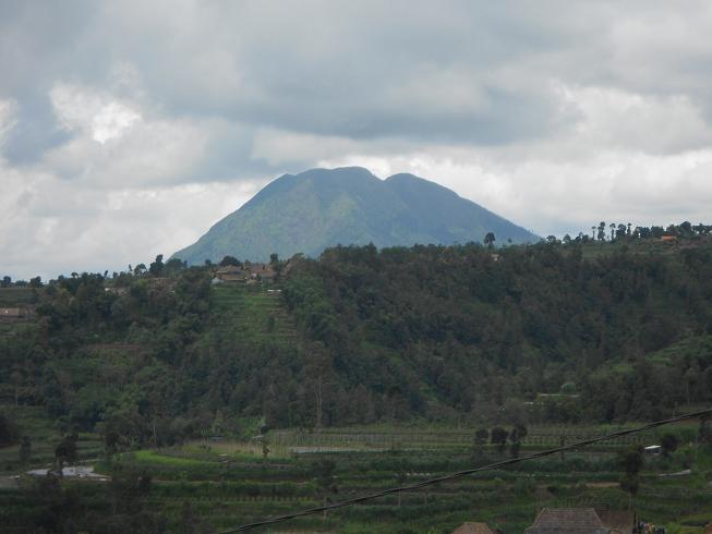
Merapi is a stratovolcano rising to 2,910 meters (9,548 feet) in Indonesia's Sunda-Banda Volcanic Regions. The volcano is currently active, with its most recent eruption in 2025 CE. The volcano has produced 20 recorded eruptions, with a maximum Volcanic Explosivity Index (VEI) of 4.
Geography & Climate
Merapi is located in Indonesia, within the Sunda Volcanic Arc of the broader Sunda-Banda Volcanic Regions. Situated at 7.54° S, 110.45° E in the Southern Hemisphere, the volcano lies within a tropical climate zone. At 2,910 meters above sea level, Merapi rises above the surrounding terrain into montane or subalpine conditions. The elevation creates distinct ecological zones along its flanks, from forested lower slopes to exposed rocky terrain near the summit. The volcanic landform is characterized as a composite, which describes the physical shape and structure of the volcanic edifice as observed from the surface.
Geological Context
Merapi sits in a subduction zone, where one tectonic plate dives beneath another, creating intense heat and pressure that generates magma. Subduction zones are responsible for many of the world's most explosive volcanoes and deadliest eruptions. For communities in Indonesia near Merapi, this tectonic setting means the volcano is capable of producing powerful explosive eruptions, pyroclastic flows, and lahars that can threaten populated areas within tens of kilometers of the summit. The dominant rock type is andesite / basaltic andesite, a dark, fine-grained volcanic rock that forms from rapidly cooling, low-viscosity lava. Basaltic eruptions tend to be less explosive and produce fluid lava flows that can travel long distances. While less immediately dangerous than explosive eruptions, basaltic lava flows can destroy structures and infrastructure in their path, and volcanic gases released during these eruptions can affect air quality over a wide area.
Eruption History Summary
Merapi has 20 recorded eruptions in the geological database, spanning from 1933 CE to 2020 CE. The most powerful recorded event was a cataclysmic eruption with ash columns reaching the stratosphere in 2010 CE, reaching VEI 4 on the Volcanic Explosivity Index. Notable eruptions include 2018 CE (VEI 3), 2014 CE (VEI 3), 2013 CE (VEI 3). With an average interval of roughly 4 years between eruptions over a span of 87 years, this is one of the more frequently active volcanoes in the database. This persistent activity suggests a robust and well-supplied magma system beneath the volcano. With eruptive activity as recently as 2020 CE, Merapi remains an actively monitored volcano.
Significance
With a maximum recorded VEI of 4, Merapi has demonstrated the capacity for significant explosive eruptions that can impact regional aviation, agriculture, and communities tens of kilometers from the summit. VEI 4 eruptions produce ash columns reaching 15-25 kilometers into the atmosphere. Its 20 recorded eruptions make it one of the most prolific volcanoes in our database, reflecting a persistent and well-documented eruptive history that has provided volcanologists with extensive data for understanding eruption patterns and forecasting future activity. Given its recent activity, Merapi is closely monitored by geological survey organizations to provide early warning of future unrest.
GVP Reference Summary
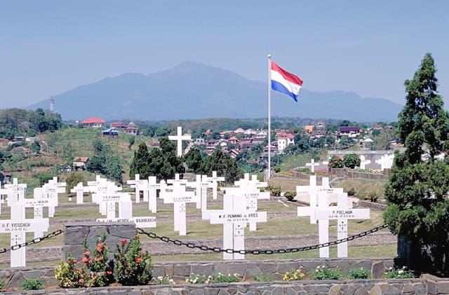
Merapi, one of Indonesia's most active volcanoes, lies in one of the world's most densely populated areas and dominates the landscape immediately north of the major city of Yogyakarta. It is the youngest and southernmost of a volcanic chain extending NNW to Ungaran volcano. Growth of Old Merapi during the Pleistocene ended with major edifice collapse perhaps about 2,000 years ago, leaving a large arcuate scarp cutting the eroded older Batulawang volcano. Subsequent growth of the steep-sided Young Merapi edifice, its upper part unvegetated due to frequent activity, began SW of the earlier collapse scarp. Pyroclastic flows and lahars accompanying growth and collapse of the steep-sided active summit lava dome have devastated cultivated lands on the western-to-southern flanks and caused many fatalities.
— Smithsonian Institution, Global Volcanism Program
20 Recorded Eruptions
| Year | VEI | Type | Area |
|---|---|---|---|
| 2020 | 1 | Confirmed Eruption | — |
| 2018 | 3 | Confirmed Eruption | Summit crater |
| 2014 | 3 | Confirmed Eruption | Summit crater |
| 2013 | 1 | Confirmed Eruption | Summit crater |
| 2013 | 3 | Confirmed Eruption | Summit crater |
| 2011 | 1 | Confirmed Eruption | Summit crater |
| 2010 | 4 | Confirmed Eruption | Summit crater |
| 2008 | — | Uncertain Eruption | — |
| 2006 | 1 | Confirmed Eruption | — |
| 1992 | 2 | Confirmed Eruption | NW of 1984 lava dome |
| 1986 | 2 | Confirmed Eruption | — |
| 1972 | 2 | Confirmed Eruption | — |
| 1971 | 1 | Uncertain Eruption | — |
| 1967 | 2 | Confirmed Eruption | Upper Batang breach (2600 m) |
| 1961 | 3 | Confirmed Eruption | — |
| 1953 | 2 | Confirmed Eruption | — |
| 1948 | 2 | Confirmed Eruption | — |
| 1942 | 2 | Confirmed Eruption | — |
| 1939 | 2 | Confirmed Eruption | — |
| 1933 | 2 | Confirmed Eruption | — |
Real-Time Data
Frequently Asked Questions About Merapi
Is Merapi an active volcano?+
Yes, Merapi is considered an active volcano. Its most recent eruption was in 2025 CE. The volcano is monitored by geological agencies, and its activity status is based on observed eruptions within recorded history.
When did Merapi last erupt?+
The most recent recorded eruption of Merapi occurred in 2020 CE with a Volcanic Explosivity Index (VEI) of 1. The eruption was classified as a "Confirmed Eruption." Merapi has 20 recorded eruptions in total.
How high is Merapi?+
Merapi has a summit elevation of 2,910 meters (9,548 feet) above sea level. At 2,910 meters, it is comparable in height to many significant mountain peaks and stands well above the tree line.
What type of volcano is Merapi?+
Merapi is classified as a Stratovolcano. Stratovolcanoes (also called composite volcanoes) are steep, conical volcanoes built up by many layers of hardened lava, tephra, and volcanic ash. They are among the most common and dangerous types, known for explosive eruptions.
Where is Merapi located?+
Merapi is located in Indonesia, in the Sunda-Banda Volcanic Regions. More specifically, it lies within the Sunda Volcanic Arc. Its exact coordinates are -7.540° latitude, 110.446° longitude.
Is it safe to visit Merapi?+
Visiting Merapi requires checking current volcanic activity and alert levels. As an active volcano with eruptions as recent as 2025 CE, conditions can change rapidly. Always consult local geological authorities and follow official warnings before visiting. Many active volcanoes have designated safe viewing areas and guided tour options.