About Merbabu
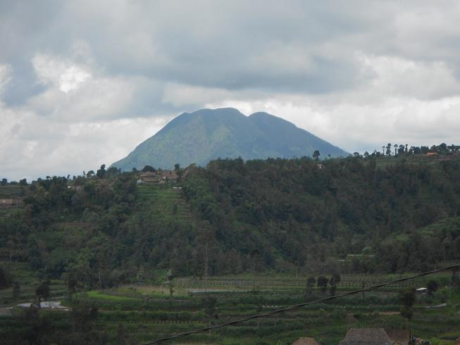
Merbabu is a stratovolcano rising to 3,118 meters (10,230 feet) in Indonesia's Sunda-Banda Volcanic Regions. Its last known eruption was in 1797 CE. The volcano has produced 3 recorded eruptions, with a maximum Volcanic Explosivity Index (VEI) of 2.
Geography & Climate
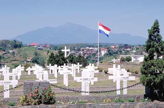
Merbabu is located in Indonesia, within the Sunda Volcanic Arc of the broader Sunda-Banda Volcanic Regions. Situated at 7.45° S, 110.44° E in the Southern Hemisphere, the volcano lies within a tropical climate zone. At 3,118 meters above sea level, Merbabu rises above the surrounding terrain into montane or subalpine conditions. The elevation creates distinct ecological zones along its flanks, from forested lower slopes to exposed rocky terrain near the summit. The volcanic landform is characterized as a composite, which describes the physical shape and structure of the volcanic edifice as observed from the surface.
Geological Context
Merbabu sits in a subduction zone, where one tectonic plate dives beneath another, creating intense heat and pressure that generates magma. Subduction zones are responsible for many of the world's most explosive volcanoes and deadliest eruptions. For communities in Indonesia near Merbabu, this tectonic setting means the volcano is capable of producing powerful explosive eruptions, pyroclastic flows, and lahars that can threaten populated areas within tens of kilometers of the summit. The dominant rock type is basalt / picro-basalt, a dark, fine-grained volcanic rock that forms from rapidly cooling, low-viscosity lava. Basaltic eruptions tend to be less explosive and produce fluid lava flows that can travel long distances. While less immediately dangerous than explosive eruptions, basaltic lava flows can destroy structures and infrastructure in their path, and volcanic gases released during these eruptions can affect air quality over a wide area.
Eruption History Summary
Merbabu has 3 recorded eruptions in the geological database, spanning from 1560 CE to 1797 CE. The most powerful recorded event was an explosive event producing ash plumes up to several kilometers in 1797 CE, reaching VEI 2 on the Volcanic Explosivity Index. These eruptions span roughly 237 years of volcanic history.
GVP Reference Summary
Gunung Merbabu is a massive forested volcano north of Merapi in central Java. Three prominent radial valleys extend from the summit toward the NW, NNE, and ESE. The most recent magmatic eruptions originated from a NNW-SSE fissure system that cut across the summit and fed the large-volume Kopeng and Kajor lava flows on the N and S flanks, respectively. Moderate explosive eruptions occurred from the summit crater in 1560 and 1797 CE.
— Smithsonian Institution, Global Volcanism Program
3 Recorded Eruptions
| Year | VEI | Type | Area |
|---|---|---|---|
| 1797 | 2 | Confirmed Eruption | — |
| 1570 | — | Uncertain Eruption | — |
| 1560 | — | Confirmed Eruption | — |
Real-Time Data
Frequently Asked Questions About Merbabu
Is Merbabu an active volcano?+
Merbabu is classified as active based on credible evidence of past eruptions. Although its last known eruption was in 1797 CE, volcanologists consider it capable of erupting again.
When did Merbabu last erupt?+
The most recent recorded eruption of Merbabu occurred in 1797 CE with a Volcanic Explosivity Index (VEI) of 2. The eruption was classified as a "Confirmed Eruption." Merbabu has 3 recorded eruptions in total.
How high is Merbabu?+
Merbabu has a summit elevation of 3,118 meters (10,230 feet) above sea level. At 3,118 meters, it is comparable in height to many significant mountain peaks and stands well above the tree line.
What type of volcano is Merbabu?+
Merbabu is classified as a Stratovolcano. Stratovolcanoes (also called composite volcanoes) are steep, conical volcanoes built up by many layers of hardened lava, tephra, and volcanic ash. They are among the most common and dangerous types, known for explosive eruptions.
Where is Merbabu located?+
Merbabu is located in Indonesia, in the Sunda-Banda Volcanic Regions. More specifically, it lies within the Sunda Volcanic Arc. Its exact coordinates are -7.454° latitude, 110.440° longitude.
Is it safe to visit Merbabu?+
Merbabu can generally be visited, but as with any volcano, visitors should check local conditions and any advisory notices before traveling. Indonesia may have specific regulations for accessing volcanic areas. Guided tours are often the safest and most informative way to experience a volcano.