About Erciyes Volcanic Complex
Erciyes Volcanic Complex is a stratovolcano rising to 3,864 meters (12,678 feet) in Turkiye's European Volcanic Regions. The volcano is currently active, with its most recent eruption in 6880 BCE. The volcano has produced 2 recorded eruptions.
Geography & Climate
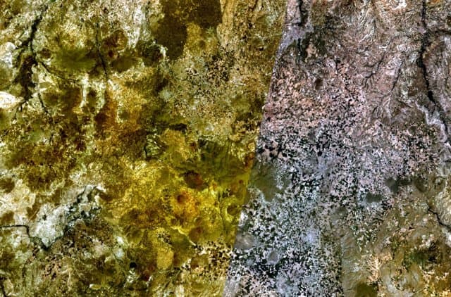
Erciyes Volcanic Complex is located in Turkiye, within the Western Anatolian Volcanic Province of the broader European Volcanic Regions. Situated at 38.53° N, 35.45° E in the Northern Hemisphere, the volcano lies within a temperate climate zone. Standing at 3,864 meters above sea level, Erciyes Volcanic Complex towers above the alpine zone, where vegetation gives way to bare rock, snow, and ice for much of the year. The high elevation means the upper slopes experience significantly colder temperatures than surrounding lowlands. The volcanic landform is characterized as a composite, which describes the physical shape and structure of the volcanic edifice as observed from the surface.
Geological Context
Erciyes Volcanic Complex is an intraplate volcano, meaning it formed away from any plate boundary. These volcanoes are often powered by hotspots — plumes of abnormally hot mantle material rising from deep within the Earth. Hotspot volcanoes like Erciyes Volcanic Complex tend to produce effusive eruptions with lava flows that can be relatively predictable, giving nearby communities in Turkiye more time to prepare. However, they can also produce explosive phases, particularly when magma interacts with groundwater. The dominant rock type is dacite, an intermediate to silica-rich volcanic rock. This composition typically produces more viscous magma, leading to more explosive eruptions with ash columns and pyroclastic flows. Andesitic and dacitic magmas build pressure before erupting, which is why volcanoes with this rock chemistry are often associated with Plinian-style eruptions that can send ash tens of kilometers into the atmosphere and disrupt aviation across entire regions.
Eruption History Summary
Erciyes Volcanic Complex has 2 recorded eruptions in the geological database, spanning from 6880 BCE to 253 CE. These eruptions span roughly 7,133 years of volcanic history.
GVP Reference Summary
The Erciyes Volcanic Complex at the northern end of the Sultansazligi Basin in central Anatolia is dominated by the massive eroded Erciyes Dagi stratovolcano at the approximate center of a radial monogenetic volcanic field 32 km in diameter, extending further towards the N. Uslular et al. (2021) identified 100 lava domes (dacitic to rhyolitic), 40 scoria cones (basaltic to andesitic), four maars (basaltic andesitic), and 44 undifferentiated features as part of this complex. Growth of the modern edifice began about 900,000 years ago, following Pliocene caldera collapse of the Kocdag complex. The youngest dated rock was from an 83,000-year-old dacitic lava flow, but rhyodacitic eruptions and lava dome growth occurred later at the Perikartin dome. One of the latest documented events was an edifice collapse that produced a large debris avalanche that extended to the east. An early Holocene distal tephra layer in Lebanon was attributed to Erciyes Dagi. Uncertainty remains regarding reported eruptions and their possible depiction on Roman Cappadocian coins. Accounts possibly referring to eruptions could also be attributed to methane releases from a swamp in the Sultansazligi Basin.
— Smithsonian Institution, Global Volcanism Program
2 Recorded Eruptions
| Year | VEI | Type | Area |
|---|---|---|---|
| 253 | — | Uncertain Eruption | — |
| 6880 BCE | — | Confirmed Eruption | — |
Real-Time Data
Frequently Asked Questions About Erciyes Volcanic Complex
Is Erciyes Volcanic Complex an active volcano?+
Erciyes Volcanic Complex is not currently classified as active. Its activity evidence is listed as "Eruption Dated." The last known eruption was in 6880 BCE. However, no volcano is ever considered permanently extinct.
When did Erciyes Volcanic Complex last erupt?+
The most recent recorded eruption of Erciyes Volcanic Complex occurred in 253 CE. The eruption was classified as a "Uncertain Eruption." Erciyes Volcanic Complex has 2 recorded eruptions in total.
How high is Erciyes Volcanic Complex?+
Erciyes Volcanic Complex has a summit elevation of 3,864 meters (12,678 feet) above sea level. At 3,864 meters, it is comparable in height to many significant mountain peaks and stands well above the tree line.
What type of volcano is Erciyes Volcanic Complex?+
Erciyes Volcanic Complex is classified as a Stratovolcano. Stratovolcanoes (also called composite volcanoes) are steep, conical volcanoes built up by many layers of hardened lava, tephra, and volcanic ash. They are among the most common and dangerous types, known for explosive eruptions.
Where is Erciyes Volcanic Complex located?+
Erciyes Volcanic Complex is located in Turkiye, in the European Volcanic Regions. More specifically, it lies within the Western Anatolian Volcanic Province. Its exact coordinates are 38.531° latitude, 35.447° longitude.
Is it safe to visit Erciyes Volcanic Complex?+
Erciyes Volcanic Complex can generally be visited, but as with any volcano, visitors should check local conditions and any advisory notices before traveling. Turkiye may have specific regulations for accessing volcanic areas. Guided tours are often the safest and most informative way to experience a volcano.